Trstenik, Benedikt
| Trstenik | |
|---|---|
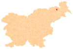
 Trstenik Location in Slovenia | |
| Coordinates: 46°37′32.64″N 15°53′48.81″E / 46.6257333°N 15.8968917°ECoordinates: 46°37′32.64″N 15°53′48.81″E / 46.6257333°N 15.8968917°E | |
| Country |
|
| Traditional region | Styria |
| Statistical region | Drava |
| Municipality | Benedikt |
| Area | |
| • Total | 1.37 km2 (0.53 sq mi) |
| Elevation | 280.4 m (919.9 ft) |
| Population (2002) | |
| • Total | 91 |
| [1] | |
Trstenik (pronounced [təɾstɛˈniːk]) is a settlement in the Municipality of Benedikt in the Slovene Hills (Slovene: Slovenske gorice) in northeastern Slovenia. The area was part of the traditional region of Styria. It is now included in the Drava Statistical Region.[2]
There are two small chapel-shrines south of the main settlement. Both were built in the early 20th century.[3]
Seven relatively intact tumuli from the Roman period have been identified near the settlement. Such burials are fairly common in the area with an extensive burial ground near Trotkova south of Trstenik.[4]
References
- ↑ Statistical Office of the Republic of Slovenia
- ↑ Benedikt municipal site
- ↑ Slovenian Ministry of Culture register of national heritage reference numbers ešd 11717 & 11718
- ↑ Slovenian Ministry of Culture register of national heritage reference number ešd 1032
External links
This article is issued from Wikipedia - version of the 3/11/2014. The text is available under the Creative Commons Attribution/Share Alike but additional terms may apply for the media files.
