Tripureshwar
| Tripureshwar त्रिपुरेश्वर | |
|---|---|
| Village development committee | |
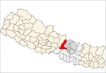
 Tripureshwar Location in Nepal | |
| Coordinates: 28°00′N 84°53′E / 28.00°N 84.89°ECoordinates: 28°00′N 84°53′E / 28.00°N 84.89°E | |
| Country |
|
| Zone | Bagmati Zone |
| District | Dhading District |
| Population (1991) | |
| • Total | 2,707 |
| • Religions | Hindu |
| Time zone | Nepal Time (UTC+5:45) |
Tripureshwar is a village development committee in Dhading District in the Bagmati Zone of central Nepal. At the time of the 1991 Nepal census it had a population of 2707 and had 497 houses in it. This is one of the mid-north village development committee which was politically popular during 10 year of insurgency.The rising number of population is making this part much more populated than last five years.The biggest river of the district,Netrawati passes from this village.One of the popular town of the district,Khahare is located in the north of Tripureshwar.There are 8 wards.[1]
References
- ↑ "Nepal Census 2001". Nepal's Village Development Committees. Digital Himalaya. Retrieved 2008-08-24.
This article is issued from Wikipedia - version of the 5/10/2016. The text is available under the Creative Commons Attribution/Share Alike but additional terms may apply for the media files.