Budhathum
| Budhathum बुढाथुम | |
|---|---|
| Village development committee | |
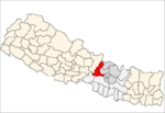
 Budhathum Location in Nepal | |
| Coordinates: 28°05′N 84°51′E / 28.08°N 84.85°ECoordinates: 28°05′N 84°51′E / 28.08°N 84.85°E | |
| Country |
|
| Zone | Bagmati Zone |
| District | Dhading District |
| Population (1991) | |
| • Total | 3,946 |
| • Religions | Hindu |
| Time zone | Nepal Time (UTC+5:45) |
Budhathum is a village development committee in Dhading District in the Bagmati Zone of central Nepal. At the time of the 1991 Nepal census it had a population of 3946 and had 693 houses in it. It is 40 kilometers away from the district headquarter Dhadingbesi. The main occupation of the people here is agriculture. However running local business, joining government service and going abroad have also become common these days.[1]
References
- ↑ "Nepal Census 2001". Nepal's Village Development Committees. Digital Himalaya. Archived from the original on 2008-10-12. Retrieved 2008-08-24.
This article is issued from Wikipedia - version of the 11/10/2016. The text is available under the Creative Commons Attribution/Share Alike but additional terms may apply for the media files.