Tokio, North Dakota
| Tokio, North Dakota | |
|---|---|
| Unincorporated community | |
|
Tokio General Store | |
 Location within the state of North Dakota | |
| Coordinates: 47°55′29″N 98°48′58″W / 47.92472°N 98.81611°WCoordinates: 47°55′29″N 98°48′58″W / 47.92472°N 98.81611°W | |
| Country | United States |
| State | North Dakota |
| County | Benson |
| Township | Wood Lake Township |
| Founded | 1906 |
| Elevation | 1,509 ft (460 m) |
| Time zone | Central (CST) (UTC-6) |
| • Summer (DST) | CDT (UTC-5) |
| ZIP Code | 58379 |
| Area code(s) | 701 |
| FIPS code | 38-79060[1] |
| GNIS feature ID | 1032494[1] |

Tokio is an unincorporated community in southeastern Benson County, North Dakota, United States, on the Spirit Lake Indian Reservation. It lies southeast of the city of Minnewaukan, the county seat of Benson County.[2] Although it is unincorporated, it has a post office, with the ZIP code of 58379.[3]
History
Tokio was established in 1906 as a station along the Great Northern Railway. The post office was opened in 1907, and remains in operation today. A railroad official chose the name Tokio, based on the local Dakota Indian word to-ki, or "gracious gift." However, some believe it is named after the city of Tokyo in Japan.[4]
References
- 1 2 "US Board on Geographic Names". United States Geological Survey. 2007-10-25. Retrieved 2008-01-31.
- ↑ Rand McNally. The Road Atlas '08. Chicago: Rand McNally, 2008, p. 77.
- ↑ Zip Code Lookup
- ↑ Wick, Douglas A. North Dakota Place Names. Hedemarken Collectibles. p. 194. ISBN 0-9620968-0-6.
Municipalities and communities of Benson County, North Dakota, United States | ||
|---|---|---|
| Cities | 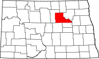 | |
| Townships |
| |
| CDP | ||
| Unincorporated communities | ||
This article is issued from Wikipedia - version of the 7/31/2014. The text is available under the Creative Commons Attribution/Share Alike but additional terms may apply for the media files.