Tappen, North Dakota
| Tappen, North Dakota | |
|---|---|
| City | |
|
Tappen Oil Company - Tappen | |
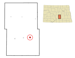 Location of Tappen, North Dakota | |
| Coordinates: 46°52′33″N 99°38′1″W / 46.87583°N 99.63361°WCoordinates: 46°52′33″N 99°38′1″W / 46.87583°N 99.63361°W | |
| Country | United States |
| State | North Dakota |
| County | Kidder |
| Area[1] | |
| • Total | 1.05 sq mi (2.72 km2) |
| • Land | 1.05 sq mi (2.72 km2) |
| • Water | 0 sq mi (0 km2) |
| Elevation | 1,772 ft (540 m) |
| Population (2010)[2] | |
| • Total | 197 |
| • Estimate (2014)[3] | 200 |
| • Density | 187.6/sq mi (72.4/km2) |
| Time zone | Central (CST) (UTC-6) |
| • Summer (DST) | CDT (UTC-5) |
| ZIP code | 58487 |
| Area code(s) | 701 |
| FIPS code | 38-77980 |
| GNIS feature ID | 1032435[4] |

Tappen is a city in Kidder County, North Dakota, United States. The population was 197 at the 2010 census.[5]
History
Tappen was founded in 1882. The city was named for Sheppard Tappen, a local landowner.[6] A post office has been in operation at Tappen since 1882.[7]
Geography
Tappen is located at 46°52′33″N 99°38′1″W / 46.87583°N 99.63361°W (46.875903, -99.633648).[8]
According to the United States Census Bureau, the city has a total area of 1.05 square miles (2.72 km2), all of it land.[1]
Demographics
| Historical population | |||
|---|---|---|---|
| Census | Pop. | %± | |
| 1920 | 182 | — | |
| 1930 | 208 | 14.3% | |
| 1940 | 323 | 55.3% | |
| 1950 | 379 | 17.3% | |
| 1960 | 326 | −14.0% | |
| 1970 | 294 | −9.8% | |
| 1980 | 271 | −7.8% | |
| 1990 | 239 | −11.8% | |
| 2000 | 210 | −12.1% | |
| 2010 | 197 | −6.2% | |
| Est. 2015 | 200 | [9] | 1.5% |
| U.S. Decennial Census[10] 2014 Estimate[3] | |||
2010 census
As of the census[2] of 2010, there were 197 people, 89 households, and 52 families residing in the city. The population density was 187.6 inhabitants per square mile (72.4/km2). There were 106 housing units at an average density of 101.0 per square mile (39.0/km2). The racial makeup of the city was 97.0% White, 0.5% African American, 1.5% from other races, and 1.0% from two or more races. Hispanic or Latino of any race were 2.5% of the population.
There were 89 households of which 28.1% had children under the age of 18 living with them, 42.7% were married couples living together, 5.6% had a female householder with no husband present, 10.1% had a male householder with no wife present, and 41.6% were non-families. 34.8% of all households were made up of individuals and 8.9% had someone living alone who was 65 years of age or older. The average household size was 2.21 and the average family size was 2.81.
The median age in the city was 40.3 years. 23.4% of residents were under the age of 18; 9.1% were between the ages of 18 and 24; 25.4% were from 25 to 44; 27.4% were from 45 to 64; and 14.7% were 65 years of age or older. The gender makeup of the city was 52.8% male and 47.2% female.
2000 census
As of the census of 2000, there were 210 people, 88 households, and 54 families residing in the city. The population density was 167.7 people per square mile (64.9/km²). There were 100 housing units at an average density of 79.9 per square mile (30.9/km²). The racial makeup of the city was 99.52% White and 0.48% African American. Hispanic or Latino of any race were 0.48% of the population.
There were 88 households out of which 29.5% had children under the age of 18 living with them, 52.3% were married couples living together, 6.8% had a female householder with no husband present, and 38.6% were non-families. 35.2% of all households were made up of individuals and 13.6% had someone living alone who was 65 years of age or older. The average household size was 2.39 and the average family size was 3.15.
In the city the population was spread out with 29.5% under the age of 18, 6.2% from 18 to 24, 24.8% from 25 to 44, 23.8% from 45 to 64, and 15.7% who were 65 years of age or older. The median age was 38 years. For every 100 females there were 107.9 males. For every 100 females age 18 and over, there were 114.5 males.
The median income for a household in the city was $31,625, and the median income for a family was $34,444. Males had a median income of $30,250 versus $15,000 for females. The per capita income for the city was $14,453. About 5.2% of families and 10.1% of the population were below the poverty line, including 6.8% of those under the age of eighteen and 11.4% of those sixty five or over.
Climate
This climatic region is typified by large seasonal temperature differences, with warm to hot (and often humid) summers and cold (sometimes severely cold) winters. According to the Köppen Climate Classification system, Tappen has a humid continental climate, abbreviated "Dfb" on climate maps.[11]
References
- 1 2 "US Gazetteer files 2010". United States Census Bureau. Retrieved 2012-06-14.
- 1 2 "American FactFinder". United States Census Bureau. Retrieved 2012-06-14.
- 1 2 "Population Estimates". United States Census Bureau. Retrieved June 18, 2015.
- ↑ "US Board on Geographic Names". United States Geological Survey. 2007-10-25. Retrieved 2008-01-31.
- ↑ "2010 Census Redistricting Data (Public Law 94-171) Summary File". American FactFinder. United States Census Bureau. Retrieved 2 May 2011.
- ↑ North Dakota: Counties, Towns & People. Watchmaker Publishing, Ltd. 2008. p. 107. ISBN 978-1-60386-191-5.
- ↑ "Kidder County". Jim Forte Postal History. Retrieved 22 October 2015.
- ↑ "US Gazetteer files: 2010, 2000, and 1990". United States Census Bureau. 2011-02-12. Retrieved 2011-04-23.
- ↑ "Annual Estimates of the Resident Population for Incorporated Places: April 1, 2010 to July 1, 2015". Retrieved July 2, 2016.
- ↑ United States Census Bureau. "Census of Population and Housing". Retrieved October 30, 2013.
- ↑ Climate Summary for Tappen, North Dakota
External links
Municipalities and communities of Kidder County, North Dakota, United States | ||
|---|---|---|
| Cities |  | |
| Townships |
| |
| Unorganized territories |
| |
| Unincorporated communities | ||