Sylvia, Kansas
| Sylvia, Kansas | |
|---|---|
| City | |
 Location within Reno County and Kansas | |
 KDOT map of Reno County (legend) | |
| Coordinates: 37°57′28″N 98°24′32″W / 37.95778°N 98.40889°WCoordinates: 37°57′28″N 98°24′32″W / 37.95778°N 98.40889°W | |
| Country | United States |
| State | Kansas |
| County | Reno |
| Area[1] | |
| • Total | 0.29 sq mi (0.75 km2) |
| • Land | 0.29 sq mi (0.75 km2) |
| • Water | 0 sq mi (0 km2) |
| Elevation | 1,732 ft (528 m) |
| Population (2010)[2] | |
| • Total | 218 |
| • Estimate (2015)[3] | 215 |
| • Density | 750/sq mi (290/km2) |
| Time zone | CST (UTC-6) |
| • Summer (DST) | CDT (UTC-5) |
| ZIP code | 67581 |
| Area code | 620 |
| FIPS code | 20-69800 [4] |
| GNIS ID | 0473602 [5] |
Sylvia is a city in Reno County, Kansas, United States. As of the 2010 census, the city population was 218.[6]
History
Sylvia was originally called Zenith, and under the latter name was founded in 1874. It was renamed Sylvia in 1886.[7] Sylvia may have been named for the wife and daughter of a railroad employee.[8]
The local high school football team was on the losing side of a lopsided football game against another school from across the county in Sylvia. Played in 1927 with a final score of 256–0, the game produced multiple state high school records.[9]
Geography
Sylvia is located at 37°57′28″N 98°24′32″W / 37.95778°N 98.40889°W (37.957673, -98.408878).[10] According to the United States Census Bureau, the city has a total area of 0.29 square miles (0.75 km2), all of it land.[1]
Demographics
| Historical population | |||
|---|---|---|---|
| Census | Pop. | %± | |
| 1890 | 205 | — | |
| 1900 | 220 | 7.3% | |
| 1910 | 634 | 188.2% | |
| 1920 | 542 | −14.5% | |
| 1930 | 540 | −0.4% | |
| 1940 | 477 | −11.7% | |
| 1950 | 496 | 4.0% | |
| 1960 | 402 | −19.0% | |
| 1970 | 390 | −3.0% | |
| 1980 | 353 | −9.5% | |
| 1990 | 308 | −12.7% | |
| 2000 | 297 | −3.6% | |
| 2010 | 218 | −26.6% | |
| Est. 2015 | 215 | [3] | −1.4% |
| U.S. Decennial Census | |||
2010 census
As of the census[2] of 2010, there were 218 people, 97 households, and 58 families residing in the city. The population density was 751.7 inhabitants per square mile (290.2/km2). There were 142 housing units at an average density of 489.7 per square mile (189.1/km2). The racial makeup of the city was 95.4% White, 0.5% from other races, and 4.1% from two or more races. Hispanic or Latino of any race were 5.0% of the population.
There were 97 households of which 24.7% had children under the age of 18 living with them, 47.4% were married couples living together, 4.1% had a female householder with no husband present, 8.2% had a male householder with no wife present, and 40.2% were non-families. 34.0% of all households were made up of individuals and 12.4% had someone living alone who was 65 years of age or older. The average household size was 2.25 and the average family size was 2.79.
The median age in the city was 45.7 years. 25.2% of residents were under the age of 18; 4.1% were between the ages of 18 and 24; 19.7% were from 25 to 44; 28% were from 45 to 64; and 22.9% were 65 years of age or older. The gender makeup of the city was 53.7% male and 46.3% female.
2000 census
As of the census[4] of 2000, there were 297 people, 122 households, and 84 families residing in the city. The population density was 1,034.5 people per square mile (395.4/km²). There were 142 housing units at an average density of 494.6 per square mile (189.1/km²). The racial makeup of the city was 96.97% White, 0.34% Native American, 1.01% Asian, 0.67% from other races, and 1.01% from two or more races. Hispanic or Latino of any race were 1.68% of the population.
There were 122 households out of which 30.3% had children under the age of 18 living with them, 59.8% were married couples living together, 5.7% had a female householder with no husband present, and 31.1% were non-families. 29.5% of all households were made up of individuals and 17.2% had someone living alone who was 65 years of age or older. The average household size was 2.43 and the average family size was 2.94.
In the city the population was spread out with 27.6% under the age of 18, 7.4% from 18 to 24, 23.2% from 25 to 44, 20.9% from 45 to 64, and 20.9% who were 65 years of age or older. The median age was 40 years. For every 100 females there were 94.1 males. For every 100 females age 18 and over, there were 93.7 males.
The median income for a household in the city was $29,167, and the median income for a family was $38,125. Males had a median income of $38,958 versus $17,813 for females. The per capita income for the city was $17,322. About 4.4% of families and 4.4% of the population were below the poverty line, including 4.3% of those under the age of eighteen and 6.3% of those sixty five or over.
Notable people
- Alva Duer, basketball coach, member of the Basketball Hall of Fame
See also
Further reading
References
- 1 2 "US Gazetteer files 2010". United States Census Bureau. Retrieved 2012-07-06.
- 1 2 "American FactFinder". United States Census Bureau. Retrieved 2012-07-06.
- 1 2 "Annual Estimates of the Resident Population for Incorporated Places: April 1, 2010 to July 1, 2015". Retrieved July 2, 2016.
- 1 2 "American FactFinder". United States Census Bureau. Retrieved 2008-01-31.
- ↑ "US Board on Geographic Names". United States Geological Survey. 2007-10-25. Retrieved 2008-01-31.
- ↑ "2010 City Population and Housing Occupancy Status". U.S. Census Bureau. Retrieved March 27, 2011.
- ↑ Kansas State Historical Society (1916). Biennial Report of the Board of Directors of the Kansas State Historical Society. Kansas State Printing Plant. p. 269.
- ↑ "Profile for Sylvia, Kansas". ePodunk. Retrieved 22 June 2014.
- ↑ "Football State Records (11-Man - Team Records - Single Game)". Kansas Sports Hall of Fame. Retrieved March 9, 2016.
- ↑ "US Gazetteer files: 2010, 2000, and 1990". United States Census Bureau. 2011-02-12. Retrieved 2011-04-23.
External links
| Wikimedia Commons has media related to Sylvia, Kansas. |
- City
- Schools
- USD 310, local school district
- Maps
- Sylvia City Map, KDOT
Municipalities and communities of Reno County, Kansas, United States | ||
|---|---|---|
| Cities | 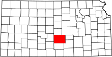 | |
| CDP | ||
| Unincorporated communities | ||
| Ghost towns | ||
| Townships |
| |