Koma Kulshan Project
| Koma Kulshan Hydroelectric Project | |
|---|---|
|
Image of project on Mount Baker as seen from space: red dot is powerhouse, green dot is dam(s). Bellingham on the upper left side of frame, Lake Shannon on lower right. | |
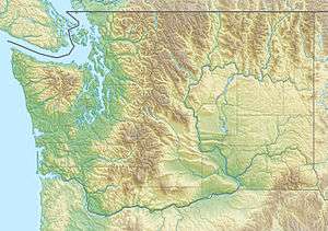 Location of Koma Kulshan Hydroelectric Project in Washington | |
| Official name | Koma Kulshan Project |
| Country | United States |
| Location | Mount Baker National Forest in Whatcom County, Washington |
| Coordinates | 48°40′49″N 121°43′24″W / 48.6802°N 121.7233°WCoordinates: 48°40′49″N 121°43′24″W / 48.6802°N 121.7233°W |
| Purpose | Hydroelectricity |
| Status | Operational |
| Construction began | 1989[1] |
| Opening date | October 1990 |
| Owner(s) | Covanta Energy and Atlantic Power |
| Operator(s) | Puget Sound Energy |
| Dam and spillways | |
| Impounds | Sulphur Creek, Rocky Creek |
| Height |
Rocky Creek Dam: 32 feet (9.8 m) Sulphur Creek Dam: 37 feet (11 m) |
| Length |
Rocky Creek Dam: 18 feet (5.5 m) Sulphur Creek Dam: 15 feet (4.6 m) |
| Power station | |
| Name | Koma Kulshan powerhouse |
| Coordinates | 48°40′49″N 121°43′24″W / 48.6802°N 121.7233°W |
| Operator(s) | Puget Sound Energy |
| Commission date | 1990 |
| Type | Run-of-the-river |
| Hydraulic head | c. 1,600 ft (490 m) |
| Turbines | 1 x Sulzer Escher Wyss Pelton wheel |
| Installed capacity | 13.3 MW @ maximum flow 120 cu ft/s (3.4 m3/s) |
| Capacity factor | 38.6% (2009-2010)[2] |
| Annual generation | 45,000,000 kWh (10/1/2009–9/30/2010[2]) |
|
Website www | |

The Koma Kulshan Project is a 13.3 MW run-of-the-river hydroelectric generation facility on the slopes of Mount Baker, a stratovolcano in Washington state's North Cascades. The project commenced commercial operation in October 1990,[3][4][5] and is owned by a Covanta Energy–Atlantic Power joint venture. It supplies Puget Sound Energy via a Power Supply Agreement (PSA) contract.[3][6] Its single turbine is a Pelton wheel supplied by Sulzer Escher Wyss.[7]
Located in the Mount Baker National Forest, it is one of six Federal Energy Regulatory Commission (FERC)-licensed small hydro installations on Federal Government land in Washington state.[8][9]
Koma Kulshan is the name of Mount Baker in the Lummi dialect.[10]:241
Dams
Intakes are located at diversion dams on the Rocky Creek and Sulphur Creek tributaries of Lake Shannon. A 42–45-inch (1,100–1,100 mm) diameter, 19,250-foot (5,870 m) long penstock carries water from a bifurcation (48°41′29″N 121°47′31″W / 48.6914°N 121.7919°W, 2,750 feet (840 m) a.s.l.) to the powerhouse.[11] Water is discharged from the powerhouse through a short run on Sandy Creek to Baker Lake.[9][8][12][13] Up to 120 cubic feet per second (3.4 m3/s) is diverted to the powerhouse.[14][15]:3-16
Rocky Creek Dam (48°41′06″N 121°48′23″W / 48.6849°N 121.8065°W) is 18 feet (5.5 m) high, 32 feet (9.8 m) long at 2,770 feet (840 m) a.s.l.[11]
Sulphur Creek Dam (48°41′34″N 121°47′34″W / 48.6928°N 121.7928°W) is 15 feet (4.6 m) high, 37 feet (11 m) long at 2,755 feet (840 m) a.s.l.[11]
Diversion of the creek affected the appearance of Upper and Middle Sulphur Creek Falls.[16][17]
Peak generation
Power generation peaks in May through July coinciding with snowmelt, and has a smaller peak in November coinciding with the wet season.[2]
References
- ↑ Burkardt, Nina (April 1995). "Technical Clarity in Inter-Agency Negotiations: Lessons From Four Hydropower Projects" (PDF). Water Resources Bulletin. American Water Resources Association. 31 (2): 188–189. Retrieved 10 July 2015.
- 1 2 3 Power generation statement, Koma Kulshan Associates, October 22, 2010 – via FERC
- 1 2 "Koma Kulshan". Atlantic Power Corporation. Retrieved 8 July 2015.
- ↑ Renewable Resources Development Report California Energy Commission, State of California, November 2003, principal authors: Ann Peterson, Pamela Doughman, Todd Lieberg
- ↑ Northwest Regional Forecast of Power Loads and Resources August 2007 – July 2017 (PDF), Portland, Oregon: Pacific Northwest Utilities Conference Committee (PNUCC), April 2007 – via efsec.wa.gov
- ↑ Covanta Energy sustainability report 2009/2010
- ↑ Christopher Bergesen (ed.), "Kulshan site", Power Plants Around the World (Website), Bethesda, Maryland, retrieved 2015-07-08
- 1 2 Micro hydro at Virtual Nuclear Tourist
- 1 2 Koma Kulshan site, Global Energy Observatory, c. 2006
- ↑ Bright, William (2004), Native American Placenames of the United States, University of Oklahoma Press, ISBN 9780806135984
- 1 2 3 Amended license, FERC, April 25, 1990
- ↑ Water quality certification, Koma Kulshan project (PDF), Washington Department of Ecology, September 16, 1986
- ↑ Site map, Hydrokinetics, September 8, 1980 – via FERC. Note: Site map shows two unbuilt diversion dams on Dillard Creek and Sandy Creek, and does not match as-built configuration of penstock.
- ↑ Koma Kulshan Hydroelectric Project average annual flows for the period 10/1/10 to 9/30/11, Koma Kulshan Associates, December 14, 2011 – via FERC
- ↑ Initial Consultation Document: Baker River Project, FERC No.2150, Existing Conditions (PDF), Puget Sound Energy
- ↑ Bryan Swan, "Upper Sulphur Creek Falls", Northwest Waterfall Survey, retrieved 2015-07-08
- ↑ Bryan Swan, "Middle Sulphur Creek Falls", Northwest Waterfall Survey, retrieved 2015-07-08
Further reading
- Beth A.K. Coughlan, Nina Burkardt, and David Fulton (November 1993), "Assessing the "need to negotiate" in ferc licensing consultations: A study of two hydropower projects", Environmental Impact Assessment Review, 13 (6), pp. 331–351, doi:10.1016/0195-9255(93)90002-S
- Vassilia Angelaki and Jonathan M. Harbor (1995), "IMPACTS OF FLOW DIVERSION FOR SMALL HYDROELECTRIC POWER PLANTS ON SEDIMENT TRANSPORT, NORTHWEST WASHINGTON", Physical Geography, 16 (5): 432–443, doi:10.1080/02723646.1995.10642564
External links
- FERC document library of documents related to permit 3239, Koma Kulshan
- "Dillard Point Lookout". Peakbagger.com. — area topographic map