Sullivan Township, Grant County, Kansas
| Sullivan Township | |
|---|---|
| Township | |
 Location in Grant County | |
| Coordinates: 37°28′00″N 101°18′17″W / 37.46667°N 101.30472°WCoordinates: 37°28′00″N 101°18′17″W / 37.46667°N 101.30472°W | |
| Country | United States |
| State | Kansas |
| County | Grant |
| Area | |
| • Total | 215.4 sq mi (557.89 km2) |
| • Land | 215.37 sq mi (557.81 km2) |
| • Water | 0.03 sq mi (0.08 km2) 0.01% |
| Elevation | 3,074 ft (937 m) |
| Population (2000) | |
| • Total | 353 |
| • Density | 1.6/sq mi (0.6/km2) |
| GNIS feature ID | 0485082 |
Sullivan Township is a township in Grant County, Kansas, USA. As of the 2000 census, its population was 353.
Geography
Sullivan Township covers an area of 215.4 square miles (558 km2) and contains no incorporated settlements. According to the USGS, it contains two cemeteries: Golden and Zionville.
The streams of North Fork Cimarron River and Sand Arroyo Creek run through this township.
References
External links
Municipalities and communities of Grant County, Kansas, United States | ||
|---|---|---|
| City | 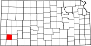 | |
| Unincorporated communities | ||
| Townships | ||
This article is issued from Wikipedia - version of the 11/11/2013. The text is available under the Creative Commons Attribution/Share Alike but additional terms may apply for the media files.