Strath Creek, Victoria
| Strath Creek Victoria | |||||||||||||
|---|---|---|---|---|---|---|---|---|---|---|---|---|---|
 Looking towards the main intersection at Strath Creek from Pioneer Park | |||||||||||||
 Strath Creek | |||||||||||||
| Coordinates | 37°14′11″S 145°13′16″E / 37.23639°S 145.22111°ECoordinates: 37°14′11″S 145°13′16″E / 37.23639°S 145.22111°E | ||||||||||||
| Population | 262 (2011 census)[1] | ||||||||||||
| Postcode(s) | 3658 | ||||||||||||
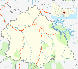
| Location | |||||||||||||
| LGA(s) | Shire of Murrindindi | ||||||||||||
| State electorate(s) | Eildon | ||||||||||||
| Federal Division(s) | Indi | ||||||||||||
| |||||||||||||
Strath Creek is a small town in central Victoria, Australia. It is in the Shire of Murrindindi local government area, 104 kilometres (65 mi) north of the state capital, Melbourne, on the creek of the same name which flows into King Parrot Creek to the north. At the 2011 census, Strath Creek and the surrounding area had a population of 262.[1]
History
Strath Creek Post Office opened on 16 April 1885.[2]
Today
The town was affected by the Black Saturday bushfires in February 2009, with the picturesque Hume and Hovell cricket ground barely escaping the flames. The cricket ground is based on the famous Lord's in England, having the same dimensions and a similar slope.[3]
References
- 1 2 Australian Bureau of Statistics (31 October 2012). "Strath Creek (State Suburb)". 2011 Census QuickStats. Retrieved 30 November 2014.
- ↑ Premier Postal History. "Post Office List". Retrieved 2008-04-11.
- ↑ Caldwell, Alison (27 February 2009). "Cricket oval's lucky escapes from bushfires". The World Today. Australian Broadcasting Corporation. Retrieved 2009-06-17.
External links
| Wikimedia Commons has media related to Strath Creek, Victoria. |
This article is issued from Wikipedia - version of the 10/20/2016. The text is available under the Creative Commons Attribution/Share Alike but additional terms may apply for the media files.