Taggerty
| Taggerty Victoria | |
|---|---|
 Public hall | |
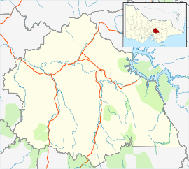 Taggerty Location in Shire of Murrindindi | |
| Coordinates | 37°19′18″S 145°42′43″E / 37.32167°S 145.71194°ECoordinates: 37°19′18″S 145°42′43″E / 37.32167°S 145.71194°E |
| Population | 330 (2011 census)[1] |
| Postcode(s) | 3714 |
| Location | |
| LGA(s) | Shire of Murrindindi |
| State electorate(s) | Eildon |
| Federal Division(s) | Indi |
Taggerty is a town in central Victoria, Australia. It is located at the intersection of Maroondah Highway and Thornton Road. The Acheron River also crosses the highway at Taggerty. At the 2011 census, Taggerty and the surrounding area had a population of 330.[1]
A pastoral run called Taggerty Run was established in 1846. The homestead of the run was called Taggerty House. Gold was discovered along the Acheron River in 1870, which led to the establishment of two settlements, named Acheron Lower (now known as Acheron) and Acheron Upper (now known as Taggerty). The Post Office opened on April 15, 1876 and was renamed Taggerty in 1893.[2] Acheron Upper Primary School opened in 1875. The general store opened in 1891, as did a butter factory, reflecting the area's shift from gold mining towards dairy farming. The town was given the name Taggerty in 1890 to avoid confusion with Acheron Lower.
Today Taggerty remains a small township, with a general store, primary school, a town hall, a caravan park, and several bed and breakfasts.
References
| Wikimedia Commons has media related to Taggerty. |
- 1 2 Australian Bureau of Statistics (31 October 2012). "Taggerty (State Suburb)". 2011 Census QuickStats. Retrieved 30 November 2014.
- ↑ Premier Postal History, Post Office List, retrieved 2008-04-11