Strandvik (municipality)
| Strandvik kommune | |
|---|---|
| Former Municipality | |
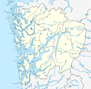 Strandvik kommune Location in Hordaland county | |
| Coordinates: 60°09′34″N 05°40′00″E / 60.15944°N 5.66667°ECoordinates: 60°09′34″N 05°40′00″E / 60.15944°N 5.66667°E | |
| Country | Norway |
| Region | Western Norway |
| County | Hordaland |
| District | Midhordland |
| Municipality ID | NO-1240 |
| Adm. Center | Strandvik |
| Area[1] | |
| • Total | 143 km2 (55 sq mi) |
| Population (1963) | |
| • Total | 2,078 |
| Time zone | CET (UTC+01:00) |
| • Summer (DST) | CEST (UTC+02:00) |
| Created as | Fusa in 1903 |
| Merged into | Fusa in 1964 |
Strandvik is a former municipality in Hordaland county, Norway. The 143-square-kilometre (55 sq mi) municipality encompassed the southern part of present-day municipality of Fusa. It included the inner part of the Bjørnafjorden. The administrative centre of the municipality was the village of Strandvik where the Strandvik Church is located.[1]
History
On 1 January 1903, the parish of Strandvik was separated from the municipality of Fusa to form a separate municipality of its own. Initially, Strandvik had a population of 1,876. It was a small municipality and so in the early 1960s, the Schei Committee recommended that it be merged with two of its neighbors: Fusa and Hålandsdal. So, on 1 January 1964, Strandvik was merged with Hålandsdal and most of Fusa, creating a new, larger municipality of Fusa. Prior to the merger, Strandvik had a population of 2,053.[2]
References
- 1 2 Store norske leksikon. "Strandvik" (in Norwegian). Retrieved 2014-07-14.
- ↑ Jukvam, Dag (1999). "Historisk oversikt over endringer i kommune- og fylkesinndelingen" (PDF) (in Norwegian). Statistisk sentralbyrå.