Bjørnafjorden
| Bjørnafjorden | |
|---|---|
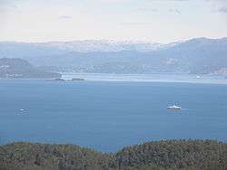 View of the fjord | |
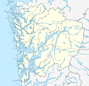 Bjørnafjorden Location in Hordaland county | |
| Location | Hordaland county, Norway |
| Coordinates | 60°05′56″N 5°23′06″E / 60.0989°N 5.3851°ECoordinates: 60°05′56″N 5°23′06″E / 60.0989°N 5.3851°E |
| Primary inflows | Fusafjorden |
| Basin countries | Norway |
| Max. length | 30 kilometres (19 mi) |
| Max. width | 10 kilometres (6.2 mi) |
| Max. depth | 583 metres (1,913 ft) |
Bjørnafjorden is a fjord in Hordaland county, Norway. It runs through the municipalities of Austevoll, Fusa, Os, and Tysnes. The large island of Tysnesøya (and many small, surrounding islands such as Reksteren) lie along the south side of the Bjørnafjorden and the Bergen Peninsula and the mainland lie along the north and east sides of the fjord. The Fusafjorden (and the Samnangerfjorden which branches off it) split off from the main fjord on the north side by the village of Osøyro. The 30-kilometre (19 mi) fjord is about 10 kilometres (6.2 mi) wide and its maximum depth is 583 metres (1,913 ft) below sea level.[1][2]
See also
References
- ↑ Godal, Anne Marit (ed.). "Bjørnafjorden". Store norske leksikon (in Norwegian). Norsk nettleksikon. Retrieved 5 January 2012.
- ↑ Evensen, Knut Harald, ed. (2006). NAF Veibok 2007-2009 (in Norwegian). Oslo: Norges Automobil-Forbund. p. 33.
This article is issued from Wikipedia - version of the 7/14/2014. The text is available under the Creative Commons Attribution/Share Alike but additional terms may apply for the media files.