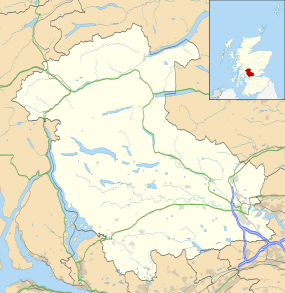
Stirling
| Stirling | |
| Scottish Gaelic: Sruighlea | |
| Scots: Stirlin | |
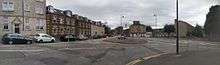
Dec2005.jpg) Stirling city centre |
|
 Stirling |
|
| Population | 45,750 Census 2011 [1] |
|---|---|
| OS grid reference | NS795935 |
| – Edinburgh | 43 mi (69 km) |
| Civil parish | Stirling |
| Council area | Stirling |
| Lieutenancy area | Stirling and Falkirk |
| Country | Scotland |
| Sovereign state | United Kingdom |
| Post town | STIRLING |
| Postcode district | FK7-FK9 |
| Dialling code | 01786 |
| Police | Scottish |
| Fire | Scottish |
| Ambulance | Scottish |
| EU Parliament | Scotland |
| UK Parliament | Stirling |
| Scottish Parliament | Stirling |
Coordinates: 56°07′02″N 3°56′23″W / 56.117222°N 3.939722°W
Stirling (/ˈstɜːrlɪŋ/; Scots: Stirlin; Scottish Gaelic: Sruighlea [ˈs̪t̪ruʝlə]) is a city in central Scotland. The city is clustered around a large fortress and medieval old town. Stirling is the administrative centre for the Stirling council area, and is traditionally the county town of Stirlingshire. The city is located several miles to the west of the mouth of the River Forth. Historically it was strategically important as the "Gateway to the Highlands", with its position near the Highland Boundary Fault between the Scottish Lowlands and Highlands and has been described as the brooch which clasps the Highlands and the Lowlands together.[2]
Its historical position as the nearest crossing of the Forth to the river mouth meant that it attracted invaders. The beast of Stirling is the wolf. According to legend, when Stirling was under attack from Viking invaders, a wolf howled, alerting the townspeople in time to save the town.[3]
Once the capital of Scotland, Stirling contains the Great Hall (restored 1999) and the Renaissance Palace (restoration completed 2011) within Stirling Castle. Stirling also has its medieval parish church, the Church of the Holy Rude, where King James VI was crowned King of Scots on 29 July 1567. The Holy Rude still functions, with a service every Sunday.
Stirling is a centre for local government, higher education, retail, and industry. The 2011 census recorded the population of the city as 45,750, the wider Stirling council area has a population of 89,850. The majority of the population is located in its southeast corner, in the City of Stirling and in the surrounding area.
One of the principal royal strongholds of the Kingdom of Scotland, Stirling was created a Royal burgh by King David I in 1130, which it remained until 1975, when the burgh as an administrative unit was abolished. In 2002, as part of Queen Elizabeth II's Golden Jubilee, Stirling was granted city status.
History

Stirling was originally a Stone Age settlement as shown by the Randolphfield standing stones and Kings Park prehistoric carvings that can still be found south of the town.[4][5] The city has been strategically significant since at least the Roman occupation of Britain, due to its naturally defensible crag and tail hill (latterly the site of Stirling Castle), and its commanding position at the foot of the Ochil Hills on the border between the Lowlands and Highlands, at the lowest crossing point of the River Forth. It remained the river's lowest crossing until the construction of the Kincardine Bridge further downstream in the 1930s. It is supposed that Stirling is the fortress of Iuddeu or Urbs Giudi where Oswiu of Northumbria was besieged by Penda of Mercia in 655, as recorded in Bede and contemporary annals.
A ford, and later bridge, of the River Forth at Stirling brought wealth and strategic influence, as did its port. The town was chartered as a royal burgh by King David in the 12th century, with charters later reaffirmed by later monarchs (the town then referred to as Strivelyn). Major battles during the Wars of Scottish Independence took place at the Stirling Bridge in 1297 and at the nearby village of Bannockburn in 1314 involving William Wallace and Robert the Bruce respectively. There were also several Sieges of Stirling Castle in the conflict, notably in 1304. Sir Robert Felton, governor of Scarborough Castle in 1311, was slain at Stirling in 1314.

The origin of the name Stirling is uncertain, but folk etymology suggests that it originates in either a Scots or Gaelic term meaning the place of battle, struggle or strife. Other sources suggest that it originates in a Brythonic name meaning "dwelling place of Melyn".[6] The town has two Latin mottoes, which appeared on the earliest burgh seal of which an impression of 1296 is on record:[7]
- Hic Armis Bruti Scoti Stant Hic Cruce Tuti (The Britons stand by force of arms, The Scots are by this cross preserved from harms) and
- Continet Hoc in Se Nemus et Castrum Strivilinse (The Castle and Wood of Stirling town are in the compass of this seal set down.)
Standing near the castle, the Church of the Holy Rude is one of the town's most historically important buildings. Founded in 1129 it is the second oldest building in the city after Stirling castle. It was rebuilt in the 15th century after Stirling suffered a catastrophic fire in 1405, and is reputed to be the only surviving church in the United Kingdom apart from Westminster Abbey to have held a coronation.[8] On 29 July 1567 the infant son of Mary, Queen of Scots, was crowned James VI of Scotland here.[8] Musket shot marks that may come from Cromwell's troops during the Wars of the Three Kingdoms are clearly visible on the tower and apse.[8] Another important historical religious site in the area is the ruins of Cambuskenneth Abbey, the resting place of King James III of Scotland and his queen, Margaret of Denmark.[9] During the Wars of the Three Kingdoms, the Battle of Stirling also took place in the centre of Stirling on 12 September 1648.

The fortifications continued to play a strategic military role during the 18th century Jacobite Risings. In 1715, the Earl of Mar failed to take control of the castle. On 8 January 1746 (OS) 19 January 1746 (NS), the army of Bonnie Prince Charlie seized control of the town but failed to take the Castle. On their consequent retreat northwards, they blew up the church of St. Ninians where they had been storing munitions; only the tower survived and can be seen to this day.[10]
Economically, the city's port supported overseas trade, including tea trade with India and timber trade with the Baltic. The coming of the railways in 1848 started the decline of the river trade, not least because a railway bridge downstream restricted access for shipping. By the mid 20th century the port had ceased to operate.
Notable people
Famous residents have included Mary, Queen of Scots; King James VI of Scotland; Sir Henry Campbell-Bannerman; documentary film pioneer John Grierson; film music composer Muir Mathieson; animation pioneer Norman McLaren; TV presenter Kirsty Young; and footballers Billy Bremner (captain of Leeds United and Scotland) and Frank Beattie (captain of Kilmarnock). John Paton, recipient of the Victoria Cross, and Scots-Argentine pioneer chemist John Joseph Jolly Kyle, were from Stirling.
The Barnwell brothers, Frank and Harold, worked at Grampian Motors in Causewayhead, and in 1909 they designed and flew the first powered aircraft in Scotland. Frank Barnwell went on to design aircraft including the Bristol Blenheim. A small monument to the brothers' pioneering achievement has been erected at Causewayhead roundabout.[11]
Geography
 |
Callander | Crieff, Dunblane | Perth | |
| Loch Lomond | |
Tullibody, Alloa, Dunfermline | ||
| ||||
| | ||||
| Glasgow, Kirkintilloch | Cumbernauld, Denny | Falkirk, Edinburgh |
Governance
In terms of local government, the city of Stirling is a part of the wider Stirling Council area, which governs on matters of local administration as set out by the Local Government etc (Scotland) Act 1994. The current members of the Council were voted in 2012 for a term of office of 5 years. The Council is currently controlled by a Labour - Conservative partnership administration.[12] The Provost of Stirling is Cllr Mike Robbins.[13]
In terms of national government, Stirling forms part of county constituency of Stirling constituency of the House of Commons, electing one Member of Parliament (MP) to the House of Commons of the parliament of the United Kingdom by first past the post system. Steven Paterson of the Scottish National Party is the MP for Stirling constituency of the House of Commons.[14]
For the purposes of the Scottish Parliament, Stirling forms part of the Stirling constituency of the Scottish Parliament constituency. The Stirling Scottish Parliament (or Holyrood) constituency created in 1999 is one of nine within the Mid Scotland and Fife electoral region. Each constituency elects one Member of the Scottish Parliament (MSP) by the first past the post system of election, and the region elects seven additional members to produce a form of proportional representation. The constituency is represented by Bruce Crawford, MSP of the Scottish National Party.[15]
As Scotland comprises a single European Parliament Constituency, Stirling participates in electing six MEPs using the D'Hondt method of proportional representation every five years.
Geography

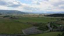
Stirling is renowned as the Gateway to the Highlands and is generally regarded as occupying a strategic position at the point where the flatter, largely undulating Scottish Lowlands meet the rugged slopes of the Highlands along the Highland Boundary Fault.[16][17] The starkness of this contrast is evidenced by the many hills and mountains of the lower Highlands such as Ben Vorlich and Ben Ledi which can be seen to the northwest of the city. On the other hand, the Carse of Stirling, stretching to the west and east of the city, is one of the flattest and most agriculturally productive expanses of land in the whole of Scotland.
The land surrounding Stirling has been most affected by glacial erosion and deposition. The city itself has grown up around its castle which stands atop an ancient quartz-dolerite sill, a major defensive position which was at the lowest crossing point on the River Forth. Stirling stands on the Forth at the point where the river widens and becomes tidal. To the east of the city the Ochil Hills dominate the skyline with the highest peak in the range being Ben Cleuch, although Dumyat is more noticeable from Stirling. The Ochils meet the flat carse (floodplain) of the River Forth to the east of the distinctive geographical feature of Abbey Craig, a crag and tail hill upon which stands the 220 ft (67m) high Wallace National Monument.[18]
The climate of Stirling differs little from that of much of the rest of central Scotland. The warm Gulf Stream air current from the Atlantic Ocean is the predominant influence, with a prevailing southwesterly wind. That said, the areas round Stirling Town Centre encounter significantly less snow in Winter than many of its very close neighbours such as Denny and Dunblane. Although this could be said as being anecdotal, it is likely to be because it is at a lower level and could be said to have its own microclimate.
Areas of Stirling
Top of the Town
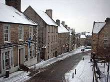
Top of the Town consists of Broad Street, Castle Wynd, Ballengeich Pass, Lower Castle Hill Road, Darnley Street, Baker Street ( formerly Baxters St) and St Mary's Wynd. These streets all lead up to Stirling Castle and are the favourite haunt of tourists who stop off at the Old Town Jail, Mar's Wark, Argyll's Lodging and the castle. Ballengeich Pass leads to the graveyard at Ballengeich and the Castle Wynd winds past the old graveyard. The Top of the Town from Broad Street upwards is renowned for its cobblestoned roads, and cars can be heard rattling over the cobblestones on the way down. Craft shops and tourist-focused shops are evident on the way up and once at the top, panoramic views are available across Stirling and beyond.
Other areas
- Abbey Craig
- Airthrey
- Allan Park
- Bannockburn
- Borestone
- Braehead
- Broomridge
- Burghmuir
- Cambusbarron
- Cambuskenneth
- Causewayhead
- Chartershall
- Corn Exchange
- Cornton
- Coxethill
- Craigmill
- Craig Leith
- Cultenhove
- Forthbank
- Gillies Hill
- Gowan Hill
- Hillpark
- Kenningknowes
- Kildean
- King's Park
- Laurelhill
- Livilands
- Loanhead
- Mercat Cross
- Raploch
- Randolphfield
- Riverside
- Spittal Hill
- Springkerse
- St. Ninians
- Torbrex
- Whins of Milton
- Viewforth
- Wolfcraig
Demography
The City of Stirling had a population of 45,750, in 2012. The City is reputed to be the third fastest growing area of Scotland in terms of population.[19] According to the 2001 census, 52.7% of the population was female compared to 47.2% male. Stirling had both a smaller proportion of under 16s, at 16.7% compared to the Scottish average of 19.2%, and a smaller proportion of those of pensionable age – 17.8% – compared to the Scottish average of 18.6%.[20] The highest proportion of the population, at 24.3%, was concentrated in the 16–29 age group. Stirling also had a higher proportion of non-Scottish born residents at 16.5%, compared to the Scottish average of 12.8%. The population was also slightly younger than the Scottish average of 37 – the median age for males was 34; and the median age for females was 36, to the national average of 39. The population peaks and troughs significantly when the students come and go from the city.
Culture
Stirling has hosted the National Mòd several times: in 1909, 1961, 1971,1987 and 2008.[21]
Economy


At the centre of a large rural agricultural hinterland that encompasses some of the flattest and most productive land in Scotland, Stirling principally functioned as a market town, symbolised by its Mercat cross, with farmers coming to sell their products and wares in the large agricultural market that was held in the town. Today, agriculture still plays a part in the economic life of Stirling, given its focus at the heart of a large rural area, but to a much lesser extent than previously.
With Stirling's development as a market town and its location as the focus of transport and communications in the region, it has developed a substantial retail sector serving a wide range of surrounding communities as well as the city itself. Primarily centred on the city centre, there are a large number of chain stores, as well as the Thistles shopping centre. However this has been augmented by out-of-town developments such as the Springkerse Retail Park on the city bypass to the east of Stirling, and the development of a large Sainsbury's in the Raploch.
A major new regeneration project on the site of the former port area and the 40-acre (160,000 m2) former Ministry of Defence site, adjacent to Stirling Railway Station, is currently underway.[22] Known as Forthside, it has the aim of developing a new waterfront district linked to the railway station via a new pedestrian bridge. The development comprises retail, residential and commercial elements, including a conference centre, hotel and Vue multiplex cinema, that will ultimately expand the city centre area, linking it to the River Forth, which has been cut off from the city centre area since the construction of the A9 bypass under the railway station in the 1960s.[23] For the first time in 100 years, local people will have access to the banks of the River Forth in the city centre with landscaped public areas, footpaths, cycleways and an improved public transport network.
In the service sector, financial services as well as tourism are the biggest employers. The financial services and insurance company Prudential have a large and well-established base at Craigforth on the outskirts of Stirling. In terms of tourism, the presence of such historical monuments as Stirling Castle, the National Wallace Monument and other nearby attractions like Blair Drummond Safari Park, the key role which Stirling has played in Scottish history, as well as the scenery of the area, has bolstered Stirling's position as an important tourist destination in Scotland.
The University of Stirling and Stirling Council are two of the biggest employers in the area. Knowledge related industries, research and development as well as life sciences have clustered around the university in the Stirling University Innovation Park, close to its main campus. Other public sector agencies that are major employers in the city include Police Scotland, Scottish Prison Service, NHS Forth Valley and the Scottish Environment Protection Agency.
Stirling is home to national construction companies Ogilvie Group, chaired by Duncan Ogilvie, who is listed in the Times Rich List as being worth £35 million.
A Bank of Scotland survey in 2009 found that workers in Stirling had the highest average earnings of £716 a week.[24]
Transport
Public transport to districts within the city and to the surrounding towns, like Bridge of Allan and Alloa, is almost completely provided by buses operated principally by FirstGroup, although there are also railway links to Bridge of Allan, Dunblane, and, since 2008, Alloa. At the heart of Scotland's Central Belt, Stirling has direct road connections to the major cities of Glasgow, via the M80 motorway, and Edinburgh, via the M9 motorway, as well as inter-city rail links from Stirling Railway Station, including services to Glasgow Queen Street, Edinburgh Waverley and London Kings Cross. Transport infrastructure in the area has been further improved with the completion of the Upper Forth Crossing and the Stirling-Alloa-Kincardine rail link, and there is an ongoing (2010) upgrade of the A80 Trunk road to Motorway standards. The City of Stirling is home to a large number of commuters, with 12,000 residents commuting to work in other areas, with 13,800 workers also travelling into the city.[25]
Sports and recreation
Stirling is home to professional league teams in football, rugby and cricket.
The senior football team, Stirling Albion, play in the Scottish League Two at their home ground at Forthbank. In July 2010, the Stirling Albion Supporters' Trust successfully took over the running of the club buying out the long-serving chairman, Peter McKenzie, after 14 months of campaigning. This made Stirling Albion the first fully owned community club in the history of British football, after previous attempts made by Manchester United, Liverpool and Rangers.[26]
Stirling County currently play in rugby's Scottish Premiership Division One.
The athletics team Central Athletic Club are based at the University of Stirling. The University Stirling Wanderers Hockey Club have also moved to a brand new (international standard) pitch at Forthbank for season 2008–09.[27] Next to this pitch there is also the ground of Stirling County Cricket Club, whose pavilion captured an architectural award in June 2009,[28] three years after its opening.
Scotland international footballers Billy Bremner, John Colquhoun, Duncan Ferguson, female footballer Frankie Brown and brothers Gary and Steven Caldwell were born in Stirling. So were rugby internationals Kenny Logan, Allister Hogg and Alison McGrandles, jockey Willie Carson, and cricketer Dougie Brown.
The University of Stirling is a major centre of sports training and education in Scotland. It was designated as Scotland's University for Sporting Excellence by the Scottish Government in 2008. The headquarters of the Scottish Institute of Sport is a purpose-built facility on the campus which opened in 2002. Also at the university is the Scottish National Swimming Academy, where Rio 2016, Olympic silver medalists and students at the university, Duncan Scott and Robbie Renwick trained. Commonwealth gold medalist Ross Murdoch, who also competed at Rio 2106, is a student at the university. The Gannochy National Tennis centre, which is seen as a tennis centre of excellence, was where Andy Murray and his brother Jamie Murray honed their skills as juniors. Gordon Reid, wheel chair Olympic gold medalist in 2016, was a tennis scholar at the university.[29] The university men's and women's golf teams are consistently ranked among the best in European. [30]
The university has a dedicated sports studies department, which is within the Faculty of Health Science and Sport, and is ranked amongst the best in the United Kingdom for its provision of sports facilities, with the maximum 5-star award, shared by 16 other universities in the UK.[31] The University of Stirling also currently hosts the Scottish men's lacrosse champions.
Stirling and its surrounding area has a number of 9- and 18-hole golf courses, the largest of which is the Stirling Golf Course, located in the Kings Park area of the city. The Peak, a new Sports Village, was opened in April 2009 to cater for a range of sporting activities.[32]
In June 2014, Stirling will become the home of Scottish cricket after an agreement between Stirling County Cricket Club, Cricket Scotland and Stirling Council. It is hoped that the redevelopment of the ground will start at end 2014 with the intention being to upgrade it to international match standards. Scotland will play the majority of their home international games at the ground, starting with the World T20 qualifiers in the summer of 2015.
The development will see a new pavilion and indoor training facility built at New Williamfield, the home of Stirling County Cricket Club, with Cricket Scotland relocating its headquarters from the National Cricket Academy at Ravelston, Edinburgh.[33]
Education
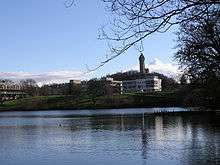
The University of Stirling opened in 1967 on a greenfield site outside the town. Currently there are 11,100 students studying at the university, of which 7,995 are undergraduates and 3105 are postgraduates. There are 120 nationalities represented on the university campus, with 19% of students coming from overseas.[34] It has grown into a major research centre, with a large science park – Innovation Park, located immediately adjacent to the main university campus. Innovation Park has grown since its initiation in 1993, and is now home to 40 companies engaging in various forms of research and development.[35] In January 2008 it was announced that students from Singapore would be able to gain degrees in retail from the University of Stirling in a tie-up with the country's Nanyang Polytechnic (NYP).[36]
Stirling is also home to part of the wider Forth Valley College which was formed on 1 August 2005 from the merger of Falkirk, Stirling and Clackmannan colleges.
There are four main high schools in Stirling itself – Stirling High School, with a school roll of 964 pupils, Wallace High School with 958 pupils, St Modan's High School with 912 pupils, and Bannockburn High School in Broomridge with 752 pupils.[37][38][39][40] All the city's secondary school premises have been redeveloped as a result of a Public-private partnership scheme. Stirling also has a Gaelic-medium unit situated in the city's Riverside Primary School which teaches pupils from across Stirling and Clackmannanshire through the medium of Scottish Gaelic.[41]
Twinned cities
 Vyborg, Russia
 Villeneuve d'Ascq, France
 Dunedin, Florida, United States
 Óbuda, Hungary
 Summerside, Prince Edward Island, Canada
 Kecioren, Turkey[42]
Photo Gallery


See also
References
- ↑ "Area Profile Populations for Localities in Scotland". Retrieved 3 December 2015.
- ↑ King, Elspeth (2009). Old Stirling. Stenlake Publishing. p. 3. ISBN 9781840334517.
- ↑ King, Elspeth (2009). Old Stirling. Stenlake Publishing. p. 3. ISBN 9781840334517.
- ↑ "Randolphfield, Stirling, Stirlingshire " The Northern Antiquarian". Megalithix.wordpress.com. 8 March 2010. Retrieved 14 July 2010.
- ↑ "King's Park, Stirling, Stirlingshire " The Northern Antiquarian". Megalithix.wordpress.com. 25 November 2008. Retrieved 14 July 2010.
- ↑ Iain Taylor. "Place names" (PDF). Retrieved 24 April 2013.
- ↑ RM Urquhart, Scottish Burgh and County Heraldry, London, 1973
- 1 2 3 "The Church Of The Holy Rude". Church of Scotland. Retrieved 1 February 2011.
- ↑ "Cambuskenneth Abbey". Historic Scotland. Retrieved 5 February 2011.
- ↑ Ross, David R. (2001). On the Trail of Bonnie Prince Charlie. Dundurn Press Ltd. p. 79. ISBN 0-946487-68-5.
- ↑ "100th anniversary of first powered flight in Scotland". University of Glasgow. 24 July 2009. Retrieved 1 February 2011.
- ↑ Labour/Tory deal at Stirling Council ousts SNP. BBC News 10 May 2012. Retrieved 18 September 2013
- ↑ Stirling Council - Provost Information. Retrieved 18 September 2013
- ↑ "Steven Paterson becomes first SNP MP for Stirling after gaining seat from Labour". Daily Record. 2015. Retrieved 16 May 2015.
- ↑ "Bruce Crawford, MSP for Stirling". The Scottish Parliament. 2010. Retrieved 5 February 2011.
- ↑ Miers, Richenda (2006). Scotland. The Globe Pequot Press. p. 271. Retrieved 30 January 2011.
- ↑ Josephine Buchanan (2003). Scotland. APA Publications. p. 213. Retrieved 6 February 2011.
- ↑ Gazetteer for Scotland Abbey Craig
- ↑ Stirling Council City Profile Stirling Profile
- ↑ "Browser Population". www.scrol.gov.uk. Retrieved 12 August 2008.
- ↑ List of Mod's places for each year on Sabhal Mòr Ostaig website
- ↑ "Stirling Council: Council » Latest News". Stirling.gov.uk. Retrieved 14 July 2010.
- ↑ "InStirling report on Forthside project". Instirling.com. Retrieved 14 July 2010.
- ↑ "Aberdeenshire tops health and wealth living survey". BBC News. 19 December 2009. Retrieved 14 July 2010.
- ↑ Stirling Council, Property and the economy Keeping an eye on your business
- ↑ Williams, Martin (2 July 2010). "Albion fans first in Britain to own club". The Herald. Retrieved 6 February 2011.
- ↑ "Stirling Wanderers Hockey club: The website for field hockey in Stirlingshire". Stirling Wanderers. Retrieved 26 August 2008.
- ↑ "Judges bowled over by club". Stirling Observer. 17 June 2009. Retrieved 7 July 2009.
- ↑ "sportscotland serves communities with Lottery funding". sportscotland. 14 August 2004. Retrieved 26 August 2008.
- ↑ "University of Stirling European Golf Champions". University of Stirling. 18 September 2016.
- ↑ University of Stirling External Visitor Information
- ↑ "Sports Village". Stirling.gov.uk. Retrieved 14 July 2010.
- ↑ "Cricket Scotland set to move to Stirling". 12 June 2014. Retrieved 12 July 2014.
- ↑ Visitor Information – Useful facts and figures Stirling University Facts and Figures
- ↑ Stirling University Innovation Park About us
- ↑ Jamieson, Alastair (21 January 2008). "Stirling in degree deal with Singapore polytechnic". Edinburgh: The Scotsman. Retrieved 26 August 2008.
- ↑ "Stirling High School". Learning and Teaching Scotland. Retrieved 4 February 2011.
- ↑ "St Modans High School". Learning and Teaching Scotland. Retrieved 4 February 2011.
- ↑ "Wallace High School". Learning and Teaching Scotland. Retrieved 4 February 2011.
- ↑ "Bannockburn High School". Learning and Teaching Scotland. Retrieved 4 February 2011.
- ↑ "Riverside Primary School". Stirling and Clackmannan. Retrieved 6 February 2011.
- ↑ "Stirling to become first UK city in more than 10 years to link with Turkey". BBC News. 8 April 2013. Retrieved 12 May 2013.
Mair, Craig (1990). Stirling: The Royal Burgh. John Donald Publishers. ISBN 0-85976-420-6.
External links
| Wikimedia Commons has media related to Stirling. |
| Wikivoyage has a travel guide for Stirling. |
- Stirling Council Website
- Stirling Castle (Historic Scotland)
- Mapping the Town: the history of Stirling, presented by Julian Richards (BBC Radio 4) (RealAudio format)
- University of Stirling
- Photos of Stirling
- Cambusbarron Village – Local website with lots of information about the village and the Stirling area
- Stirling Gaelic Choir
- Tolbooth, Stirling's venue for live music
- Albion Trust Video link shows worlds oldest football, located at Smith Museum Stirling