Stansstad
| Stansstad | ||
|---|---|---|
 | ||
| ||
 Stansstad | ||
|
Location of Stansstad  | ||
| Coordinates: 46°58.602′N 8°20.403′E / 46.976700°N 8.340050°ECoordinates: 46°58.602′N 8°20.403′E / 46.976700°N 8.340050°E | ||
| Country | Switzerland | |
| Canton | Nidwalden | |
| District | n.a. | |
| Area[1] | ||
| • Total | 9.11 km2 (3.52 sq mi) | |
| Elevation | 436 m (1,430 ft) | |
| Population (Dec 2015[2]) | ||
| • Total | 4,396 | |
| • Density | 480/km2 (1,200/sq mi) | |
| Postal code | 6362 | |
| SFOS number | 1510 | |
| Surrounded by | Alpnach (OW), Ennetbürgen, Ennetmoos, Hergiswil, Horw (LU), Meggen (LU), Stans, Weggis (LU) | |
| Website |
www SFSO statistics | |

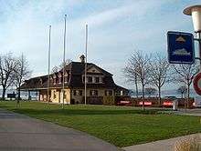
Stansstad is a village in the canton of Nidwalden in Switzerland.
Geography

Stansstad has an area, as of 2006, of 9.1 square kilometers (3.5 sq mi). Of this area, 33.8% is used for agricultural purposes, while 49.9% is forested. Of the rest of the land, 14.9% is settled (buildings or roads) and the remainder (1.4%) is non-productive (rivers, glaciers or mountains).[3]
Demographics
Stansstad has a population (as of 31 December 2015) of 4,396.[4] As of 2007, 13.3% of the population was made up of foreign nationals.[5] Over the last 10 years the population has grown at a rate of 0.6%. Most of the population (as of 2000) speaks German (90.1%), with Italian being second most common ( 2.1%) and Albanian being third ( 1.5%).[3] As of 2008 the gender distribution of the population was 51.4% male and 48.6% female.
As of 2000 there are 1,988 households, of which 1,431 households (or about 72.0%) contain only one or two individuals. 85 or about 4.3% are large households, with at least five members.[6]
In the 2007 federal election the most popular party was the FDP which received 88.6% of the vote. Most of the rest of the votes were given to local, small right-wing parties (10.8%).[3]
In Stansstad about 77.9% of the population (between age 25-64) have completed either non-mandatory upper secondary education or additional higher education (either university or a Fachhochschule).[3]
Stansstad has an unemployment rate of 1.49%. As of 2005, there were 81 people employed in the primary economic sector and about 33 businesses involved in this sector. 375 people are employed in the secondary sector and there are 56 businesses in this sector. 1,793 people are employed in the tertiary sector, with 231 businesses in this sector.[3]
The historical population is given in the following table:[6]
| year | population |
|---|---|
| 1960 | 1,738 |
| 1970 | 2,469 |
| 1980 | 3,104 |
| 1990 | 3,877 |
| 2000 | 4,455 |
| 2005 | 4,478 |
Transport
Stansstad is served by Stansstad station on the Luzern–Stans–Engelberg line, on which the Lucerne S-Bahn S4 service provides two trains per hour. The village is also served by post bus services, including services to Bürgenstock, Stans and Büren, and by shipping services of the Schifffahrtsgesellschaft des Vierwaldstättersees on Lake Lucerne.[7][8][9][10]
Sights
The main sights of Stansstad are a museum of the fortifications, a tower (Schnitzturm), and the chapel Marie Linden in Kehrsiten.
Heritage sites of national significance
The prehistoric lakeside settlement at Kehrsiten and the Teller/Palisaden and Schnitzturm, all part of the medieval fortifications are listed as Swiss heritage site of national significance.[11] The prehistoric settlement is part of the Prehistoric Pile dwellings around the Alps a UNESCO World Heritage Site.[12]
References
| Wikimedia Commons has media related to Stansstad. |
- ↑ Arealstatistik Standard - Gemeindedaten nach 4 Hauptbereichen
- ↑ Swiss Federal Statistical Office - STAT-TAB, online database – Ständige und nichtständige Wohnbevölkerung nach institutionellen Gliederungen, Geburtsort und Staatsangehörigkeit (German) accessed 30 August 2016
- 1 2 3 4 5 Swiss Federal Statistical Office accessed 04-Sep-2009
- ↑ Swiss Federal Statistical Office - STAT-TAB, online database – Ständige und nichtständige Wohnbevölkerung nach institutionellen Gliederungen, Geburtsort und Staatsangehörigkeit (German) accessed 30 August 2016
- ↑ Nidwalden Statistical Office-Population (German) accessed 4 September 2009
- 1 2 Nidwalden Statistical Office-Municipalities (German) accessed 4 September 2009
- ↑ "Luzern–Alpnachstad (Vierwaldstättersee)" (PDF). Bundesamt für Verkehr. Retrieved 2013-01-07.
- ↑ "Luzern–Stans–Engelberg" (PDF). Bundesamt für Verkehr. Retrieved 2013-01-14.
- ↑ "Stansstad–Obbürgen–Bürgenstock (Linie 321)" (PDF). Bundesamt für Verkehr. Retrieved 2013-01-18.
- ↑ "BürenNW–Oberdorf NW–Stans–Stansstad (Linie 323)" (PDF). Bundesamt für Verkehr. Retrieved 2013-01-18.
- ↑ "KGS-Inventar". KGS Inventar (in German). Federal Office of Civil Protection. 2009. Retrieved 12 July 2010.
- ↑ UNESCO World Heritage Site - Prehistoric Pile dwellings around the Alps