St. Edward, Nebraska
| St. Edward, Nebraska | |
|---|---|
| City | |
|
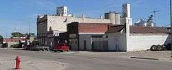
Downtown St. Edward: Beaver Street | |
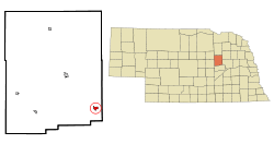 Location of St. Edward, Nebraska | |
| Coordinates: 41°34′17″N 97°51′41″W / 41.57139°N 97.86139°WCoordinates: 41°34′17″N 97°51′41″W / 41.57139°N 97.86139°W | |
| Country | United States |
| State | Nebraska |
| County | Boone |
| Area[1] | |
| • Total | 0.66 sq mi (1.71 km2) |
| • Land | 0.66 sq mi (1.71 km2) |
| • Water | 0 sq mi (0 km2) |
| Elevation | 1,663 ft (507 m) |
| Population (2010)[2] | |
| • Total | 705 |
| • Estimate (2012[3]) | 700 |
| • Density | 1,068.2/sq mi (412.4/km2) |
| Time zone | Central (CST) (UTC-6) |
| • Summer (DST) | CDT (UTC-5) |
| FIPS code | 31-43055[4] |
| GNIS feature ID | 0832856[5] |
St. Edward is a city in Boone County, Nebraska, United States. The population was 705 at the 2010 census.
History
St. Edward was founded in 1871.[6] It was named for Catholic priest Edward Sorin, C.S.C..[7][8]
Geography
St. Edward is located at 41°34′17″N 97°51′41″W / 41.57139°N 97.86139°W (41.571350, -97.861282).[9]
According to the United States Census Bureau, the city has a total area of 0.66 square miles (1.71 km2), all of it land.[1]
Demographics
| Historical population | |||
|---|---|---|---|
| Census | Pop. | %± | |
| 1880 | 158 | — | |
| 1890 | 293 | 85.4% | |
| 1900 | 625 | 113.3% | |
| 1910 | 814 | 30.2% | |
| 1920 | 1,002 | 23.1% | |
| 1930 | 1,030 | 2.8% | |
| 1940 | 893 | −13.3% | |
| 1950 | 917 | 2.7% | |
| 1960 | 777 | −15.3% | |
| 1970 | 853 | 9.8% | |
| 1980 | 891 | 4.5% | |
| 1990 | 822 | −7.7% | |
| 2000 | 796 | −3.2% | |
| 2010 | 705 | −11.4% | |
| Est. 2015 | 682 | [10] | −3.3% |
2010 census
As of the census[2] of 2010, there were 705 people, 292 households, and 181 families residing in the city. The population density was 1,068.2 inhabitants per square mile (412.4/km2). There were 337 housing units at an average density of 510.6 per square mile (197.1/km2). The racial makeup of the city was 97.6% White, 1.4% African American, 0.1% Asian, 0.6% from other races, and 0.3% from two or more races. Hispanic or Latino of any race were 1.4% of the population.
There were 292 households of which 28.4% had children under the age of 18 living with them, 50.0% were married couples living together, 8.9% had a female householder with no husband present, 3.1% had a male householder with no wife present, and 38.0% were non-families. 34.6% of all households were made up of individuals and 19.5% had someone living alone who was 65 years of age or older. The average household size was 2.29 and the average family size was 2.93.
The median age in the city was 46.3 years. 22.7% of residents were under the age of 18; 8.3% were between the ages of 18 and 24; 17.6% were from 25 to 44; 26.7% were from 45 to 64; and 24.7% were 65 years of age or older. The gender makeup of the city was 47.5% male and 52.5% female.
2000 census
As of the census[4] of 2000, there were 796 people, 315 households, and 206 families residing in the city. The population density was 1,214.8 people per square mile (465.7/km²). There were 359 housing units at an average density of 547.9 per square mile (210.0/km²). The racial makeup of the city was 99.12% White, 0.38% African American, 0.13% Native American, and 0.38% from two or more races. Hispanic or Latino of any race were 1.01% of the population.
There were 315 households out of which 30.2% had children under the age of 18 living with them, 53.3% were married couples living together, 8.3% had a female householder with no husband present, and 34.6% were non-families. 32.1% of all households were made up of individuals and 19.7% had someone living alone who was 65 years of age or older. The average household size was 2.37 and the average family size was 3.03.
In the city the population was spread out with 26.6% under the age of 18, 4.6% from 18 to 24, 22.0% from 25 to 44, 20.7% from 45 to 64, and 26.0% who were 65 years of age or older. The median age was 42 years. For every 100 females there were 98.0 males. For every 100 females age 18 and over, there were 92.7 males.
The median income for a household in the city was $27,212, and the median income for a family was $33,750. Males had a median income of $28,500 versus $17,891 for females. The per capita income for the city was $13,973. About 13.6% of families and 15.0% of the population were below the poverty line, including 15.9% of those under age 18 and 20.8% of those age 65 or over.
Notable people
- W. Ward Reynoldson, Chief Justice of the Iowa Supreme Court, was born in St. Edward.[12]
References
- 1 2 "US Gazetteer files 2010". United States Census Bureau. Retrieved 2012-06-24.
- 1 2 "American FactFinder". United States Census Bureau. Retrieved 2012-06-24.
- ↑ "Population Estimates". United States Census Bureau. Retrieved 2013-05-29.
- 1 2 "American FactFinder". United States Census Bureau. Retrieved 2008-01-31.
- ↑ "US Board on Geographic Names". United States Geological Survey. 2007-10-25. Retrieved 2008-01-31.
- ↑ Burr, George L. (1921). History of Hamilton and Clay Counties, Nebraska, Volume 1. S.J. Clarke Publishing Company. p. 98.
- ↑ Fitzpatrick, Lillian L. (1960). Nebraska Place-Names. University of Nebraska Press. p. 19.
- ↑ "St. Edward, Boone County". Center for Advanced Land Management Information Technologies. University of Nebraska. Retrieved 30 July 2014.
- ↑ "US Gazetteer files: 2010, 2000, and 1990". United States Census Bureau. 2011-02-12. Retrieved 2011-04-23.
- ↑ "Annual Estimates of the Resident Population for Incorporated Places: April 1, 2010 to July 1, 2015". Retrieved July 2, 2016.
- ↑ "Census of Population and Housing". Census.gov. Retrieved June 4, 2015.
- ↑ Iowa Judicial Branch-W. Ward Reynoldson
External links
Municipalities and communities of Boone County, Nebraska, United States | ||
|---|---|---|
| Cities | ||
| Villages | ||
| CDPs | ||
| Unincorporated communities | ||