St. Clair, Ontario
| St. Clair | |
|---|---|
| Township (lower-tier) | |
| Township of St. Clair | |
|
View of St. Clair River from Port Lambton | |
 St. Clair | |
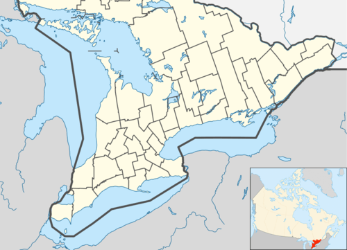
| Coordinates: 42°47′N 82°21′W / 42.783°N 82.350°WCoordinates: 42°47′N 82°21′W / 42.783°N 82.350°W | |
| Country |
|
| Province |
|
| County | Lambton |
| Formed | 2001 |
| Government | |
| • Mayor | Steve Arnold |
| • Federal riding | Sarnia—Lambton |
| • Prov. riding | Sarnia—Lambton |
| Area[1] | |
| • Land | 619.32 km2 (239.12 sq mi) |
| Population (2011)[1] | |
| • Total | 14,515 |
| • Density | 23.4/km2 (61/sq mi) |
| Time zone | EST (UTC-5) |
| • Summer (DST) | EDT (UTC-4) |
| Postal Code | N0N & N0P |
| Area code(s) | 519, 226, and 548 |
| Website | www.twp.stclair.on.ca |

St. Clair is a township in southwestern Ontario, Canada, immediately south of Sarnia in Lambton County, along the eastern shores of the St. Clair River.
Communities
The township comprises the communities of Avonry, Babys Point, Blecher, Bickford, Bradshaw, Brigden, Charlemont, Colinville, Courtright, Corunna, Cromar, Duthill, Frog Point, Froomfield, Kimball, Ladysmith, Moore Centre, Mooretown, Osborne, Payne, Port Lambton, Port Seckerton, Sombra, Sykeston, Thornyhurst, Vye's Grove, Waubuno, West Becher, Wilkesport.
 Corunna
 Port Lambton
 Sombra
History
In 1823, Lord Hicks surveyed the town site of Corunna, naming it after the Battle of Corunna in Spain. He chose to name the site after the town A Coruña in Spain because he had spent considerable time there during the Napoleonic Wars. The town's name also owes itself to one of Beresford's commanders, Sir John Moore, who died at the hands of French forces in the Battle of Corunna. Beresford had been sent on a mission to find a suitable capital for a future union between the colonies of Upper Canada (Ontario) and Lower Canada (Quebec). Corunna was not chosen, as it was seen as being too close to the Canada–US border—in the 1820s–1830s, the prospect of an Irish Fenian raid from the United States was considered a serious threat to the British colonies. Today, a small stone cairn stands along Baird Street, near the CSX north-south train track that divides the town. The cairn marks the spot where survey crews planned to build St. George's Square, the area that was to house the Parliament Buildings.[2]
Today, most of Corunna's streets in the downtown bear the name of British military officials that served with Lord Beresford. The streets (Beckwith, Beresford, Baird, Fane, Paget, Lyndoch, Cameron, Bentinck, Colborne, Hill, Murray, etc.) follow some of the original specifications that Beresford's survey crew set out as part of its plans to create a capital.
The Corunna area was originally settled by French farmers, who rented land near the river from the Chippewa First Nation. As the French presence faded, Corunna was settled by a wave of British settlers. One early settler was James Cruickshank, who settled south of Corunna on the Eighth Line near Kimball Side Road, in 1834. A plaque to commemorate his early contribution to the township can be seen in the village of Corunna in a park on Beresford Street, on land which was donated by the descendants of James. The town saw an influx of grist mills, saw mills and taverns. There were attempts to build a canal through Corunna early in its history, but the canal was abandoned soon after it was dug, since it could not maintain consistent water levels. The early history of the town is spotty, but some accounts suggest a brewery was briefly in business in the town. In the 1920s and 30s, there were some village stores. A popular general store was on the west side of Lyndock, north of Hill, where an Esso station later stood and now is a dentist office. Billy Locke, brother of Jack, ran Billy's Bunnery. Billy Garoch had another general store on the Lyndoch and Hill corner where the liquor store is now. It later became MacRae's store and closed in the early 1960s. Billy Garoch also had an ice house to the east of his store, in the old school that had been moved from Lyndoch near the present Roses Variety Store.
Many of Corunna's historic relics have been torn down over the years, but a few structures remain, providing clues to the area's history. The town's Catholic church, St. Joseph's, was built in 1862 and still stands. Its wooden structure is bolstered by enormous trunks of the area's original trees, which were simply squared off and put in place to build the church. Several 1800s vintage homes remain in the town as well. Ambers statue is still standing located near the water on St.Clair parkway.

Baby's Point is the extreme southern point of Lambton County. Kayla Baby owned all the land from this point, and all of Port Lambton site. Inherited from his grandfather in 1742. There also was a brother, James Baby. Edward Kelly was the first postmaster at Baby's Point 1848.
After 1812, people started to settle along the St. Clair River. They were French, and didn't have legal title to the land. When the Irish moved in, the French sold their squatters rights to the Irish about 1833. Indigenous people could sell land only with the approval of the Province. Anyhow, soon after 1812, people bought up land legally along the St. Clair River. In the spring of 1820, Duncan McDonald built the first frame house. A post office opened in 1871, one time known as Lambton Village. Rural mail was first delivered in 1908, and all mail routes completed in January 1909.
The first Sacred Heart Church was built at Baby's Butt Point around 1825. It burned. Fr. Monocq was drowned January 12, 1861, and the body was found in 1862. He was buried beneath the altar of the first Port Lambton Church. The plaque was on the right hand of the side altar. The Sacred Heart Church, Port Lambton, was built in 1877. Martin Regan was the first person baptised there, December 1877. It was demolished, and the new church built on the same site in 1964.
Climate
St. Clair has a humid continental climate (Köppen climate classification Dfa/Dfb) with cold winters, and warm, humid summers. Winters are cold with a maximum of −1.2 °C (29.8 °F) during the day and −8.2 °C (17.2 °F) during the night in January. Winters are variable with mild spells of weather pushing temperatures above 0 °C (32.0 °F) and occasionally above 10 °C (50.0 °F) and arctic air masses pushing temperatures below −20 °C (−4.0 °F) though these events are rare with only one day above 10 °C (50.0 °F) and 1 or 2 days below −20 °C (−4.0 °F).[3] St. Clair receives 97 centimetres (38.2 in) and since it is not located in the snowbelt region, snow cover is intermittent throughout the season. Summers are warm and humid with a July high of 27.8 °C (82.0 °F) and a low of 16.7 °C (62.1 °F). In an average summer, temperatures above 30 °C (86.0 °F) occur on 20 days per year.[3] The average annual precipitation is 865 millimetres (34 in) which is fairly evenly distributed throughout the year and there are 136 days with measureable precipitation.[3]
| Climate data for Courtright, Ontario | |||||||||||||
|---|---|---|---|---|---|---|---|---|---|---|---|---|---|
| Month | Jan | Feb | Mar | Apr | May | Jun | Jul | Aug | Sep | Oct | Nov | Dec | Year |
| Record high °C (°F) | 14.5 (58.1) |
14.5 (58.1) |
26.0 (78.8) |
32.0 (89.6) |
34.0 (93.2) |
39.0 (102.2) |
37.5 (99.5) |
38.0 (100.4) |
35.0 (95) |
28.9 (84) |
23.3 (73.9) |
17.5 (63.5) |
39.0 (102.2) |
| Average high °C (°F) | −1.2 (29.8) |
0.3 (32.5) |
5.8 (42.4) |
12.9 (55.2) |
19.8 (67.6) |
25.4 (77.7) |
27.8 (82) |
26.5 (79.7) |
21.9 (71.4) |
15.3 (59.5) |
7.8 (46) |
1.5 (34.7) |
13.7 (56.7) |
| Average low °C (°F) | −8.2 (17.2) |
−7.1 (19.2) |
−2.9 (26.8) |
2.9 (37.2) |
8.5 (47.3) |
13.7 (56.7) |
16.7 (62.1) |
15.8 (60.4) |
11.8 (53.2) |
6.2 (43.2) |
0.8 (33.4) |
−4.7 (23.5) |
4.5 (40.1) |
| Record low °C (°F) | −28.0 (−18.4) |
−26.0 (−14.8) |
−20.0 (−4) |
−11.5 (11.3) |
−3.0 (26.6) |
0.6 (33.1) |
7.2 (45) |
4.0 (39.2) |
−0.6 (30.9) |
−5.0 (23) |
−11.1 (12) |
−23.0 (−9.4) |
−28.0 (−18.4) |
| Average precipitation mm (inches) | 62.6 (2.465) |
56.4 (2.22) |
62.7 (2.469) |
75.7 (2.98) |
76.5 (3.012) |
83.6 (3.291) |
67.7 (2.665) |
75.2 (2.961) |
92.2 (3.63) |
66.1 (2.602) |
77.3 (3.043) |
70.2 (2.764) |
865.9 (34.091) |
| Average rainfall mm (inches) | 25.6 (1.008) |
30.8 (1.213) |
50.5 (1.988) |
72.6 (2.858) |
76.4 (3.008) |
83.6 (3.291) |
67.7 (2.665) |
75.2 (2.961) |
92.2 (3.63) |
65.7 (2.587) |
73.0 (2.874) |
46.4 (1.827) |
759.6 (29.906) |
| Average snowfall cm (inches) | 35.8 (14.09) |
24.8 (9.76) |
12.3 (4.84) |
2.9 (1.14) |
0 (0) |
0 (0) |
0 (0) |
0 (0) |
0 (0) |
0 (0) |
3.1 (1.22) |
18.1 (7.13) |
96.9 (38.15) |
| Average precipitation days (≥ 0.2 mm) | 12.6 | 10.1 | 11.9 | 12.9 | 10.9 | 10.5 | 9.9 | 10.3 | 10.6 | 11.1 | 12.3 | 13.0 | 136.2 |
| Average rainy days (≥ 0.2 mm) | 4.3 | 4.4 | 8.5 | 12.3 | 10.9 | 10.5 | 9.9 | 10.3 | 10.6 | 11.1 | 11.0 | 7.5 | 111.2 |
| Average snowy days (≥ 0.2 cm) | 8.8 | 6.1 | 4.0 | 1.2 | 0.04 | 0 | 0 | 0 | 0 | 0.07 | 1.6 | 6.5 | 28.4 |
| Source: Environment Canada[3] | |||||||||||||
Demographics
| Canada census – St. Clair, Ontario community profile | |||
|---|---|---|---|
| 2011 | 2006 | 2001 | |
| Population: | 14,515 (-0.9% from 2006) | 14,649 (-0.1% from 2001) | 14,659 (-2.8% from 1996) |
| Land area: | 619.32 km2 (239.12 sq mi) | 619.30 km2 (239.11 sq mi) | 619.29 km2 (239.11 sq mi) |
| Population density: | 23.4/km2 (61/sq mi) | 23.7/km2 (61/sq mi) | 23.7/km2 (61/sq mi) |
| Median age: | 42.7 (M: 42.6, F: 42.8) | 41.0 (M: 40.5, F: 41.5) | 38.3 (M: 37.7, F: 38.7) |
| Total private dwellings: | 6193 | 5913 | 5749 |
| Median household income: | $70,249 | $60,946 | |
| References: 2011[4] 2006[5] 2001[6] | |||
Population trend:[7]
- Population in 2011: 14,515
- Population in 2006: 14,649
- Population in 2001: 14,659
- Population total in 1996: 15,081
- Moore (township): 10,864
- Sombra (township): 4,217
- Population in 1991:
- Moore (township): 10,873
- Sombra (township): 4,179
Education
St. Clair Township has schools in several of its communities.
Brigden houses Brigden Public School, Corunna hosts of three schools - two public schools (Sir John Moore Community School, opened in 2000 and Colonel Cameron Public School) and one Catholic school (St. Joseph's Catholic School), the latter of which opened in September 1992. Colborne Street School was a public school on Colborne Street, that closed in 2002. Murray Street School (K to 6) on Murray Street was closed earlier. Hill Street School (originally a Jr. room and Sr. room, a teacher's room and principal's office, then later a Gr.7–8 school), the earliest school still standing in Corunna, located at the corner of Hill and Lyndock, was closed several years ago as well, and is now an O.P.P. station. Students who attended Colborne, transferred to Colonel Cameron or Sir John Moore. The building currently housing Colonel Cameron was previously Father Gerald LaBelle Catholic School, which was open between 1976 and the early 2000s.
Corunna has not developed any high schools, though the topic has been debated in the past.
Port Lambton is home to two schools - Riverview Central School and Sacred Heart Catholic Elementary School.
Mooretown has a school named Mooretown Courtright Public School.
St. Clair Parkway
The presence of the St. Clair Parkway has given St. Clair Township a reputation for its beautiful parks along the riverfront. The head office had been located in Corunna since 1968. As of February 2006, the St. Clair Parkway has been disbanded and the parks have been handed over to the municipalities where they are located.
Notable people
- Maude Menten, pioneering chemist. Broke ground as a woman and with her famous contribution to scientific thought, the Michaelis-Menten equation. She was born in Port Lambton on March 20, 1879.[8]
- Derek Drouin, high jumper, bronze medalist at the Athletics at the 2012 Summer Olympics – Men's high jump 2012 Olympic Games in London. Rio 2016 Olympic Games Gold medalist - Men's high jump[9]
- John R. Boyle, Politician and Judge in Alberta. Boyle, Alberta is named after him.
- Stewart James, Magician and magic inventor
- Paul Ysebaert, Professional hockey player
See also
References
- 1 2 "St. Clair, Ontario (Code 3538003) and Lambton, Ontario (Code 3538) (table)". 2011 Census of Population. Statistics Canada. Retrieved 2012-08-03.
- ↑ "From pipe dream to footnote: The capital city that never was", Ottawa Sun, September 22, 2005.
- 1 2 3 4 "Courtright, Ontario". Canadian Climate Normals 1971–2000 (in English and French). Environment Canada. Retrieved February 23, 2013.
- ↑ "2011 Community Profiles". Canada 2011 Census. Statistics Canada. July 5, 2013. Retrieved 2012-08-03.
- ↑ "2006 Community Profiles". Canada 2006 Census. Statistics Canada. March 30, 2011. Retrieved 2011-02-24.
- ↑ "2001 Community Profiles". Canada 2001 Census. Statistics Canada. February 17, 2012. Retrieved 2011-02-24.
- ↑ Statistics Canada: 1996, 2001, 2006 census
- ↑ "Maude Lenora Menten". Biographical Snapshots of Famous Women and Minority Chemists. Journal of Chemical Education. Retrieved 2006-06-03.
- ↑ http://www.theobserver.ca/2016/08/12/drouin-relaxed-ahead-of-high-jump-qualifier-coach-says
