South Rockwood, Michigan
| South Rockwood, Michigan | |
|---|---|
| Village | |
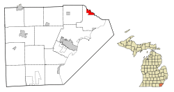 Location in Monroe County and the state of Michigan | |
| Coordinates: 42°03′50″N 83°15′40″W / 42.06389°N 83.26111°W | |
| Country | United States |
| State | Michigan |
| County | Monroe |
| Area[1] | |
| • Total | 2.46 sq mi (6.37 km2) |
| • Land | 2.35 sq mi (6.09 km2) |
| • Water | 0.11 sq mi (0.28 km2) |
| Elevation | 587 ft (179 m) |
| Population (2010)[2] | |
| • Total | 1,675 |
| • Estimate (2012[3]) | 1,665 |
| • Density | 712.8/sq mi (275.2/km2) |
| Time zone | Eastern (EST) (UTC-5) |
| • Summer (DST) | EDT (UTC-4) |
| ZIP code | 48179 |
| Area code(s) | 734 |
| FIPS code | 26-75280[4] |
| GNIS feature ID | 0638409[5] |
South Rockwood is a village in Monroe County in the U.S. state of Michigan. The population was 1,675 at the 2010 census. The village lies at the very southern tip of the Detroit metro area.
Geography
According to the United States Census Bureau, the village has a total area of 2.46 square miles (6.37 km2), of which 2.35 square miles (6.09 km2) is land and 0.11 square miles (0.28 km2) is water.[1]
Demographics
| Historical population | |||
|---|---|---|---|
| Census | Pop. | %± | |
| 1880 | 251 | — | |
| 1960 | 1,337 | — | |
| 1970 | 1,477 | 10.5% | |
| 1980 | 1,353 | −8.4% | |
| 1990 | 1,221 | −9.8% | |
| 2000 | 1,284 | 5.2% | |
| 2010 | 1,675 | 30.5% | |
| Est. 2015 | 1,642 | [6] | −2.0% |
2010 census
As of the census[2] of 2010, there were 1,675 people, 687 households, and 453 families residing in the village. The population density was 712.8 inhabitants per square mile (275.2/km2). There were 734 housing units at an average density of 312.3 per square mile (120.6/km2). The racial makeup of the village was 95.4% White, 2.3% African American, 0.2% Native American, 0.4% Asian, 0.4% from other races, and 1.3% from two or more races. Hispanic or Latino of any race were 4.1% of the population.
There were 687 households of which 30.0% had children under the age of 18 living with them, 50.4% were married couples living together, 11.5% had a female householder with no husband present, 4.1% had a male householder with no wife present, and 34.1% were non-families. 25.6% of all households were made up of individuals and 6.2% had someone living alone who was 65 years of age or older. The average household size was 2.44 and the average family size was 2.95.
The median age in the village was 38.9 years. 20.8% of residents were under the age of 18; 8.9% were between the ages of 18 and 24; 29% were from 25 to 44; 31.1% were from 45 to 64; and 10.1% were 65 years of age or older. The gender makeup of the village was 50.7% male and 49.3% female.
2000 census
As of the census[4] of 2000, there were 1,284 people, 450 households, and 359 families residing in the village. The population density was 526.1 per square mile (203.2/km²). There were 464 housing units at an average density of 190.1 per square mile (73.4/km²). The racial makeup of the village was 97.59% White, 0.23% African American, 0.23% Native American, 0.08% Asian, 0.08% from other races, and 1.79% from two or more races. Hispanic or Latino of any race were 0.78% of the population.
There were 450 households out of which 37.3% had children under the age of 18 living with them, 66.9% were married couples living together, 8.9% had a female householder with no husband present, and 20.2% were non-families. 14.9% of all households were made up of individuals and 5.8% had someone living alone who was 65 years of age or older. The average household size was 2.85 and the average family size was 3.18.
In the village the population was spread out with 26.6% under the age of 18, 9.0% from 18 to 24, 29.0% from 25 to 44, 26.3% from 45 to 64, and 9.0% who were 65 years of age or older. The median age was 37 years. For every 100 females there were 109.8 males. For every 100 females age 18 and over, there were 102.6 males.
The median income for a household in the village was $62,500, and the median income for a family was $68,304. Males had a median income of $50,882 versus $27,813 for females. The per capita income for the village was $22,245. About 2.3% of families and 4.1% of the population were below the poverty line, including 2.9% of those under age 18 and 4.8% of those age 65 or over.
References
- 1 2 "US Gazetteer files 2010". United States Census Bureau. Retrieved 2012-11-25.
- 1 2 "American FactFinder". United States Census Bureau. Retrieved 2012-11-25.
- ↑ "Population Estimates". United States Census Bureau. Retrieved 2013-06-03.
- 1 2 "American FactFinder". United States Census Bureau. Retrieved 2008-01-31.
- ↑ "US Board on Geographic Names". United States Geological Survey. 2007-10-25. Retrieved 2008-01-31.
- ↑ "Annual Estimates of the Resident Population for Incorporated Places: April 1, 2010 to July 1, 2015". Retrieved July 2, 2016.
- ↑ "Census of Population and Housing". Census.gov. Retrieved June 4, 2015.
 |
Flat Rock | Rockwood | | |
| |
Brownstown Charter Township | |||
| ||||
| | ||||
| Berlin Charter Township |
Municipalities and communities of Monroe County, Michigan, United States | ||
|---|---|---|
| Cities | 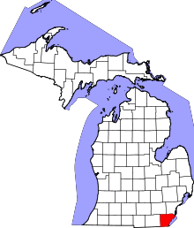 | |
| Villages | ||
| Charter townships | ||
| General law townships | ||
| CDPs | ||
| Other unincorporated communities | ||
| Footnotes | ‡This populated place also has portions in an adjacent county or counties | |
Coordinates: 42°03′50″N 83°15′40″W / 42.06389°N 83.26111°W