South Dakota Highway 10
| ||||
|---|---|---|---|---|
|
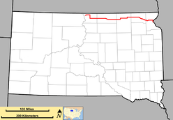
Route of SD 10 (in red) | ||||
| Route information | ||||
| Defined by SDCL §31-4-130 | ||||
| Maintained by SDDOT | ||||
| Length: | 193 mi (311 km) | |||
| Existed: | 1927 – present | |||
| Major junctions | ||||
| West end: |
| |||
|
| ||||
| East end: |
| |||
| Location | ||||
| Counties: | Campbell, McPherson, Brown, Marshall, Roberts | |||
| Highway system | ||||
| ||||

South Dakota Highway 10 is a state route that runs from South Dakota Highway 1804 in Pollock, east to the Minnesota border, where it becomes Minnesota State Highway 28 near Browns Valley. The route is about 193 miles (313 km) in length.
History
SD 10 was designated in 1927, replacing what had been SD 12. This was presumably to avoid confusion with US 12, which was implemented nearby. Before numbering, this road was designated as the Glacier Trail.
When first designated, the western end of SD 10 was at US 83. The extension further west was added in the early 1960s.
Major intersections
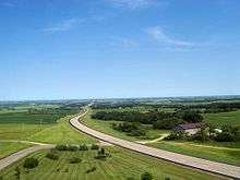
SD 10 near Sisseton
| County | Location | mi | km | Destinations | Notes |
|---|---|---|---|---|---|
| Campbell | Pollock | 0.000 | 0.000 | ||
| | Northern end of US 83 concurrency | ||||
| | Southern end of US 83 concurrency | ||||
| | |||||
| McPherson | Eureka | Western end of SD 47 concurrency | |||
| Eastern end of SD 47 concurrency | |||||
| | Western end of SD 45 concurrency | ||||
| | |||||
| Leola | Eastern end of SD 45 concurrency | ||||
| Brown | | Southern end of US 281 concurrency | |||
| | Northern end of US 281 concurrency | ||||
| | Western end of SD 37 concurrency | ||||
| | Eastern end of SD 37 concurrency | ||||
| Marshall | Britton | Western end of SD 27 concurrency | |||
| | Eastern end of SD 27 concurrency | ||||
| Lake City | Western end of SD 25 concurrency | ||||
| | Eastern end of SD 25 concurrency | ||||
| Roberts | Sisseton | ||||
| | |||||
| Traverse | | Continuation into Minnesota | |||
1.000 mi = 1.609 km; 1.000 km = 0.621 mi
| |||||
External links
This article is issued from Wikipedia - version of the 7/7/2014. The text is available under the Creative Commons Attribution/Share Alike but additional terms may apply for the media files.