Ashley, North Dakota
| Ashley, North Dakota | |
|---|---|
| City | |
 | |
 | |
| Coordinates: 46°2′6″N 99°22′25″W / 46.03500°N 99.37361°WCoordinates: 46°2′6″N 99°22′25″W / 46.03500°N 99.37361°W | |
| Country | United States |
| State | North Dakota |
| County | McIntosh |
| Government | |
| • Mayor | Kent Lovell |
| Area[1] | |
| • Total | 0.64 sq mi (1.66 km2) |
| • Land | 0.64 sq mi (1.66 km2) |
| • Water | 0 sq mi (0 km2) |
| Elevation | 2,014 ft (614 m) |
| Population (2010)[2] | |
| • Total | 749 |
| • Estimate (2015)[3] | 726 |
| • Density | 1,200/sq mi (450/km2) |
| Time zone | Central (CST) (UTC-6) |
| • Summer (DST) | CDT (UTC-5) |
| ZIP code | 58413 |
| Area code(s) | 701 |
| FIPS code | 38-03540 |
| GNIS feature ID | 1027755[4] |
| Website | ashley-nd.com |
Ashley is a city in and the county seat of McIntosh County, North Dakota, United States.[5] The population was 749 at the 2010 census.[6] Ashley was founded in 1888.
History
Ashley was laid out in 1888 when the Minneapolis, St. Paul and Sault Ste. Marie Railroad was extended to that point.[7] The city was named for Ashley E. Morrow, a railroad man.[8] A post office has been in operation at Ashley since 1888.[9]
Geography
Ashley is located at 46°2′6″N 99°22′25″W / 46.03500°N 99.37361°W (46.034894, -99.373714).[10]
According to the United States Census Bureau, the city has a total area of 0.64 square miles (1.66 km2), all of it land.[1]
Climate
| Climate data for Ashley, North Dakota (1981–2010) | |||||||||||||
|---|---|---|---|---|---|---|---|---|---|---|---|---|---|
| Month | Jan | Feb | Mar | Apr | May | Jun | Jul | Aug | Sep | Oct | Nov | Dec | Year |
| Average high °F (°C) | 22.2 (−5.4) |
27.1 (−2.7) |
38.5 (3.6) |
55.2 (12.9) |
67.1 (19.5) |
75.9 (24.4) |
83.1 (28.4) |
81.6 (27.6) |
71.3 (21.8) |
57.0 (13.9) |
39.2 (4) |
25.3 (−3.7) |
53.6 (12) |
| Daily mean °F (°C) | 11.9 (−11.2) |
16.9 (−8.4) |
28.4 (−2) |
42.7 (5.9) |
54.9 (12.7) |
64.3 (17.9) |
70.6 (21.4) |
68.5 (20.3) |
58.2 (14.6) |
44.6 (7) |
29.0 (−1.7) |
15.9 (−8.9) |
42.2 (5.7) |
| Average low °F (°C) | 1.9 (−16.7) |
6.7 (−14.1) |
18.2 (−7.7) |
30.1 (−1.1) |
42.7 (5.9) |
52.7 (11.5) |
58.1 (14.5) |
55.5 (13.1) |
45.2 (7.3) |
32.2 (0.1) |
18.7 (−7.4) |
6.4 (−14.2) |
30.7 (−0.7) |
| Average precipitation inches (mm) | 0.36 (9.1) |
0.41 (10.4) |
0.90 (22.9) |
1.38 (35.1) |
2.93 (74.4) |
3.48 (88.4) |
3.07 (78) |
2.62 (66.5) |
1.93 (49) |
1.65 (41.9) |
0.54 (13.7) |
0.34 (8.6) |
19.61 (498.1) |
| Average snowfall inches (cm) | 6.3 (16) |
5.2 (13.2) |
6.4 (16.3) |
3.3 (8.4) |
0.0 (0) |
0.0 (0) |
0.0 (0) |
0.0 (0) |
0.0 (0) |
0.6 (1.5) |
4.9 (12.4) |
5.5 (14) |
32.3 (82) |
| Source: NOAA[11] | |||||||||||||
Demographics
| Historical population | |||
|---|---|---|---|
| Census | Pop. | %± | |
| 1910 | 682 | — | |
| 1920 | 1,009 | 47.9% | |
| 1930 | 1,033 | 2.4% | |
| 1940 | 1,345 | 30.2% | |
| 1950 | 1,423 | 5.8% | |
| 1960 | 1,419 | −0.3% | |
| 1970 | 1,236 | −12.9% | |
| 1980 | 1,192 | −3.6% | |
| 1990 | 1,052 | −11.7% | |
| 2000 | 882 | −16.2% | |
| 2010 | 749 | −15.1% | |
| Est. 2015 | 726 | [12] | −3.1% |
| U.S. Decennial Census[13] 2015 Estimate[3] | |||
2010 census
As of the census[2] of 2010, there were 749 people, 391 households, and 201 families residing in the city. The population density was 1,170.3 inhabitants per square mile (451.9/km2). There were 520 housing units at an average density of 812.5 per square mile (313.7/km2). The racial makeup of the city was 97.3% White, 0.1% African American, 0.1% Native American, 0.7% Asian, and 1.7% from two or more races. Hispanic or Latino of any race were 0.4% of the population.
There were 391 households of which 13.0% had children under the age of 18 living with them, 44.8% were married couples living together, 4.1% had a female householder with no husband present, 2.6% had a male householder with no wife present, and 48.6% were non-families. 45.5% of all households were made up of individuals and 31% had someone living alone who was 65 years of age or older. The average household size was 1.80 and the average family size was 2.46.
The median age in the city was 64.3 years. 12.3% of residents were under the age of 18; 3% were between the ages of 18 and 24; 14% were from 25 to 44; 22% were from 45 to 64; and 48.6% were 65 years of age or older. The gender makeup of the city was 45.1% male and 54.9% female.
2000 census
As of the census of 2000, there were 882 people, 436 households, and 258 families residing in the city. The population density was 1,404.9 people per square mile (540.5/km²). There were 528 housing units at an average density of 841.0 per square mile (323.6/km²). The racial makeup of the city was 98.41% White, 0.34% Native American, 0.91% Asian, and 0.34% from two or more races. Hispanic or Latino of any race were 0.91% of the population.
The top 6 ancestry groups in the city are German (66.9%), Russian (15.1%), Norwegian (7.1%), United States (3.3%), English (2.3%), French (1.9%).
There were 436 households out of which 12.6% had children under the age of 18 living with them, 54.1% were married couples living together, 3.2% had a female householder with no husband present, and 40.8% were non-families. 39.4% of all households were made up of individuals and 25.7% had someone living alone who was 65 years of age or older. The average household size was 1.90 and the average family size was 2.49.
In the city, the population was spread out with 12.0% under the age of 18, 4.2% from 18 to 24, 14.4% from 25 to 44, 21.2% from 45 to 64, and 48.2% who were 65 years of age or older. The median age was 64 years. For every 100 females there were 82.2 males. For every 100 females age 18 and over, there were 83.0 males.
The median income for a household in the city was $18,015, and the median income for a family was $28,500. Males had a median income of $17,292 versus $14,783 for females. The per capita income for the city was $13,001. About 9.3% of families and 18.9% of the population were below the poverty line, including 9.3% of those under age 18 and 27.4% of those age 65 or over.
Notable people
- David Berman, Las Vegas gambling pioneer and Jewish mob boss, grew up in Ashley[14]
- Bryan Klipfel, superintendent of the North Dakota Highway Patrol (2003–2007)
References
- 1 2 "US Gazetteer files 2010". United States Census Bureau. Archived from the original on 2012-01-24. Retrieved 2012-06-14.
- 1 2 "American FactFinder". United States Census Bureau. Retrieved 2012-06-14.
- 1 2 "Population Estimates". United States Census Bureau. Retrieved June 26, 2016.
- ↑ "US Board on Geographic Names". United States Geological Survey. 2007-10-25. Retrieved 2008-01-31.
- ↑ "Find a County". National Association of Counties. Archived from the original on 2011-05-31. Retrieved 2011-06-07.
- ↑ "2010 Census Redistricting Data (Public Law 94-171) Summary File". American FactFinder. United States Census Bureau. Archived from the original on 26 July 2011. Retrieved 2 May 2011.
- ↑ Hellmann, Paul T. (May 13, 2013). Historical Gazetteer of the United States. Routledge. p. 831. Retrieved 30 November 2013.
- ↑ Federal Writers' Project (1938). North Dakota, a Guide to the Northern Prairie State,. WPA. p. 287. ISBN 978-1-62376-033-5.
- ↑ "McIntosh County". Jim Forte Postal History. Retrieved 22 October 2015.
- ↑ "US Gazetteer files: 2010, 2000, and 1990". United States Census Bureau. 2011-02-12. Retrieved 2011-04-23.
- ↑ "NOWData - NOAA Online Weather Data". National Oceanic and Atmospheric Administration. Retrieved May 4, 2013.
- ↑ "Annual Estimates of the Resident Population for Incorporated Places: April 1, 2010 to July 1, 2015". Retrieved July 2, 2016.
- ↑ United States Census Bureau. "Census of Population and Housing". Archived from the original on May 11, 2015. Retrieved November 12, 2013.
- ↑ Bismarck Tribune, "Las Vegas mob boss had ties to N.D.," January 2, 2011
External links
| Wikivoyage has a travel guide for Ashley. |
| Wikimedia Commons has media related to Ashley, North Dakota. |
Municipalities and communities of McIntosh County, North Dakota, United States | ||
|---|---|---|
| Cities | 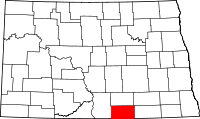 | |
| Township | ||
| Unorganized territory |
| |
| Unincorporated communities |
| |
| Footnotes | ‡This populated place also has portions in an adjacent county or counties | |