Sostra Heights
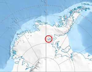
Sostra Heights (Bulgarian: Состренски възвишения, ‘Sostrenski Vazvisheniya’ \'so-stren-ski v&-zvi-'she-ni-ya\) are the heights rising ro 2460 m at Mount Malone and including also Mount McKeown, Mount Lanning and Bracken Peak on the east side of northern Sentinel Range in Ellsworth Mountains, Antarctica. They extend 22 km in northwest-southeast direction and 16.5 km in northeast-southwest direction. The heights are bounded by Embree Glacier to the south, Sabazios Glacier to the west, Newcomer Glacier to the north and Rutford Ice Stream to the east, and separated by Robinson Pass to the southwest from the side ridge that trends 9.15 km east-northeastwards from Mount Dalrymple on the main crest of Sentinel Range. Their interior is drained by Anchialus Glacier and Vit Ice Piedmont.
The heights are named after the ancient Roman fortress of Sostra in Northern Bulgaria.
Location
Sostra Heights are centred at 77°53′00″S 85°28′00″W / 77.88333°S 85.46667°WCoordinates: 77°53′00″S 85°28′00″W / 77.88333°S 85.46667°W. US mapping in 1961.
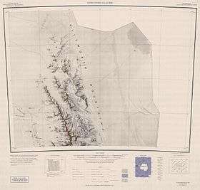
- Newcomer Glacier. Scale 1:250 000 topographic map. Reston, Virginia: US Geological Survey, 1961.
- Antarctic Digital Database (ADD). Scale 1:250000 topographic map of Antarctica. Scientific Committee on Antarctic Research (SCAR), 1993–2016.
References
- Sostra Heights. SCAR Composite Gazetteer of Antarctica.
- Bulgarian Antarctic Gazetteer. Antarctic Place-names Commission. (details in Bulgarian, basic data in English)
This article includes information from the Antarctic Place-names Commission of Bulgaria which is used with permission.