Sololá
| Sololá | |
|---|---|
| Municipality | |
|
Torre Centroamericana | |
 Sololá Location in Guatemala | |
| Coordinates: 14°46′N 91°11′W / 14.767°N 91.183°WCoordinates: 14°46′N 91°11′W / 14.767°N 91.183°W | |
| Country |
|
| Department |
|
| Municipality | Sololá |
| Founded | 1547 |
| Government | |
| • Type | Municipal |
| Area | |
| • Municipality | 94 km2 (36 sq mi) |
| Elevation | 2,114 m (6,936 ft) |
| Population (Census 2002)[1] | |
| • Municipality | 63,973 |
| • Urban | 30,155 |
| • Ethnicities | Kaqchikel, K'iche', Ladino |
| • Religions | Roman Catholicism, Evangelicalism, Maya |
| Climate | Cwb |
| Website | inforpressca.com/solola |

Sololá is a city in Guatemala. It is the capital of the department of Sololá and the administrative seat of Sololá municipality. It resides around lake Atitlan.
The name is a hispanicized form of its pre-Columbian name, one spelling variant of which is T'zolojy'a.[2] The urban center has about 14,000 people, but the municipality also includes four village communities—Los Encuentros, El Tablón, San Jorge la Laguna, and Argueta—as well as 59 smaller rural communities.[2]
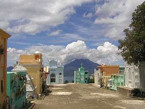
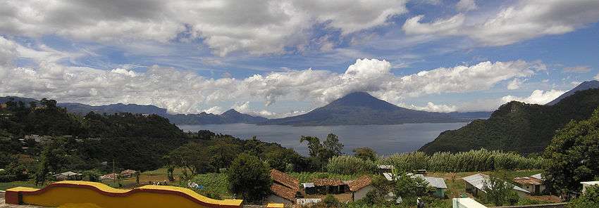
Sololá is situated at 2.114 m on a mountainside overlooking Lake Atitlán, some 600 meters below. It is a highland market center and is the headquarters for the Catholic Bishopric encompassing the Sololá and Chimaltenango Departments.
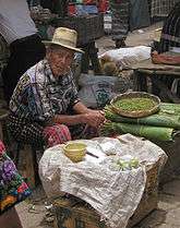
Almost all residents of Sololá are Kaqchikel Maya, except in Argueta, where most are K'iche' Maya.[2] A large percentage of both men and women continue to wear traditional Mayan clothing.
Sololá is home to many international organizations including Manna Project International, Friendship Bridge, Mayan Families and Love Futbol.
See also
-
 Guatemala portal
 -
 Geography portal
 - List of places in Guatemala
References
- ↑ "XI Censo Nacional de Poblacion y VI de Habitación (Censo 2002)". INE. 2002.
- 1 2 3 "Sololá - Historia". Inforpressca.com. Retrieved 2009-04-20.
Further reading
- Maudslay, Alfred Percival; Maudslay, Anne Cary (1899). A glimpse at Guatemala, and some notes on the ancient monuments of Central America (PDF). London, UK: John Murray. p. 47.
External links
-
 Media related to Sololá, Sololá at Wikimedia Commons
 - Solola market video
