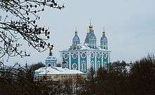
Smolensk
| Smolensk (English) Смоленск (Russian) | |
|---|---|
| - City[1] - | |
 Smolensk railway station | |
.svg.png) Location of Smolensk Oblast in Russia | |
 Smolensk | |
|
| |
_(2001).png) |
|
|
| |
| Administrative status (as of November 2011) | |
| Country | Russia |
| Federal subject | Smolensk Oblast[1] |
| Administratively subordinated to | Smolensk Urban Okrug[1] |
| Administrative center of | Smolensk Oblast,[1] Smolensky District,[1] Smolensk Urban Okrug[1] |
| Municipal status (as of December 2011) | |
| Urban okrug | Smolensk Urban Okrug[2] |
| Administrative center of | Smolensk Urban Okrug,[2] Smolensky Municipal District[2] |
| Head | Nikolay Alasheyev |
| Representative body | Smolensk City Council[3] |
| Statistics | |
| Area | 166.35 km2 (64.23 sq mi)[4] |
| Population (2010 Census) | 326,861 inhabitants[5] |
| - Rank in 2010 | 54th |
| Density | 1,965/km2 (5,090/sq mi)[6] |
| Time zone | MSK (UTC+03:00)[7] |
| Founded | 863 |
| Postal code(s)[8] | 214ХХХ |
| Dialing code(s) | +7 4812 |
|
| |
| Smolensk on Wikimedia Commons | |
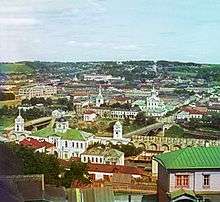
Smolensk (Russian: Смоленск; IPA: [smɐˈlʲensk]) is a city and the administrative center of Smolensk Oblast, Russia, located on the Dnieper River, 360 kilometers (220 mi) west-southwest of Moscow. Population: 326,861 (2010 Census);[5] 325,137 (2002 Census);[9] 341,483 (1989 Census).[10]
The walled city in the center of Smolensk (along with the outskirts) was destroyed several times throughout its long history because it was on the invasion routes of both Napoleon and Hitler. Today, Smolensk is noted for electronics, textiles, food processing, and diamond faceting.
Etymology
The name of the city is derived from the name of the Smolnya River. The origin of the river's name is less clear. One possibility is the old Slavic word "смоль" (smol) for black soil, which might have colored the waters of the Smolnya. An alternative origin could be the Russian word "смола" (smola), which means resin, tar, or pitch. Pine trees grow in the area, and the city was once a center of resin processing and trade. The Byzantine emperor Constantine VII (r. 913–959) recorded its name as "Μιλινισκα" (Miliniska).[11]
Geography
The city is located in European Russia on the banks of the upper Dnieper River, which crosses the city within the Smolensk Upland, which is the western part of the Smolensk–Moscow Upland.The Dniepr River flows through the city from east to west and divides it into two parts: the northern (Zadneprove) and southern (center). Within the city and its surroundings the river takes in several small tributaries.
In the valleys are stretched streets, high ridges, hills, and headlands form the mountain. Smolensk is situated on seven hills (mountains).
The old part of the city occupies the high, rugged left (south) bank of the Dnieper River. The area features undulating terrain, with a large number of tributaries, creeks and ravines.
History
Medieval origins
Smolensk is among the oldest Russian cities. The first recorded mention of the city was 863 AD, two years after the founding of ancient Rus'. According to Russian Primary Chronicle, Smolensk (probably located slightly downstream, at the archaeological site of Gnezdovo) was located on the area settled by the West Slavic Radimichs tribe in 882 when Oleg of Novgorod took it in passing from Novgorod to Kiev. The town was first attested two decades earlier, when the Varangian chieftains Askold and Dir, while on their way to Kiev, decided against challenging Smolensk on account of its large size and population.

The first foreign writer to mention the city was the Byzantine Emperor Constantine Porphyrogenitus. In De Administrando Imperio (c. 950) he described Smolensk as a key station on the trade route from the Varangians to the Greeks. The Rus' people sailed from the Baltics up the Western Dvina as far as they could then they pulled their boats out onto the ground and dragged them along to the upper Dnieper. It was in Smolensk that they supposedly mended any leaks and small holes that might have appeared in their boats from being dragged on the ground and they used tar to do that, hence the city name.
The Principality of Smolensk was founded in 1054. Due to its central position amid Kievan Rus' lands, the city developed rapidly. By the end of the 12th century, the princedom was one of the strongest in Eastern Europe, so that Smolensk Dynasty frequently controlled the Kievan throne. Numerous churches were built in the city at that time, including the church of Sts. Peter and Paul (1146, reconstructed to its presumed original appearance after World War II) and church of St. John the Baptist (1180, also partly rebuilt). The most remarkable church in the city is called Svirskaya (1197, still standing); it was admired by contemporaries as the most beautiful structure to the east of Kiev.
Smolensk had its own veche since the very beginning of its history. Its power increased after the disintegration of Kievan Rus, and although it was not as strong as the veche in Novgorod, the princes had to take its opinion into consideration; several times in 12th and 13th centuries there was an open conflict between them.[12]
Between Russia, Lithuania, and Poland
Although spared by the Mongol armies in 1240, Smolensk paid tribute to the Golden Horde, gradually becoming a pawn in the long struggle between Lithuania and the Grand Duchy of Moscow. The last sovereign monarch of Smolensk was Yury of Smolensk; during his reign the city was taken by Vytautas the Great of Lithuania on three occasions: in 1395, 1404, and 1408. After the city's incorporation into the Grand Duchy of Lithuania, some of Smolensk's boyars (e.g., the Sapiehas) moved to Vilnius; descendants of the ruling princes (e.g., the Tatishchevs, Kropotkins, Mussorgskys, Vyazemskys) fled to Moscow.

With tens of thousands of people living there, Smolensk was probably the largest city in 15th-century Lithuania. Three Smolensk regiments took part in the Battle of Grunwald against the Teutonic Knights. It was a severe blow to Lithuania when the city was taken by Vasily III of Russia in 1514. To commemorate this event, the Tsar founded the Novodevichy Convent in Moscow and dedicated it to the icon of Our Lady of Smolensk.
In order to repel future Polish–Lithuanian attacks, Boris Godunov made it his priority to heavily fortify the city. The stone kremlin constructed in 1597–1602 is the largest in Russia. It features thick walls and numerous watchtowers. Heavy fortifications did not prevent the fortress from being taken by the Polish–Lithuanian Commonwealth in 1611 after a long twenty-month siege, during the Time of Troubles and Dimitriads. Weakened Muscovy temporarily ceded Smolensk land to the Commonwealth in the Truce of Deulino and for the next forty-three years it was the seat of Smolensk Voivodeship.
To recapture the city, the Tsardom of Russia launched the so-called "Smolensk War" against the Commonwealth in 1632. After a defeat at the hands of king Wladislaw IV, the city remained in Polish–Lithuanian hands. In 1632, the Uniate bishop Lew Kreuza built his apartments in Smolensk; they were later converted into the Orthodox Church of Saint Barbara. The hostilities resumed in 1654 when the Commonwealth was being affected by the Khmelnytsky Uprising and the Swedish invasion. After another siege, on September 23, 1654, Smolensk was recaptured by Russia. In the 1667 Truce of Andrusovo, the Polish–Lithuanian Commonwealth finally renounced its claims to Smolensk.
Modern history

Smolensk has been a special place to Russians for many reasons, not least for the fact that the local cathedral housed one of the most venerated Orthodox icons, attributed to St. Luke. Building the new Cathedral of the Assumption was a great project which took more than a century to complete. Despite slowly sinking into economic backwater, Smolensk was still valued by Tsars as a key fortress defending the route to Moscow. It was made the seat of Smolensk Governorate in 1708.
In August 1812, two of the largest armies ever assembled clashed in Smolensk. During the hard-fought battle, described by Leo Tolstoy in War and Peace, Napoleon entered the city. Total losses were estimated at 30,000 men. Apart from other military monuments, central Smolensk features the Eagles monument, unveiled in 1912 to mark the centenary of Napoleon's Russian campaign.
At the beginning of World War I, the 56th Smolensk Infantry Division was first assigned to the First Army of the Imperial Russian Army. They fought at the Battle of Tannenberg. It was subsequently transferred to the 10th Army and fought at the Second Battle of the Masurian Lakes. In March 1918, while the city remained a part of Russia, Belarusian People's Republic, proclaimed in Minsk under the German occupation, declared Smolensk a part of it. In February–December 1918, Smolensk was home to the headquarters of the Western Front, North-West Oblast Bolshevik Committee and Western Oblast Executive Committee. On January 1, 1919, the Byelorussian Soviet Socialist Republic was proclaimed in Smolensk,[13] but its government moved to Minsk as soon as the German forces had been driven out of Minsk several days later.
Soviet period
After the Revolution, for inclusion in its composition as claimed Smolensk Belarusian People's Republic and the Byelorussian SSR. Since April 1918 Smolensk was the center of the Western Region, which is based on January 1, 1919, Byelorussian SSR was formed. January 7 BSSR government moved from Minsk and Smolensk already January 16, 1919 decision of the Central Committee of the RCP Smolensk region was transferred to the RSFSR. In 1920 was held the new provincial census, according to which the Russian population prevailed over Belarus, but the Belarusian party leadership until 1926 leaves no hope for the inclusion of Smolensk in the Belorussian SSR. In 1940, 18 km (11 mi) from Smolensk, the Katyn Massacre occurred.
During World War II, Smolensk once again saw wide-scale fighting during the first Battle of Smolensk when the city was captured by the Germans on July 16, 1941. The first Soviet counteroffensive against the German army was launched in August 1941 but failed. However, the limited Soviet victories outside the city halted the German advance for a crucial two months, granting time to Moscow's defenders to prepare in earnest. Camp 126 was situated close to Smolensk and at this time Boris Menshagin was mayor of Smolensk, with his deputy Boris Bazilevsky. Both of them would be key witnesses in the Nuremberg Trials over the Katyn massacre.[14] Over 93% of the city was destroyed during the fighting; the ancient icon of Our Lady of Smolensk was lost. Nevertheless, it escaped total destruction. In late 1943, Göring had ordered Gotthard Heinrici to destroy Smolensk in accordance with the Nazi "scorched earth" policy. He refused and was punished for it. The city was finally liberated on September 25, 1943, during the second Battle of Smolensk. The rare title of Hero City was bestowed on Smolensk after the war.
After the Germans captured the city in 1941, they found the intact archives of Smolensk Oblast Committee of the Communist Party, the so-called Smolensk Archive. The archive was moved to Germany, and a significant part of it eventually ended up in the United States, providing Western scholars and intelligence specialists with unique information on the local workings of the Soviet government during its first two decades. The archives were returned to Russia by the United States in 2002.[15][16]
Recent events
On April 10, 2010, a Tu-154 military jet carrying Polish president Lech Kaczyński, his wife, and many notable political and military figures crashed in a wooded area near Smolensk while approaching the local military airport. All ninety-six passengers died immediately on impact. The purpose of the visit was to commemorate the 70th anniversary of the Katyn massacre, in which some 22,000 Polish POWs were murdered by the NKVD.
In 2013, archaeologists of the Russian Academy of Sciences discovered and unearthed in the ancient temples in Smolensk dated to middle to second half of the 12th century, built on the left bank at the time the city was the capital of Smolensk principality. From unique object preserved walls in some places low, in others the height of human growth.[17]
In September 2013, Smolensk widely celebrated the 1,150th anniversary with funds spent on different construction and renovation projects in the city.[18] In celebration Central Bank of Russia issued commemorative coins made of precious metals.[19]
Administrative and municipal status
Smolensk serves as the administrative center of the oblast and, within the framework of administrative divisions, it also serves as the administrative center of Smolensky District, even though it is not a part of it.[1] As an administrative division, it is incorporated separately as Smolensk Urban Okrug—an administrative unit with the status equal to that of the districts.[1] As a municipal division, this administrative unit also has urban okrug status.[2]
Climate
| Climate data for Smolensk | |||||||||||||
|---|---|---|---|---|---|---|---|---|---|---|---|---|---|
| Month | Jan | Feb | Mar | Apr | May | Jun | Jul | Aug | Sep | Oct | Nov | Dec | Year |
| Record high °C (°F) | 9.3 (48.7) |
9.0 (48.2) |
19.4 (66.9) |
28.0 (82.4) |
30.1 (86.2) |
31.2 (88.2) |
34.5 (94.1) |
37.2 (99) |
29.5 (85.1) |
24.8 (76.6) |
14.6 (58.3) |
9.8 (49.6) |
37.2 (99) |
| Average high °C (°F) | −3.8 (25.2) |
−3.4 (25.9) |
2.1 (35.8) |
11.2 (52.2) |
18.0 (64.4) |
21.0 (69.8) |
23.1 (73.6) |
21.7 (71.1) |
15.8 (60.4) |
9.0 (48.2) |
1.3 (34.3) |
−2.8 (27) |
9.4 (48.9) |
| Daily mean °C (°F) | −6.2 (20.8) |
−6.4 (20.5) |
−1.4 (29.5) |
6.3 (43.3) |
12.5 (54.5) |
15.8 (60.4) |
17.8 (64) |
16.3 (61.3) |
10.9 (51.6) |
5.3 (41.5) |
−0.9 (30.4) |
−5.1 (22.8) |
5.4 (41.7) |
| Average low °C (°F) | −8.9 (16) |
−9.6 (14.7) |
−4.9 (23.2) |
1.9 (35.4) |
7.3 (45.1) |
10.9 (51.6) |
12.9 (55.2) |
11.5 (52.7) |
6.7 (44.1) |
2.2 (36) |
−3.2 (26.2) |
−7.6 (18.3) |
1.6 (34.9) |
| Record low °C (°F) | −37.9 (−36.2) |
−36.8 (−34.2) |
−28.1 (−18.6) |
−19.8 (−3.6) |
−5.4 (22.3) |
−0.7 (30.7) |
4.4 (39.9) |
0.3 (32.5) |
−4.4 (24.1) |
−12.8 (9) |
−24.8 (−12.6) |
−35.2 (−31.4) |
−37.9 (−36.2) |
| Average precipitation mm (inches) | 48 (1.89) |
42 (1.65) |
42 (1.65) |
38 (1.5) |
61 (2.4) |
87 (3.43) |
90 (3.54) |
85 (3.35) |
70 (2.76) |
66 (2.6) |
58 (2.28) |
51 (2.01) |
738 (29.06) |
| Average rainy days | 9 | 8 | 10 | 15 | 17 | 18 | 16 | 16 | 16 | 18 | 15 | 11 | 169 |
| Average snowy days | 25 | 22 | 16 | 5 | 1 | 0 | 0 | 0 | 1 | 4 | 15 | 23 | 112 |
| Average relative humidity (%) | 87 | 84 | 78 | 69 | 69 | 75 | 77 | 79 | 83 | 85 | 89 | 89 | 80 |
| Mean monthly sunshine hours | 47 | 75 | 123 | 178 | 249 | 271 | 259 | 231 | 156 | 91 | 35 | 24 | 1,739 |
| Source #1: Pogoda.ru.net[20] | |||||||||||||
| Source #2: NOAA (sun, 1961–1990)[21] | |||||||||||||
Economy
Smolensk has several factories including the Smolensk Aviation Plant and several electronics and agricultural machinery factories.
Transportation
Smolensk is located on the M1 main highway and main railway between Moscow and Minsk. Since 1870, there is a railway connection between Smolensk and Moscow.[22] Local public transport includes buses and trolleybuses. Public transportation network includes buses, trolleybuses, trams, and marshrutkas.
There are two airports located in the outskirts of the city; Smolensk South (civilian) and Smolensk North (military); however, there are no regular flights scheduled to Smolensk South Airport.
Education
Smolensk is home to the Smolensk State University (SMOLGU) and the Smolensk State Medical University (affiliated as university in 2015) (SSMU); together with colleges of further education and other educational institutes. Smolensk is home for many foreign students including Indians, Japanese, Sri Lankans and few others. Among them Indians are with highest count of population. Smolensk is a great site for pursuing medical education.
Twin towns and sister cities
Smolensk is twinned with:
 Tulle, France (1981)
 Hagen, Germany (1985)
 Colorado Springs, Colorado, United States (1993)
 Kerch, Ukraine (1998)
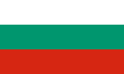 Targovishte, Bulgaria (2002)[23]
- Woodstock, Georgia, United States (2006)
Notable people
- Sergey Belavenets (1910–1942), chess master, theoretician, and chess journalist
- Alexander Belyayev (1884–1942), science fiction writer
- Lydia Durnovo (1885–1963), art restorer and historian
- Dzham (born 1986), hip hop musician
- Konstantin Dzyuba (born 1983), football player
- Peter Fishman (born 1955), sculptor
- Yuri Gagarin (1934–1968), cosmonaut
- Mikhail Glinka (1804–1857), composer
- Elizaveta Golovanova (born 1993), Miss Russia 2012
- Natalia Ishchenko (born 1986), swimmer
- Anatoly Kharlampiyev (1906–1979), founder of Sambo
- Eduard Khil (1934–2012), singer
- Patriarch Kirill of Moscow (born 1946), religious leader
- Ivan Kirpa (born 1978), boxer
- Vladimir Kirpichnikov (1903–1950), general
- Sergey Konenkov (1874–1971), sculptor
- Dina Korzun (born 1971), theater and film actress
- Pavel Kucherov, (born 1964), football player and coach
- Olga Kuzenkova, (born 1970), athlete
- Semyon Lavochkin (1900–1960), aircraft designer
- Maria Itkina (born 1932), runner
- Natalia Levchenkova(born 1977), biathlete
- Anatoly Lukyanov (born 1930), politician
- Morris Markin (1893–1970), businessman and founder of Checker Motors Corporation
- Gregori Maximoff (1893–1950), politician
- Timofey Mikhaylov (1859-1881), revolutionary, one of the assassins of Tsar Alexander II
- Uladzimir Navumau (born 1956), Belarusian politician and general
- Viktor Nemytskii (1900-1967), mathematician
- Anatoly Onishchuk (born 1946), sport shooter
- Taisiya Osipova (born 1984), political activist
- Nikita Pankevich, (born 1995), football player
- Yevgeny Polivanov (1891-1938), linguist, orientalist
- Grigory Potyomkin (1739–1791), statesman
- Aleksandr Tvardovsky (1910–1971), writer
- Olga Voronets (1926–2014), mezzo-soprano folk singer
Honors
Smolensk Strait between Livingston Island and Deception Island in the South Shetland Islands, Antarctica is named after the city.[24]
See also
References
Notes
- 1 2 3 4 5 6 7 8 Resolution #261
- 1 2 3 4 Decision #164
- ↑ http://www.smolsovet.ru/
- ↑ БД ПМО Смоленской области. Город Смоленск
- 1 2 Russian Federal State Statistics Service (2011). "Всероссийская перепись населения 2010 года. Том 1" [2010 All-Russian Population Census, vol. 1]. Всероссийская перепись населения 2010 года (2010 All-Russia Population Census) (in Russian). Federal State Statistics Service. Retrieved June 29, 2012.
- ↑ The value of density was calculated automatically by dividing the 2010 Census population by the area specified in the infobox. Please note that this value may not be accurate as the area specified in the infobox does not necessarily correspond to the area of the entity proper or is reported for the same year as the population.
- ↑ Правительство Российской Федерации. Федеральный закон №107-ФЗ от 3 июня 2011 г. «Об исчислении времени», в ред. Федерального закона №271-ФЗ от 03 июля 2016 г. «О внесении изменений в Федеральный закон "Об исчислении времени"». Вступил в силу по истечении шестидесяти дней после дня официального опубликования (6 августа 2011 г.). Опубликован: "Российская газета", №120, 6 июня 2011 г. (Government of the Russian Federation. Federal Law #107-FZ of June 31, 2011 On Calculating Time, as amended by the Federal Law #271-FZ of July 03, 2016 On Amending Federal Law "On Calculating Time". Effective as of after sixty days following the day of the official publication.).
- ↑ Почта России. Информационно-вычислительный центр ОАСУ РПО. (Russian Post). Поиск объектов почтовой связи (Postal Objects Search) (Russian)
- ↑ Russian Federal State Statistics Service (May 21, 2004). "Численность населения России, субъектов Российской Федерации в составе федеральных округов, районов, городских поселений, сельских населённых пунктов – районных центров и сельских населённых пунктов с населением 3 тысячи и более человек" [Population of Russia, Its Federal Districts, Federal Subjects, Districts, Urban Localities, Rural Localities—Administrative Centers, and Rural Localities with Population of Over 3,000] (XLS). Всероссийская перепись населения 2002 года [All-Russia Population Census of 2002] (in Russian). Retrieved August 9, 2014.
- ↑ Demoscope Weekly (1989). "Всесоюзная перепись населения 1989 г. Численность наличного населения союзных и автономных республик, автономных областей и округов, краёв, областей, районов, городских поселений и сёл-райцентров" [All Union Population Census of 1989: Present Population of Union and Autonomous Republics, Autonomous Oblasts and Okrugs, Krais, Oblasts, Districts, Urban Settlements, and Villages Serving as District Administrative Centers]. Всесоюзная перепись населения 1989 года [All-Union Population Census of 1989] (in Russian). Институт демографии Национального исследовательского университета: Высшая школа экономики [Institute of Demography at the National Research University: Higher School of Economics]. Retrieved August 9, 2014.
- ↑ http://faculty.uml.edu/ethan_spanier/Teaching/documents/CP21DeAdministrandoImperio.pdf
- ↑ Алексеев, Л. В. (1980). Смоленская земля в IX-XIII вв. (in Russian). Moscow: Наука. pp. 111–115.
- ↑ Marples, D. (2016). Belarus: From Soviet Rule to Nuclear Catastrophe. Springer. p. 11. ISBN 978-0230378315.
- ↑ Sanford, George. Katyn and the Soviet Massacre of 1940: Truth, Justice and Memory, Part 804, 2005, p. 140. ISBN 978-0-415-33873-8.
- ↑ Archived January 29, 2008, at the Wayback Machine.
- ↑ "Prologue: Selected Articles". Archives.gov. 2011-10-19. Retrieved 2011-12-24.
- ↑ Интерфакс-Религия: Археологи обнаружили в Смоленске храм XII века
- ↑ 1150-летие Смоленска: от проектов к реализации
- ↑ К 1150-летию основания Смоленска отчеканили памятные монеты из драгоценных металлов
- ↑ "Weather and Climate-The Climate of Somlensk" (in Russian). Weather and Climate (Погода и климат). Retrieved 11 April 2016.
- ↑ "Smolensk Climate Normals 1961–1990". National Oceanic and Atmospheric Administration. Retrieved 11 April 2016.
- ↑ Train Station in Smolensk (Russian)
- ↑ "International Contacts". Targovishte Municipality. Archived from the original on 2007-08-13. Retrieved 2013-08-29.
- ↑ Smolensk Strait. SCAR Composite Antarctic Gazetteer.
Sources
- Администрация Смоленской области. Постановление №261 от 30 апреля 2008 г. «Об утверждении реестра административно-территориальных единиц и территориальных единиц Смоленской области», в ред. Постановления №464 от 27 июня 2014 г. «О внесении изменений в реестр административно-территориальных единиц и территориальных единиц Смоленской области». Опубликован: База данных "Консультант-плюс". (Administration of Smolensk Oblast. Resolution #261 of April 30, 2008 On the Adoption of the Registry of the Administrative-Territorial Units and Territorial Units of Smolensk Oblast, as amended by the Resolution #464 of June 27, 2014 On Amending the Registry of the Administrative-Territorial Units and Territorial Units of Smolensk Oblast. ).
- Смоленский городской Совет. Решение №164 от 28 октября 2005 г. «Устав города Смоленска (новая редакция)», в ред. Решения №1419 от 29 мая 2015 г. «О внесении изменений в Устав города Смоленска». Вступил в силу со дня официального опубликования, за исключением положений, для которых установлены иные сроки вступления в силу. Опубликован: "Смоленские новости", №71, 22 декабря 2005 г. (Smolensk City Council. Decision #164 of October 28, 2005 Charter of the City of Smolensk (New Edition), as amended by the Decision #1419 of May 29, 2015 On Amending the Charter of the City of Smolensk. Effective as of the day of the official publication, with the exception of the clauses for which other dates of taking effect are specified.).
External links
- (Russian) Official website of Smolensk
- (Russian) Travel in Smolensk
- (Russian) Smolensk news
- (Russian) Smolensk Wiki
- (Russian) Homepage of the Smolensk fortress
- Some photos of the Smolensk fortress
- More photos of Smolensk
- Historic images of Smolensk
- (Russian) Basketball in Smolensk
- (Russian) News of Smolensk sport
- (Russian) News of Smolensk medicine
- The murder of the Jews of Smolensk during World War II, at Yad Vashem website.
| Cities and towns | |||
|---|---|---|---|
| Districts | |||
Major fortresses of Western Russia | ||
|---|---|---|
 | ||
Hero Cities of the Soviet Union | ||
|---|---|---|