Slough (UK Parliament constituency)
| Slough | |
|---|---|
|
Borough constituency for the House of Commons | |
|
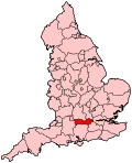
Boundary of Slough in Berkshire. | |
|
Location of Berkshire within England. | |
| County | Berkshire |
| Electorate | 81,327 (December 2010)[1] |
| Current constituency | |
| Created | 1983 |
| Member of parliament | Fiona Mactaggart (Labour) |
| Number of members | One |
| Created from | Eton & Slough, and Beaconsfield |
| Overlaps | |
| European Parliament constituency | South East England |
Slough is a constituency[n 1] represented in the House of Commons of the UK Parliament since 1997 by Fiona Mactaggart, a member of the Labour Party.[n 2]
Boundaries
1983-1997: The Borough of Slough.
1997-2010: The Borough of Slough wards of Baylis, Britwell, Central, Chalvey, Cippenham, Farnham, Haymill, Kederminster, Langley St Mary's, Stoke, Upton, and Wexham Lea.
2010-present: The Borough of Slough wards of Baylis and Stoke, Britwell, Central, Chalvey, Cippenham Green, Cippenham Meadows, Farnham, Foxborough, Haymill, Kedermister, Langley St Mary’s, Upton, and Wexham Lea.
The constituency was created in 1983 and covers the Borough of Slough, a unitary authority, in Berkshire, with the exception of one ward.
The former Eton and Slough constituency, which contributed 88.2% of the Slough constituency, was a safe seat for the Labour Party. The remaining northern slice came from the safe Conservative constituency of Beaconsfield.
Constituency profile
The Conservatives gained the new Slough seat in 1983, and held it until 1997, when Labour gained the constituency.
Workless claimants stood at 3.9% in November 2012, just 0.1% above the national average, and while lower than all of eastern Kent and the Isle of Wight, statistically significantly greater than the regional average of 2.5%.[2] The borough has one of the largest mixed commercial (company headquarters and manufacturing) estates in Europe and fast rail links to London on the Great Western Main Line, to be bolstered by direct city centre services with Crossrail. The area is also the part of the M4 corridor that is the closest to the capital and London Heathrow Airport.
History
From 1945 to 1983 most of the area presently covered by this seat was in the Eton and Slough constituency, whose Labour MP from 1950 to 1964 was Fenner Brockway, a radical progressive social democrat, who led in writing on pacifism, prison reform, anti-colonialism and anti-discrimination, and was editor of the Labour Leader, attended talks by the Fabian Society and joined the fledgling Independent Labour Party in 1907.
Members of Parliament
| Election | Member[3] | Party | |
|---|---|---|---|
| 1983 | John Watts | Conservative | |
| 1997 | Fiona Mactaggart | Labour | |
Elections
Elections in the 2010s
| Party | Candidate | Votes | % | ± | |
|---|---|---|---|---|---|
| Labour | Fiona Mactaggart | 23,421 | 48.5 | +2.7 | |
| Conservative | Gurcharan Singh[6] | 16,085 | 33.3 | −1.0 | |
| UKIP | Diana Coad[7] | 6,274 | 13.0 | +9.8 | |
| Liberal Democrat | Tom McCann | 1,275 | 2.6 | −11.9 | |
| Green | Julian Edmonds[8] | 1,220 | 2.5 | +1.4 | |
| Majority | 7,336 | 15.2 | +3.6 | ||
| Turnout | 48,275 | 55.9 | −6.0 | ||
| Labour hold | Swing | +1.8 | |||
UKIP originally selected Ken Wight, who was replaced by former Conservative member, Diana Coad.[7]
| Party | Candidate | Votes | % | ± | |
|---|---|---|---|---|---|
| Labour | Fiona Mactaggart | 21,884 | 45.8 | −0.4 | |
| Conservative | Diana Coad | 16,361 | 34.3 | +7.9 | |
| Liberal Democrat | Chris Tucker | 6,943 | 14.5 | −2.2 | |
| UKIP | Peter Mason-Apps | 1,517 | 3.2 | −0.5 | |
| Green | Miriam Kennet | 542 | 1.1 | −0.9 | |
| Christian | Sunil Chaudhary | 495 | 1.0 | N/A | |
| Majority | 5,523 | 11.6 | |||
| Turnout | 47,742 | 61.9 | +8.1 | ||
| Labour hold | Swing | ||||
Elections in the 2000s
| Party | Candidate | Votes | % | ± | |
|---|---|---|---|---|---|
| Labour | Fiona Mactaggart | 17,517 | 47.2 | −11.1 | |
| Conservative | Sheila Gunn | 9,666 | 26.1 | −0.1 | |
| Liberal Democrat | Thomas McCann | 5,739 | 15.5 | +5.0 | |
| Respect | Ajaz Khan | 1,632 | 4.4 | N/A | |
| UKIP | Geoff Howard | 1,415 | 3.8 | +1.9 | |
| Green | David Wood | 759 | 2.0 | N/A | |
| Independent | Paul Janik | 367 | 1.0 | N/A | |
| Majority | 7,851 | 21.2 | |||
| Turnout | 37,095 | 50.5 | −2.9 | ||
| Labour hold | Swing | −5.5 | |||
| Party | Candidate | Votes | % | ± | |
|---|---|---|---|---|---|
| Labour | Fiona Mactaggart | 22,718 | 58.3 | +1.6 | |
| Conservative | Diana Coad | 10,210 | 26.2 | −3.1 | |
| Liberal Democrat | Keith Kerr | 4,109 | 10.5 | +3.2 | |
| Independent | Tony Haines | 859 | 2.2 | +1.6 | |
| UKIP | John Lane | 738 | 1.9 | N/A | |
| Independent | Choudry Nazir | 364 | 0.9 | N/A | |
| Majority | 12,508 | 32.1 | |||
| Turnout | 38,998 | 53.4 | −14.5 | ||
| Labour hold | Swing | ||||
Elections in the 1990s
| Party | Candidate | Votes | % | ± | |
|---|---|---|---|---|---|
| Labour | Fiona Mactaggart | 27,029 | 56.6 | +12.9 | |
| Conservative | Peta Buscombe | 13,958 | 29.2 | −15.4 | |
| Liberal Democrat | Chris Bushill | 3,509 | 7.4 | +0.4 | |
| Liberal | Anne Bradshaw | 1,835 | 3.8 | +1.3 | |
| Referendum | Terence J. Sharkey | 1,124 | 2.4 | N/A | |
| Independent | Paul P. Whitmore | 277 | 0.6 | N/A | |
| Majority | 13,071 | 27.4 | |||
| Turnout | 47,732 | 67.9 | −10.3 | ||
| Labour gain from Conservative | Swing | ||||
| Party | Candidate | Votes | % | ± | |
|---|---|---|---|---|---|
| Conservative | John Arthur Watts | 25,793 | 44.6 | −2.3 | |
| Labour | Eddie Lopez | 25,279 | 43.7 | +4.1 | |
| Liberal Democrat | Peter Mapp | 4,041 | 7.0 | −6.4 | |
| Liberal | John Clark | 1,426 | 2.5 | N/A | |
| Independent Labour | Declan Alford | 699 | 1.2 | N/A | |
| National Front | Andy Carmichael | 290 | 0.5 | N/A | |
| Natural Law | Martin Raymond Creese | 153 | 0.3 | N/A | |
| Independent | Ms Elizabeth Anne Smith | 134 | 0.2 | N/A | |
| Majority | 514 | 0.9 | −6.5 | ||
| Turnout | 57,815 | 78.0 | +2.1 | ||
| Conservative hold | Swing | −3.3 | |||
Elections in the 1980s
| Party | Candidate | Votes | % | ± | |
|---|---|---|---|---|---|
| Conservative | John Arthur Watts | 26,166 | 47.0 | +4.1 | |
| Labour | Eddie Lopez | 22,076 | 39.6 | +2.7 | |
| Social Democratic | Michael Goldstone | 7,490 | 13.4 | −5.1 | |
| Majority | 4,090 | 7.4 | +1.4 | ||
| Turnout | 55,732 | 75.9 | +4.4 | ||
| Conservative hold | Swing | ||||
| Party | Candidate | Votes | % | ± | |
|---|---|---|---|---|---|
| Conservative | John Arthur Watts | 22,064 | 42.9 | +4.3 | |
| Labour | Joan Lestor | 18,958 | 36.9 | −6.7 | |
| Social Democratic | Nicholas Bosanquet | 9,519 | 18.5 | +7.2 | |
| National Front | Graham John | 528 | 1.0 | N/A | |
| Ecology | Ian Flindall | 325 | 0.6 | N/A | |
| Majority | 3,106 | 6.0 | N/A | ||
| Turnout | 51,394 | 71.5 | N/A | ||
| Conservative win (new seat) | |||||
See also
- List of Parliamentary constituencies in Berkshire
- Slough Borough Council includes historical information about wards and local elections
Notes and references
- Notes
- ↑ A borough constituency (for the purposes of election expenses and type of returning officer)
- ↑ As with all constituencies, the constituency elects one Member of Parliament (MP) by the first past the post system of election at least every five years.
- References
- ↑ "Electorate Figures – Boundary Commission for England". 2011 Electorate Figures. Boundary Commission for England. 4 March 2011. Archived from the original on 6 November 2010. Retrieved 13 March 2011.
- ↑ Unemployment claimants by constituency The Guardian
- ↑ Leigh Rayment's Historical List of MPs – Constituencies beginning with "S" (part 3)
- ↑ "Election Data 2015". Electoral Calculus. Archived from the original on 17 October 2015. Retrieved 17 October 2015.
- ↑ https://www.slough.gov.uk/council/voting-and-elections/2015-general-election-results.aspx 8July 2015
- ↑ http://www.sloughobserver.co.uk/news/roundup/articles/2014/12/19/106235-new-slough-conservative-parliamentary-candidate-we-can-overturn-labour-stronghold/
- 1 2 Miles, Paul (11 March 2015). "Diana Coad announced as new UKIP parliamentary candidate for Slough". Slough Express. Retrieved 12 March 2015.
- ↑ "Facebook post". Eastberks Green Party. Retrieved 12 March 2015.
- ↑ "Politics Resources". Election 1992. Politics Resources. 9 April 1992. Retrieved 6 December 2010.
Sources
- British Parliamentary Constituencies, A Statistical Compendium, by Ivor Crewe and Anthony Fox (Faber and Faber 1984).
- Official list of candidates nominated 2010 Slough Borough Council website accessed 21 April 2010
External links
- The Boundary Committee for England page about Slough Unitary Authority, with links to pre and post 2004 ward maps
Coordinates: 51°30′43″N 0°35′31″W / 51.512°N 0.592°W