Slieve Donard
| Slieve Donard | |
|---|---|
| Sliabh Dónairt | |
|
Slieve Donard and Newcastle from Murlough Beach | |
| Highest point | |
| Elevation | 850 m (2,790 ft) [1][2] |
| Prominence | 822 m (2,697 ft) [1] |
| Listing | Hewitt, Marilyn |
| Coordinates | 54°10′49″N 5°55′15″W / 54.180238°N 5.920898°WCoordinates: 54°10′49″N 5°55′15″W / 54.180238°N 5.920898°W |
| Naming | |
| Translation | Dónairt's mountain (Irish) |
| Geography | |
 Location of Slieve Donard in Northern Ireland | |
| Location |
County Down, Northern Ireland |
| Parent range | Mournes |
| OSI/OSNI grid | J357276 |
| Topo map | OSNI Discoverer 29 |
.JPG)
Slieve Donard (/ˌsliːv ˈdɒnərd/ SLEEV DON-ərd; from Irish: Sliabh Dónairt, meaning "Dónairt's mountain")[3] is an 850-metre (2,790 ft)[1][2][4] mountain in County Down, Northern Ireland. Part of the Mourne Mountains, it is the highest peak in Northern Ireland and in the wider province of Ulster.[1] It is also the 19th highest peak on the island of Ireland.[1] Slieve Donard sits near the town of Newcastle on the eastern coast of County Down, only 2 miles (3 km) from the Irish Sea.
The Mourne Wall – built in the early 20th century – runs up the western and southern slopes of the mountain, joining a small stone tower at the summit. Also on the summit are the remains of two prehistoric burial cairns, one of which is the remains of the highest known passage tomb in Ireland. In Irish mythology the mountain was associated with, and named after, the mythical figures Boirche and Slángha. It was later associated with, and named after, Saint Donard, who was said to have made the summit his hermitage. Up until the 1830s, people would climb the mountain as part of a yearly pilgrimage, which may have originally been a Lughnasadh ritual. Royal Engineers camped on the summit for four months in 1826 as part of the Ordnance Survey's Principal Triangulation.
Geography
Slieve Donard sits at the northeastern edge of the Mournes, overlooking Newcastle and Dundrum Bay. It has three subsidiary peaks on the seaward side – Millstone Mountain (460 m),[5] Thomas's Mountain and Crossone. Two glens separate Slieve Donard from the neighbouring mountains of Slieve Commedagh (to the northwest) and Chimney Rock Mountain (to the south).[2] Slieve Commedagh, at 767 m (2,516 ft), is the second-highest of the Mourne Mountains.[6]
The mountain is an easy climb although the path is very eroded at places. In recent years a stone path has been made on the steepest parts of the mountain. The summit provides spectacular views of the coast and as far afield as Belfast, 30 miles north, and Dublin, 55 miles to the south.
History and folklore
On the summit are the remains of two prehistoric cairns. The Great Cairn measures 36.5 metres from north to south, 43m from east to west, and 1m high. It appears to have been a Neolithic passage tomb, dating to 3300–3000 BCE. It is the highest known passage tomb in Britain and Ireland.[7] The Lesser Cairn lies 210 metres to the northeast. It measures 18m from north to south, 16m from east to west, and 4.5m high. It appears to have been an Early Bronze Age multiple-cist cairn, dating to 2300–1950 BCE.[7] They appear to parallel the two cairns on Slieve Gullion, which can be seen from Slieve Donard.[8] Both the cairns have been badly damaged and altered over time.[7]

Irish mythology identifies the Great Cairn as being the tomb or abode of mythical figures, and an entrance to the Otherworld.[9] The earliest sources give two names for the mountain: Benn mBoirchi (modern spelling: Beann Boirche) and Sliab Slánga (modern spelling: Sliabh Slángha).[9][10] Beann Boirche means "Boirche's peak", referring to a mythical cowherd and king who had seemingly supernatural powers. The plural name Beanna Boirche ("Boirche's peaks") was given to the Mourne Mountains. In Cath Maige Tuired ("the Battle of Moytura"), "Bennai Boirche" is called one of the "twelve chief mountains" of Ireland.[11] The name Sliabh Slángha means "Slángha's mountain". This refers to the mythical Slángha, son of Partholón, who was said to be the first physician in Ireland. According to the Annals of the Four Masters, he died in Anno Mundi 2533 (2533 years after "the creation of the world") and was buried in the passage tomb.[9]
Ireland was Christianized from the 5th to 8th centuries. A local Christian missionary, Saint Donard (known in Irish as Domhanghairt or Domhanghart),[12][13][14] became associated with the mountain. According to tradition, he was a follower of Saint Patrick and founded a monastery at Maghera, a few miles north of the mountain. Donard seems to have made the Great Cairn into a hermit's cell and used the Lesser Cairn as an oratory.[15] In doing so, he "appropriated the mountain and the monument for Christianity".[16] According to the Life of Saint Patrick and the Tripartite Life of Saint Patrick, Patrick blessed Donard in the womb, declaring that Donard would not die but abide inside the mountain as a perpetual guardian.[17] According to folklore, a cave runs from the seashore to the cairn on the summit, and it is here that Donard (or Boirche) lives.[18] The writings of Gerald de Barri indicate that in the late 12th century the name Sliabh Slángha was going out of use and being replaced by Sliabh Domhanghairt.[19] Sliabh Dónairt is the modernised spelling.

Up until the 1830s,[20] people made a pilgrimage to the mountaintop in late July each year. It is likely that this was originally a Lughnasadh ritual that became Christianized.[21] The church at Maghera and St Mary's Church at Ballaghanery Upper may have been starting points for the pilgrimage.[22]
In 1826, as part of the Principal Triangulation, Royal Engineers used Slieve Donard as a base to map Ireland. They camped on the mountaintop from late July until late November that year and used the two cairns to make triangulation points.[23] During the Survey, two men died in a snowstorm on their way down the mountain and others were hurt during storms on the summit.[24]
The Mourne Wall was built in the early 20th century and passes over fifteen mountains, including Slieve Donard. The wall goes up the western slope to a stone tower and then down the southern slope. It took 18 years to build, from 1904 to 1922, with stonemasons working in the mountains from March to mid-October each year. Some stones from the cairns were used to build it.[25]
In April 2006, a man was killed on Slieve Donard after being struck by lightning. A brass plaque on the summit commemorates him.[26]
See also
References
- 1 2 3 4 5 MountainViews.ie
- 1 2 3 Ordnance Survey Ireland – Online map viewer
- ↑ Placenames Database of Ireland
- ↑ Ken Stewart (2004). "Measuring the height of Slieve Donard". 2004 Year Book. Archived from the original on 19 November 2007. Retrieved 21 June 2008.
This final calculation gives a measured height for Slieve Donard of 849.14m above MSL Belfast, and is estimated to be correct to better than 5cm.
- ↑ MountainViews – Millstone Mountain
- ↑ MountainViews – Slieve Commedagh
- 1 2 3 Moore (2012), p. 3.
- ↑ Moore (2012), p. 29.
- 1 2 3 Moore (2012), pp. 17–18.
- ↑ Paul Tempan. "Names in sliabh in the Mourne Mountains and beyond". Queen's University Belfast.
- ↑ Augusta, Lady Gregory. Part I Book III: The Great Battle of Magh Tuireadh. Gods and Fighting Men (1904) at Sacred-Texts.com.
- ↑ O'Donovan (1856), p. 6.
- ↑ Joyce (1885), p. 83.
- ↑ Kay Muhr (12 March 2015). "Celebrating Ulster's Townlands". Ulster Place-Name Society (Queen's University, Belfast). Retrieved 2 March 2016.
- ↑ Moore (2012), p. 57.
- ↑ Moore (2012), p. 113.
- ↑ Moore (2012), pp. 58–59.
- ↑ Moore (2012), p. 61.
- ↑ Moore (2012), p. 19.
- ↑ Moore (2012), p. 67.
- ↑ Moore (2012), pp. 62–63.
- ↑ Moore (2012), p. 81.
- ↑ Moore (2012), p. 83.
- ↑ Moore (2012), p. 114.
- ↑ Moore (2012), p. 91.
- ↑ Moore (2012), p. 117.
Bibliography
- Joyce, P. W. (1885). Irish Local Names Explained. Dublin: M. H. Gill & Son.
- Moore, Sam (2012). The Archaeology of Slieve Donard: a Cultural Biography of Ulster's Highest Mountain. Down County Museum. ISBN 978-0-9567278-6-2.
- O'Donovan, John (1856). Annala Rioghachta Éireann: Annals of the kingdom of Ireland, by the Four Masters, from the Earliest Period to the Year 1616. 1. Dublin: Hodges, Smith, and Co.
External links
- Interactive 360° view from the summit
- Computer generated summit panoramas: North, South, index
- The County Tops of Ireland: Slieve Donard, County Down
- The County Tops in Photos: Slieve Donard, County Down
Mountains and hills of Ulster | ||
|---|---|---|
| Antrim Hills |  | |
| Antrim Plateau | ||
| Belfast Hills | ||
| Croaghgorms | ||
| Derryveagh | ||
| Inishowen | ||
| Mournes | ||
| Sperrins | ||
| Southwest Donegal | ||
| Others | ||
Highest mountains of Ireland (by province) | ||
|---|---|---|
| Munster |
|  |
| Leinster |
| |
| Ulster |
| |
| Connacht |
| |
Highest mountains of the United Kingdom (by country) | ||
|---|---|---|
| Scotland | Ben Nevis / Beinn Nibheis – 1,344 metres (4,409 ft) | 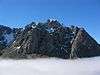 |
| Wales | ||
| England | ||
| Northern Ireland | ||