Slavsk
| Slavsk (English) Славск (Russian) | |
|---|---|
| - Town[1] - | |
 Church in Slavsk | |
.svg.png) Location of Kaliningrad Oblast in Russia | |
 Slavsk | |
|
| |
.png) | |
|
| |
| Administrative status (as of November 2011) | |
| Country | Russia |
| Federal subject | Kaliningrad Oblast[1] |
| Administrative district | Slavsky District[1] |
| Town of district significance | Slavsk[1] |
| Administrative center of | Slavsky District,[1] town of district significance of Slavsk[1] |
| Municipal status (as of June 2012) | |
| Municipal district | Slavsky Municipal District[2] |
| Urban settlement | Slavskoye Urban Settlement[2] |
| Administrative center of | Slavsky Municipal District,[2] Slavskoye Urban Settlement[2] |
| Statistics | |
| Population (2010 Census) | 4,614 inhabitants[3] |
| Time zone | USZ1 (UTC+02:00)[4] |
| Founded | 1292[5] |
| Previous names |
Heinrichswalde (until 1945),[5] Khaynrikhsvalde (until 1946)[5] |
| Postal code(s)[6] | 238600 |
| Slavsk on Wikimedia Commons | |
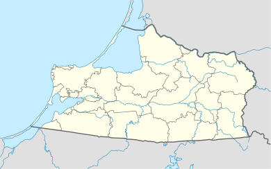
Slavsk (Russian: Славск), prior to 1946 known by its German name Heinrichswalde (Polish: Jędrzychowo; Lithuanian: Gastos), is a town and the administrative center of Slavsky District in Kaliningrad Oblast, Russia, located 105 kilometers (65 mi) northeast of Kaliningrad, the administrative center of the oblast. Population: 4,614 (2010 Census);[3] 5,172 (2002 Census);[7] 4,682 (1989 Census).[8]
History
![]() Teutonic Order 1292–1466
Teutonic Order 1292–1466
![]() Teutonic Order 1466–1525 (fief of Poland)
Teutonic Order 1466–1525 (fief of Poland)
![]() Duchy of Prussia 1525–1657 (fief of Poland)
Duchy of Prussia 1525–1657 (fief of Poland)
![]() Duchy of Prussia 1657–1701
Duchy of Prussia 1657–1701
![]() Kingdom of Prussia 1701–1871
Kingdom of Prussia 1701–1871
![]() German Empire 1871–1918
German Empire 1871–1918
![]() Weimar Republic 1918–1933
Weimar Republic 1918–1933
![]() Nazi Germany 1933–1945
Nazi Germany 1933–1945
![]() Soviet Union 1945–1991
Soviet Union 1945–1991
![]() Russian Federation 1991–present
Russian Federation 1991–present
The town was established in 1292.[5] In 1819 it became seat of the Prussian Elchniederung district. After World War II and the subsequent border shift, the region was placed under Soviet administration and ethnically cleansed according to the post-war Potsdam Agreement, the native German populace was expelled.
Administrative and municipal status
Within the framework of administrative divisions, Slavsk serves as the administrative center of Slavsky District.[1] As an administrative division, it is, together with six rural localities, incorporated within Slavsky District as the town of district significance of Slavsk.[1] As a municipal division, the town of district significance of Slavsk is incorporated within Slavsky Municipal District as Slavskoye Urban Settlement.[2]
Transportation
The town has a railway station on the Sovetsk-Kaliningrad railroad.
Notable residents
- Ernst Siehr (1869–1945), German lawyer and politician
- Arthur Ewert (1890-1959),German politician
Twin towns and sister cities
Slavsk is twinned with:
References
Notes
- 1 2 3 4 5 6 7 8 Resolution #640
- 1 2 3 4 5 Law #261
- 1 2 Russian Federal State Statistics Service (2011). "Всероссийская перепись населения 2010 года. Том 1" [2010 All-Russian Population Census, vol. 1]. Всероссийская перепись населения 2010 года (2010 All-Russia Population Census) (in Russian). Federal State Statistics Service. Retrieved June 29, 2012.
- ↑ Правительство Российской Федерации. Федеральный закон №107-ФЗ от 3 июня 2011 г. «Об исчислении времени», в ред. Федерального закона №271-ФЗ от 03 июля 2016 г. «О внесении изменений в Федеральный закон "Об исчислении времени"». Вступил в силу по истечении шестидесяти дней после дня официального опубликования (6 августа 2011 г.). Опубликован: "Российская газета", №120, 6 июня 2011 г. (Government of the Russian Federation. Federal Law #107-FZ of June 31, 2011 On Calculating Time, as amended by the Federal Law #271-FZ of July 03, 2016 On Amending Federal Law "On Calculating Time". Effective as of after sixty days following the day of the official publication.).
- 1 2 3 4 Энциклопедия Города России. Moscow: Большая Российская Энциклопедия. 2003. p. 424. ISBN 5-7107-7399-9.
- ↑ Почта России. Информационно-вычислительный центр ОАСУ РПО. (Russian Post). Поиск объектов почтовой связи (Postal Objects Search) (Russian)
- ↑ Russian Federal State Statistics Service (May 21, 2004). "Численность населения России, субъектов Российской Федерации в составе федеральных округов, районов, городских поселений, сельских населённых пунктов – районных центров и сельских населённых пунктов с населением 3 тысячи и более человек" [Population of Russia, Its Federal Districts, Federal Subjects, Districts, Urban Localities, Rural Localities—Administrative Centers, and Rural Localities with Population of Over 3,000] (XLS). Всероссийская перепись населения 2002 года [All-Russia Population Census of 2002] (in Russian). Retrieved August 9, 2014.
- ↑ Demoscope Weekly (1989). "Всесоюзная перепись населения 1989 г. Численность наличного населения союзных и автономных республик, автономных областей и округов, краёв, областей, районов, городских поселений и сёл-райцентров" [All Union Population Census of 1989: Present Population of Union and Autonomous Republics, Autonomous Oblasts and Okrugs, Krais, Oblasts, Districts, Urban Settlements, and Villages Serving as District Administrative Centers]. Всесоюзная перепись населения 1989 года [All-Union Population Census of 1989] (in Russian). Институт демографии Национального исследовательского университета: Высшая школа экономики [Institute of Demography at the National Research University: Higher School of Economics]. Retrieved August 9, 2014.
Sources
- Правительство Калининградской области. Постановление №640 от 30 августа 2011 г. «Об утверждении реестра объектов административно-территориального деления Калининградской области», в ред. Постановления №877 от 21 ноября 2011 г «О внесении изменения в Постановление Правительства Калининградской области от 30 августа 2011 г. №640». Вступил в силу со дня официального опубликования. Опубликован: "Калининградская правда" (вкладыш "Официально"), №170, 15 сентября 2011 г. (Government of Kaliningrad Oblast. Resolution #640 of August 30, 2011 On the Adoption of the Registry of the Objects of the Administrative-Territorial Divisions of Kaliningrad Oblast, as amended by the Resolution #877 of November 21, 2011 On Amending the Resolution of the Government of Kaliningrad Oblast #640 of August 30, 2011. Effective as of the day of the official publication.).
- Калининградская областная Дума. Закон №261 от 30 июня 2008 г. «Об организации местного самоуправления на территории муниципального образования "Славский городской округ"», в ред. Закона №123 от 19 июня 2012 г. «О внесении изменения в Закон Калининградской области "Об организации местного самоуправления на территории муниципального образования "Славский городской округ"». Вступил в силу со дня официального опубликования. Опубликован: "Калининградская правда", №124, 11 июля 2008 г. (Kaliningrad Oblast Duma. Law #261 of June 30, 2008 On the Organization of the Local Self-Government on the Territory of the Municipal Formation of "Slavsky Urban Okrug", as amended by the Law #123 of June 19, 2012 On Amending the Law of Kaliningrad Oblast "On the Organization of the Local Self-Government on the Territory of the Municipal Formation of "Slavsky Urban Okrug". Effective as of the day of the official publication.).
Administrative divisions of Kaliningrad Oblast (former German names are given in parentheses and italicized) | ||
|---|---|---|
Administrative center: Kaliningrad (Königsberg) | ||
| Cities and towns |
| |
| Urban-type settlements of oblast significance |
| |
| Districts | ||