Slaughter, Louisiana
| Slaughter, Louisiana | |
| Town | |
| Country | United States |
|---|---|
| State | Louisiana |
| Parish | East Feliciana |
| Elevation | 131 ft (39.9 m) |
| Coordinates | 30°42′59″N 91°08′40″W / 30.71639°N 91.14444°WCoordinates: 30°42′59″N 91°08′40″W / 30.71639°N 91.14444°W |
| Area | 5.5 sq mi (14.2 km2) |
| - land | 5.5 sq mi (14 km2) |
| - water | 0.0 sq mi (0 km2), 0% |
| Population | 997 (2010) |
| Density | 181.8/sq mi (70.2/km2) |
| Mayor | "Robbie" Jackson (R) Police Chief Joseph E. Beavers (D) |
| Timezone | CST (UTC-6) |
| - summer (DST) | CDT (UTC-5) |
| ZIP code | 70777 |
| Area code | 225 |
 Location of Slaughter in Louisiana | |
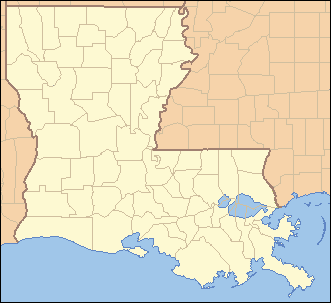
 Location of Louisiana in the United States | |
Slaughter is a town in East Feliciana Parish, Louisiana, United States. The population was 997 at the 2010 census.[1] It is part of the Baton Rouge Metropolitan Statistical Area.
Slaughter was designated a town in 2002.[2]
History
The name of the town figures in the title of Michael Ondaatje's novel about legendary jazz player Buddy Bolden: Coming Through Slaughter.
Geography
Slaughter is located along the southern edge of East Feliciana Parish at 30°42′59″N 91°8′40″W / 30.71639°N 91.14444°W (30.716484, -91.144506).[3] The town is bordered on the south by the city of Zachary in East Baton Rouge Parish.
Louisiana Highway 19 passes through Slaughter, leading north 15 miles (24 km) to Wilson and south 20 miles (32 km) to Baton Rouge. Clinton, the East Feliciana Parish seat, is 14 miles (23 km) to the northeast.
According to the United States Census Bureau, Slaughter has a total area of 5.5 square miles (14.2 km2), of which 0.01 square miles (0.02 km2), or 0.16%, is water.[1]
Demographics
| Historical population | |||
|---|---|---|---|
| Census | Pop. | %± | |
| 1900 | 259 | — | |
| 1910 | 287 | 10.8% | |
| 1920 | 215 | −25.1% | |
| 1930 | 327 | 52.1% | |
| 1940 | 306 | −6.4% | |
| 1950 | 290 | −5.2% | |
| 1960 | 403 | 39.0% | |
| 1970 | 580 | 43.9% | |
| 1980 | 729 | 25.7% | |
| 1990 | 827 | 13.4% | |
| 2000 | 1,011 | 22.2% | |
| 2010 | 997 | −1.4% | |
| Est. 2015 | 963 | [4] | −3.4% |
As of the census[6] of 2000, there were 1,011 people, 359 households, and 286 families residing in the village. The population density was 184.3 inhabitants per square mile (71.2/km²). There were 376 housing units at an average density of 68.6 per square mile (26.5/km²). The racial makeup of the village was 94.56% White, 3.56% African American, 0.99% Native American, 0.10% Asian, 0.40% from other races, and 0.40% from two or more races. Hispanic or Latino of any race were 0.79% of the population.
There were 359 households out of which 38.2% had children under the age of 18 living with them, 64.6% were married couples living together, 8.9% had a female householder with no husband present, and 20.1% were non-families. 16.7% of all households were made up of individuals and 7.5% had someone living alone who was 65 years of age or older. The average household size was 2.82 and the average family size was 3.17.
In the village the population was spread out with 28.8% under the age of 18, 7.9% from 18 to 24, 30.8% from 25 to 44, 24.8% from 45 to 64, and 7.7% who were 65 years of age or older. The median age was 33 years. For every 100 females there were 101.8 males. For every 100 females age 18 and over, there were 98.3 males.
The median income for a household in the village was $44,896, and the median income for a family was $46,932. Males had a median income of $34,375 versus $21,141 for females. The per capita income for the village was $17,457. About 3.4% of families and 3.5% of the population were below the poverty line, including 3.1% of those under age 18 and 5.7% of those age 65 or over.
Education
East Feliciana Parish School Board serves Slaughter. Slaughter Elementary School and Slaughter Community Charter School is located in Slaughter.
References
- 1 2 "Geographic Identifiers: 2010 Demographic Profile Data (G001): Slaughter town, Louisiana". American Factfinder. U.S. Census Bureau. Retrieved February 9, 2016.
- ↑ "Boundary Changes". Geographic Change Notes: Louisiana. Population Division, United States Census Bureau. 2006-05-19. Retrieved 2008-10-24.
- ↑ "US Gazetteer files: 2010, 2000, and 1990". United States Census Bureau. 2011-02-12. Retrieved 2011-04-23.
- ↑ "Annual Estimates of the Resident Population for Incorporated Places: April 1, 2010 to July 1, 2015". Retrieved July 2, 2016.
- ↑ "Census of Population and Housing". Census.gov. Retrieved June 4, 2015.
- ↑ "American FactFinder". United States Census Bureau. Retrieved 2008-01-31.
Municipalities and communities of East Feliciana Parish, Louisiana, United States | ||
|---|---|---|
| Towns | 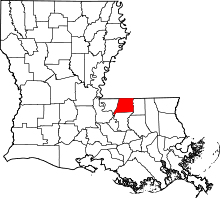 | |
| Villages | ||
| Unincorporated communities | ||