Sheikhpura district
| Sheikhpura district शेखपुरा जिला,ضلع شیخ پورہ | |
|---|---|
| District of Bihar | |
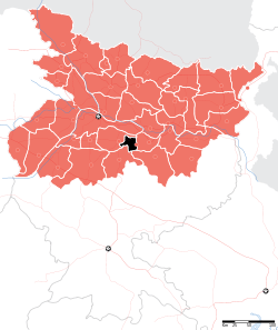 Location of Sheikhpura district in Bihar | |
| Country | India |
| State | Bihar |
| Administrative division | Munger |
| Headquarters | Sheikhpura |
| Government | |
| • Lok Sabha constituencies | Jamui |
| • Assembly seats | barbigha and sheikhpura |
| Area | |
| • Total | 689 km2 (266 sq mi) |
| Population (2011) | |
| • Total | 634,927 |
| • Density | 920/km2 (2,400/sq mi) |
| Demographics | |
| • Literacy | 65.96 per cent |
| • Sex ratio | 926 |
| Major highways | NH 82 |
| Website | Official website |
Sheikhpura district is one of the thirty eight districts of Bihar state, India, and Sheikhpura town is the administrative headquarters of this district. Sheikhpura district is a part of Munger Division. Sheikhpura was separated from Munger District and was made a separate district with headquarters at Sheikhpura on 31 July 1994. Sheikhpura district has given many veteran leaders to the nation like the first chief minister of Bihar, Shri Krishna Singh, Sukhdev Prasad Singh, Member of Parliyament Rajo Singh etc. The main role in the formation of this district was of Rajo Singh.
As of 2011 it is the least populous district of Bihar (out of 39).[1]
Geography
Sheikhpura district occupies an area of 689 square kilometres (266 sq mi),[2] comparatively equivalent to the Solomon Islands' Kolombangara.[3]
Economy
Shekhpura is one of the smallest district of Bihar having just six blocks and people are dependent on agriculture. Sone Mining of smaller hillocks with crushers is one of the main activities for employment. In 2006 Ministry of Panchayati Raj named Sheikhpura one of the country's 250 Poverty in India (out of a total of 640).[4] It is one of the 36 districts in Bihar currently receiving funds from the Backward Regions Grant Fund Programme (BRGF).[4]
Infrastructure
Health and medicine
Sheikhpura is a centre of health care for all village and block. Sadar Hospital first medical Hospital by government was established in the city most popular place which is called Grihinda Chowk.After some time Private hospital flourish by Government Doctor Slowly healthcare system in hand of private doctor like Mirgenra Babu Clinic.
Divisions
Sub Divisions: The district consists only one sub-division Sheikhpura, which is divided into six developmental blocks: Ariari, Sheikhpura, Barbigha, Ghatkosumbha, Chewara, Shekhopur Sarai.
.
Legislative Constituencies: Sheikhpura and Barbigha
Villages: The district has many villages including Chittaura,Jagdishpur, Toygarh, Teus, Narsingh pur,Jairampur, Bazidpur, Barsa, Pinjari, Bhalua, Bhadarathi, AIFNI, Ramzanpur,Kuttubchak,Samas,Herganwan, Mohni, Konand, Nabi Nagar Kakrar, Hussainabad, Bigha (Vidyapur), Pandhar, Pachna, Deole, Mahuat, Dalhar, Nimi,Miyan Bigha, Biman, Lohan, sohadi, Kasar,Karki, Diha,jodhanbigha,baikatpur, Farpar, Rampur, Ariari, Kaithwan, Bhadauns, Sirari, Barama, Sultanpur, Gagri,Ghoghnsa, Gaway, Hathiyawan,Hasauri, Charuanwa,Maniyouri, Mehus,AIJHI, Katari,RamnuBigha, Mafo, Pain, Audhe, Namdargang, Ambari, Kshema, Belao, Sadikpur, Bhadeli, Panepur, Asthana, Jodhanbigha, Sugiya, Dobadih,Ismailpur,Nagdih,Maldah,Murarpur,Sasbahna,Latkana,karimabigha,Ghuskuri,Eksari,Jamuara, Maninda,Kurmuri,siyani, Bhikhni.
Village in Chewara Block:
Ekhara,Ekarma,Bhusri,Aazadnagar,Lohan,Noni
Police Stations: Sheikhpura P.S., Sirari O.P., Ariyari P.S., Kasar O.P., Mahuli O.P., Kusumbha O.P.,Chewara P.S., Karande O.P., Korma P.S., Mehus P.S., Barbigha P.S., Shekhopur Sarai P.S., Jayrampur O.P.
Village
Template:EKHARA village is situated on bank of PUNCHKUTHI River. EKHARA is determined as a locality with 5,000 or fewer people.Many of them who reside urban Area to come back to village for the holidays. A Popular Shiv Temple(Lord Shiva) height(200m) is most famous temple.Also have popular Tripurari temple which is popular in Sheikhpura district, Everyone have wish to visit one times in own life.
Transport
Roadways
The town is connected by road to major hubs in the region with frequent bus service.
Railways
Sheikhpura is located on the broad gauge line Gaya-Kiul line connecting Kiul and Gaya. The town is served by a direct daily train to Kolkata, and a weekly service to Guwahati via Bhagalpur. The state capital Patna could be reached through a stop-over at Kiul from where rest of India is well connected.
Very recently the Fatuha-Islampur and Bakhtiyarpur-Rajgir branch lines have been connected with this route. Extension of passenger services to inter-link Sheikhpura with Hilsa, Bihar|Hilsa and Bihar Sharif is expected very soon.
Airport
The nearest airport is Lok Nayak Jayaprakash Airport|Patna Airport. Domestic flights to major Indian cities are available from there.For International Flights consider Bodhgaya Airport mainly for Buddhism country like nepal ,Myanmar,Sri lanka.
Local transport
Tam Tam
Sheikhpura has a well developed transport system inside city on very cheap rate. TamTam Generally Driven by Horse ,TamTam is use in all part of city for local transport. Tam tams are now old memory of sheikhpura auto has been started in the city since 2 years.
Demographics
According to the 2011 census Sheikhpura district has a population of 634,927,[1] roughly equal to the nation of Montenegro[5] or the US state of Vermont.[6] This gives it a ranking of 516th in India (out of a total of 640).[1] The district has a population density of 922 inhabitants per square kilometre (2,390/sq mi) .[1] Its population growth rate over the decade 2001-2011 was 20.82%.[1] Sheikhpura has a sex ratio of 926 females for every 1000 males,[1] and a literacy rate of 65.96%.[1]
Languages
Languages used in the district include Hindi . Urdu, Magadhi, an Indo-Aryan language written in the Devanagari script,
Culture
The district is a part of erstwhile Magadh empire and proudly follows rich culture of Magadh. Tourist Places: Arghauti Pokhar, Girihinda Pahar (With Temple of Lord 'SHIV'), Samas (Lord 'VISHNU'),.Tripurai Temple famous in Akhara Village which is situated in Chewara Block. You reach Akhara Village via two route via chewara city and Ariyari ,Situated 14 km from sheikhpura.
Education
School:
,S.A.D.N. Convent School
HIGH SCHOOL AIJHI KATARI
D.M. High school
HIGH SCHOOL AIFNI, High school Mehus, Janta High School Sirari, high school nimi,Rajo Sigh High School Ambari, Kasturba Gandhi Balika Vidyalaya, Gagari, Kasturba Gandhi Ba a Vidyalaya, Shekhopur Sarai, R.N.Jha High School, Barama, Rajkiya Madhya Vidyalay Biman, Uccha Vidyalay Lohan ,Adrash high school pharpar diha,at pharpar,Sri Bijojanki High School,Akhara(Established in the year 1948 just one year after freedom of india)
&Ideal Middle School Of Charuanwa will be a next High School of this District.
College: Islamia high school,Jawahar Navodaya Vidyalaya, Chandrshekhar Banke Nasib College, Hathiama, Sanjay Gandhi Smarika Women's College Shekhpura, Sundar Singh College Mehus, Sheikhpura, Nimi College Shekhopur Sarai,MURLIDHAR MURARKA, Sanskar Public High School.
References
- 1 2 3 4 5 6 7 "District Census 2011". Census2011.co.in. 2011. Retrieved 2011-09-30.
- ↑ Srivastava, Dayawanti et al. (ed.) (2010). "States and Union Territories: Bihar: Government". India 2010: A Reference Annual (54th ed.). New Delhi, India: Additional Director General, Publications Division, Ministry of Information and Broadcasting (India), Government of India. pp. 1118–1119. ISBN 978-81-230-1617-7.
- ↑ "Island Directory Tables: Islands by Land Area". United Nations Environment Program. 1998-02-18. Retrieved 2011-10-11.
Kolombangara 688km2
- 1 2 Ministry of Panchayati Raj (8 September 2009). "A Note on the Backward Regions Grant Fund Programme" (PDF). National Institute of Rural Development. Retrieved 27 September 2011.
- ↑ US Directorate of Intelligence. "Country Comparison:Population". Retrieved 2011-10-01.
Montenegro 661,807 July 2011 est.
- ↑ "2010 Resident Population Data". U. S. Census Bureau. Retrieved 2011-09-30.
Vermont 625,741
External links
 |
Nalanda district | Lakhisarai district | | |
| |
||||
| ||||
| | ||||
| Nawada district | Jamui district |
Coordinates: 25°07′48″N 85°51′00″E / 25.13000°N 85.85000°E