Senčak pri Juršincih
| Senčak pri Juršincih | |
|---|---|
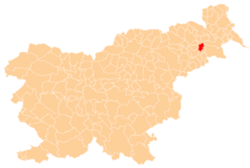
 Senčak pri Juršincih Location in Slovenia | |
| Coordinates: 46°30′24.92″N 16°0′1.72″E / 46.5069222°N 16.0004778°ECoordinates: 46°30′24.92″N 16°0′1.72″E / 46.5069222°N 16.0004778°E | |
| Country |
|
| Traditional region | Styria |
| Statistical region | Drava |
| Municipality | Juršinci |
| Area | |
| • Total | 2.05 km2 (0.79 sq mi) |
| Elevation | 335.8 m (1,101.7 ft) |
| Population (2002) | |
| • Total | 92 |
| [1] | |
Senčak pri Juršincih (pronounced [ˈseːntʃak pɾi ˈjuːɾʃintsix]) is a settlement in the Slovene Hills (Slovene: Slovenske gorice) in the Municipality of Juršinci in northeastern Slovenia. Traditionally the area was part of Styria and is now included in the Drava Statistical Region.[2]
Name
The name of the settlement was changed from Senčak to Senčak pri Juršincih in 1955.[3]
Cultural heritage
A small chapel-shrine known as the Vrabel Shrine (Vrablova kapelica) was built in the village after the end of the First World War.[4]
References
- ↑ Statistical Office of the Republic of Slovenia
- ↑ Juršinci municipal site
- ↑ Spremembe naselij 1948–95. 1996. Database. Ljubljana: Geografski inštitut ZRC SAZU, DZS.
- ↑ Slovenian Ministry of Culture register of national heritage reference number ešd 19905
External links
| Settlements | Administrative centre: Juršinci
|  | ||||||
|---|---|---|---|---|---|---|---|---|
| Notable people |
| |||||||
This article is issued from Wikipedia - version of the 12/22/2015. The text is available under the Creative Commons Attribution/Share Alike but additional terms may apply for the media files.