Schell City, Missouri
| Schell City, Missouri | |
|---|---|
| City | |
 Location of Schell City, Missouri | |
| Coordinates: 38°1′9″N 94°7′0″W / 38.01917°N 94.11667°WCoordinates: 38°1′9″N 94°7′0″W / 38.01917°N 94.11667°W | |
| Country | United States |
| State | Missouri |
| County | Vernon |
| Area[1] | |
| • Total | 0.63 sq mi (1.63 km2) |
| • Land | 0.62 sq mi (1.61 km2) |
| • Water | 0.01 sq mi (0.03 km2) |
| Elevation | 768 ft (234 m) |
| Population (2010)[2] | |
| • Total | 249 |
| • Estimate (2012[3]) | 246 |
| • Density | 401.6/sq mi (155.1/km2) |
| Time zone | Central (CST) (UTC-6) |
| • Summer (DST) | CDT (UTC-5) |
| ZIP code | 64783 |
| Area code(s) | 417 |
| FIPS code | 29-66134[4] |
| GNIS feature ID | 0726097[5] |
Schell City is a city in Vernon County, Missouri, United States. The population was 249 at the 2010 census.
History
Schell City was laid out in 1871.[6] The city was named for one of its original proprietors, Augustus Schell of New York.[7] A post office has been in operation at Schell City since 1871.[8]
Geography
Schell City is located at 38°1′9″N 94°7′0″W / 38.01917°N 94.11667°W (38.019168, -94.116617).[9]
According to the United States Census Bureau, the city has a total area of 0.63 square miles (1.63 km2), of which 0.62 square miles (1.61 km2) is land and 0.01 square miles (0.03 km2) is water.[1]
Landmarks
On Main St. important buildings include Farmers State Bank, the Schell City Cafe, T&T repair, City Hall, the post office and J&S repair. The NEVC elementary school is on 2nd & Hickory in Schell City. River Road Discount Convenience store is located on River Road but is now closed.
Demographics
| Historical population | |||
|---|---|---|---|
| Census | Pop. | %± | |
| 1880 | 676 | — | |
| 1890 | 847 | 25.3% | |
| 1900 | 668 | −21.1% | |
| 1910 | 562 | −15.9% | |
| 1920 | 596 | 6.0% | |
| 1930 | 413 | −30.7% | |
| 1940 | 454 | 9.9% | |
| 1950 | 400 | −11.9% | |
| 1960 | 343 | −14.2% | |
| 1970 | 367 | 7.0% | |
| 1980 | 327 | −10.9% | |
| 1990 | 292 | −10.7% | |
| 2000 | 286 | −2.1% | |
| 2010 | 249 | −12.9% | |
| Est. 2015 | 247 | [10] | −0.8% |
2010 census
As of the census[2] of 2010, there were 249 people, 115 households, and 66 families residing in the city. The population density was 401.6 inhabitants per square mile (155.1/km2). There were 133 housing units at an average density of 214.5 per square mile (82.8/km2). The racial makeup of the city was 97.6% White, 1.6% Native American, and 0.8% from two or more races. Hispanic or Latino of any race were 1.6% of the population.
There were 115 households of which 28.7% had children under the age of 18 living with them, 36.5% were married couples living together, 11.3% had a female householder with no husband present, 9.6% had a male householder with no wife present, and 42.6% were non-families. 40.0% of all households were made up of individuals and 20% had someone living alone who was 65 years of age or older. The average household size was 2.17 and the average family size was 2.89.
The median age in the city was 39.9 years. 27.3% of residents were under the age of 18; 9.5% were between the ages of 18 and 24; 19.2% were from 25 to 44; 24.4% were from 45 to 64; and 19.3% were 65 years of age or older. The gender makeup of the city was 49.8% male and 50.2% female.
2000 census
As of the census[4] of 2000, there were 286 people, 128 households, and 84 families residing in the city. The population density was 454.3 people per square mile (175.3/km²). There were 161 housing units at an average density of 255.7 per square mile (98.7/km²). The racial makeup of the city was 100.00% White. Hispanic or Latino of any race were 1.05% of the population.
There were 128 households out of which 27.3% had children under the age of 18 living with them, 55.5% were married couples living together, 7.0% had a female householder with no husband present, and 33.6% were non-families. 32.8% of all households were made up of individuals and 14.8% had someone living alone who was 65 years of age or older. The average household size was 2.23 and the average family size was 2.78.
In the city the population was spread out with 25.5% under the age of 18, 5.6% from 18 to 24, 22.7% from 25 to 44, 29.0% from 45 to 64, and 17.1% who were 65 years of age or older. The median age was 42 years. For every 100 females there were 98.6 males. For every 100 females age 18 and over, there were 93.6 males.
The median income for a household in the city was $20,500, and the median income for a family was $27,813. Males had a median income of $20,000 versus $16,094 for females. The per capita income for the city was $11,027. About 19.8% of families and 25.7% of the population were below the poverty line, including 30.0% of those under the age of eighteen and 21.3% of those sixty five or over.
Notable people
- Shotgun and Lace - Nashville Recording Sibling Country Duo composed of Jordan Coleman and Joanna Coleman[12]
References
- 1 2 "US Gazetteer files 2010". United States Census Bureau. Retrieved 2012-07-08.
- 1 2 "American FactFinder". United States Census Bureau. Retrieved 2012-07-08.
- ↑ "Population Estimates". United States Census Bureau. Retrieved 2013-05-30.
- 1 2 "American FactFinder". United States Census Bureau. Retrieved 2008-01-31.
- ↑ "US Board on Geographic Names". United States Geological Survey. 2007-10-25. Retrieved 2008-01-31.
- ↑ "Area towns approaching 100". The Nevada Daily Mail. Aug 14, 1970. p. 10. Retrieved 28 October 2015.
- ↑ Eaton, David Wolfe (1918). How Missouri Counties, Towns and Streams Were Named. The State Historical Society of Missouri. p. 369.
- ↑ "Vernon County". Jim Forte Postal History. Retrieved 14 April 2015.
- ↑ "US Gazetteer files: 2010, 2000, and 1990". United States Census Bureau. 2011-02-12. Retrieved 2011-04-23.
- ↑ "Annual Estimates of the Resident Population for Incorporated Places: April 1, 2010 to July 1, 2015". Retrieved July 2, 2016.
- ↑ "Census of Population and Housing". Census.gov. Retrieved June 4, 2015.
- ↑ http://shotgunandlace.com/
External links
- Historic maps of Schell City in the Sanborn Maps of Missouri Collection at the University of Missouri
Municipalities and communities of Vernon County, Missouri, United States | ||
|---|---|---|
| Cities | 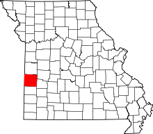 | |
| Villages | ||
| Townships | ||
| Unincorporated communities |
| |
| Footnotes | ‡This populated place also has portions in an adjacent county or counties | |