Sargeant Township, Mower County, Minnesota
| Sargeant Township, Minnesota | |
|---|---|
| Township | |
 Sargeant Township, Minnesota Location within the state of Minnesota | |
| Coordinates: 43°47′51″N 92°44′22″W / 43.79750°N 92.73944°WCoordinates: 43°47′51″N 92°44′22″W / 43.79750°N 92.73944°W | |
| Country | United States |
| State | Minnesota |
| County | Mower |
| Area | |
| • Total | 35.4 sq mi (91.6 km2) |
| • Land | 35.4 sq mi (91.6 km2) |
| • Water | 0.0 sq mi (0.0 km2) |
| Elevation | 1,339 ft (408 m) |
| Population (2000) | |
| • Total | 316 |
| • Density | 8.9/sq mi (3.4/km2) |
| Time zone | Central (CST) (UTC-6) |
| • Summer (DST) | CDT (UTC-5) |
| ZIP code | 55973 |
| Area code(s) | 507 |
| FIPS code | 27-58594[1] |
| GNIS feature ID | 0665555[2] |
Sargeant Township is a township in Mower County, Minnesota, United States. The population was 316 at the 2000 census. The largest town in the township is Sargeant with a population of 76 people. All other area in the township is unincorporated.
History
The township is named for its first permanent settler, Henry N. Sargeant, a Canadian.[3] He moved to Dodge County, Wisconsin in 1858 and then to Mower County in March 1865 where he purchased the south half of section 11 of Sargeant Township. The township was organized in 1873 and the Chicago Great Western Railway came through in 1887. The village of Sargeant was platted on September 7, 1894 in section 18 along the railroad.
Geography
According to the United States Census Bureau, the township has a total area of 35.4 square miles (91.6 km²), all of it land.
Demographics
As of the census[1] of 2000, there are 316 people, 97 households, and 83 families residing in the township. The population density is 8.9 people per square mile (3.4/km²). There are 101 housing units at an average density of 2.9/sq mi (1.1/km²). The racial makeup of the township is 97.47% White, 0.32% African American, 0.63% Asian, and 1.58% from two or more races. 0.00% of the population are Hispanic or Latino of any race.
There are 97 households out of which 39.2% have children under the age of 18 living with them, 75.3% are married couples living together, 3.1% have a female householder with no husband present, and 14.4% are non-families. 13.4% of all households are made up of individuals and 8.2% have someone living alone who is 65 years of age or older. The average household size is 2.68 and the average family size is 2.88.
In the township the population is spread out with 30.4% under the age of 18, 4.4% from 18 to 24, 30.1% from 25 to 44, 22.2% from 45 to 64, and 13.0% who are 65 years of age or older. The median age is 35 years. For every 100 females there are 98.7 males. For every 100 females age 18 and over, there are 105.6 males.
The median income for a household in the township is $46,875, and the median income for a family is $52,500. Males have a median income of $31,625 versus $25,000 for females. The per capita income for the township is $16,720. 21.5% of the population and 12.2% of families are below the poverty line. Out of the total population, 15.3% of those under the age of 18 and none of those 65 and older are living below the poverty line.
Cemeteries
- Zion Lutheran Cemetery is located section 2 of the township.
References
- 1 2 "American FactFinder". United States Census Bureau. Retrieved 2008-01-31.
- ↑ "US Board on Geographic Names". United States Geological Survey. 2007-10-25. Retrieved 2008-01-31.
- ↑ Upham, Warren (1920). Minnesota Geographic Names: Their Origin and Historic Significance. Minnesota Historical Society. p. 361.
Further reading
- Mill on the Willow: A History of Mower County, Minnesota by various authors. Library of Congress No. 84-062356
Municipalities and communities of Mower County, Minnesota, United States | ||
|---|---|---|
| Cities | 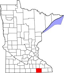 | |
| Townships | ||
| CDP | ||
| Unincorporated communities | ||
| Footnotes | ‡This populated place also has portions in adjacent county or counties | |