Santa Helena, Maranhão
| Santa Helena | |
|---|---|
| Municipality | |
| The Municipality of Santa Helena | |
| Nickname(s): "Pérola do Turí" (Pearl of Turi) | |
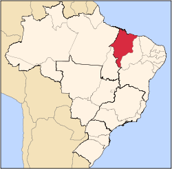
 Location of Santa Helena in the State of Maranhão | |
| Coordinates: 02°13′51″S 45°18′00″W / 2.23083°S 45.30000°WCoordinates: 02°13′51″S 45°18′00″W / 2.23083°S 45.30000°W | |
| Country | Brazil |
| Region | Northeast |
| State | Maranhão |
| Founded | September 30, 1935 |
| Government | |
| • Mayor | Helena Maria Lobato Pavão (PTB) |
| Area | |
| • Total | 2,308.403 km2 (891.279 sq mi) |
| [1] | |
| Population (2012) | |
| • Total | 40,356 |
| • Density | 17/km2 (45/sq mi) |
| [2] | |
| Time zone | UTC-3 (UTC-3) |
| HDI (2000) | 0.600 – medium[3] |
| Website | www.santahelena.ma.gov.br |
Santa Helena is a municipality in the state of Maranhão in the Northeast region of Brazil.
The municipality contains a small part of the Baixada Maranhense Environmental Protection Area, a 1,775,035.6 hectares (4,386,208 acres) sustainable use conservation unit created in 1991 that has been a Ramsar Site since 2000.[4]
See also
References
- ↑ IBGE -
- ↑ "2012 Populational Estimate" (PDF). Censo Populacional 2012. Instituto Brasileiro de Geografia e Estatística (IBGE). July 2012. Retrieved September 8, 2012.
- ↑ UNDP
- ↑ APA Baixada Maranhense (in Portuguese), ISA: Instituto Socioambiental, retrieved 2016-06-13
This article is issued from Wikipedia - version of the 6/13/2016. The text is available under the Creative Commons Attribution/Share Alike but additional terms may apply for the media files.