San Sebastian, Lempira
| San Sebastián Colosuca | |
|---|---|
| Municipality | |
|
Panoramic View San Sebastián | |
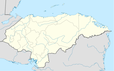 San Sebastián Location in Honduras | |
| Coordinates: 14°15′N 88°30′W / 14.250°N 88.500°W | |
| Country | Honduras |
| Department | Lempira |
| Municipality since | 7 March 1896 |
| Area | |
| • Total | 227 km2 (88 sq mi) |
| Population (2014) | |
| • Total | 10,857 |
| • Density | 48/km2 (120/sq mi) |

San Sebastian is a municipality in the Honduran department of Lempira.
It is one of the farthest municipalities of the Lempira department. It is 13 km ahead of San Manuel Colohete. It is highly recommended to go on a 4 wheel drive vehicle when visiting this municipality.
History
In the census of 1887 it appears as "Colosuca" village, of Gracias. It became a municipality on 7 March 1896. The name of "Colosuca" means "Beautiful Place".

Geography
The municipality capital is up on a big mountain. Surrounded by many pine trees and some oak trees. The mountains are very high and steep. In some of these mountains the vegetation changes to bushes and undergrowth. The origin of the rocks and soil all around is volcanic.
Boundaries
Its boundaries are:
- North : San Manuel Colohete municipality and Ocotepeque department.
- South : Tomalá and San Andrés municipalities.
- East : La Campa and San Manuel Colohete municipalities.
- West : Guarita, Cololaca and San Marcos de Caiquin municipalities.
- Surface Extents: 227 km²
Resources
The coffee harvest provides a lot of jobs for the locals and even people from other places because it is the main economical activity of this region. The second most important activity is raising cattle. The commerce of groceries with Gracias is a very profitable activity. The corn and beans crops are mostly for local consumption. In 2007, they were installing the pipes for the sewer system. They obtained the water from perforated wells. Also it has electricity and mobile communications coverage. As for the transportation services, only one bus is available and it stays in the municipality capital and travels back from Gracias in the afternoon.
Population
In this case, the descendants of Native Americans are only 60% of the population, the rest is made up of the cross-breed of Spanish and Indians, some of these individuals have white skin and blue or green eyes.
- Population:For the year 2001 this municipality had 8,025 people, this figure was the base for an estimate, resulting in 10,857 people for the year of 2015.
- Villages: 7
- Settlements: 108
Tourism
Once Colohete is passed the road becomes narrower and steeper and therefore more dangerous. There is 1 river to cross, in the rainy season it is just not possible to do so. There is also a 2nd river, but in this case a bridge was built. The "congolon" mountain can be seen to the south and some other mountains in Ocotepeque to the north. The old church also gives a good reason to visit, if the traveller enjoys ancient colonial buildings. This municipality is in the "Colosuca" path, this is organised by the national institute of tourism and some Mayor's offices of several municipalities. The object of this is to show the Indian legacy.
- Local Holidays: "San Sebastián" day on 20 January.
External links
| Wikimedia Commons has media related to San Sebastián. |

Capital: Gracias | ||
| Municipalities | 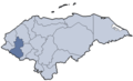 | |
Coordinates: 14°15′N 88°30′W / 14.250°N 88.500°W