Saint-Thomas-Didyme, Quebec
| Saint-Thomas-Didyme | |
|---|---|
| Municipality | |
 | |
 | |
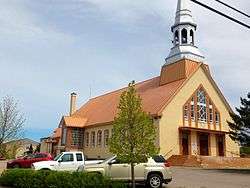
 Saint-Thomas-Didyme Location in Saguenay–Lac-Saint-Jean Quebec. | |
| Coordinates: 48°54′N 72°40′W / 48.900°N 72.667°WCoordinates: 48°54′N 72°40′W / 48.900°N 72.667°W[1] | |
| Country |
|
| Province |
|
| Region | Saguenay–Lac-Saint-Jean |
| RCM | Maria-Chapdelaine |
| Settled | 1910s |
| Constituted | May 11, 1923 |
| Government[2] | |
| • Mayor | Denis Tremblay |
| • Federal riding | Roberval—Lac-Saint-Jean |
| • Prov. riding | Roberval |
| Area[2][3] | |
| • Total | 357.20 km2 (137.92 sq mi) |
| • Land | 339.67 km2 (131.15 sq mi) |
| Population (2011)[3] | |
| • Total | 677 |
| • Density | 2.0/km2 (5/sq mi) |
| • Pop (2006–11) |
|
| • Dwellings | 529 |
| Time zone | EST (UTC−5) |
| • Summer (DST) | EDT (UTC−4) |
| Postal code(s) | G0W 1P0 |
| Area code(s) | 418 and 581 |
| Website |
www |
Saint-Thomas-Didyme is a municipality in Maria-Chapdelaine Regional County Municipality in the Saguenay–Lac-Saint-Jean region of Quebec, Canada. It had a population of 677 in the Canada 2011 Census.
Demographics
Population trend:[4]
- Population in 2011: 677 (2006 to 2011 population change: -4.4 %)
- Population in 2006: 708
- Population in 2001: 797
- Population in 1996: 855
- Population in 1991: 944
Private dwellings occupied by usual residents: 299 (total dwellings: 529)
Mother tongue:[5]
- English as first language: 0%
- French as first language: 96.5%
- English and French as first language: 0%
- Other as first language: 3.5%
References
- ↑ Reference number 57715 of the Commission de toponymie du Québec (French)
- 1 2 Ministère des Affaires municipales, des Régions et de l'Occupation du territoire - Répertoire des municipalités: Saint-Thomas-Didyme
- 1 2 "Saint-Thomas-Didyme census profile". 2011 Census data. Statistics Canada. Retrieved 2010-11-24.
- ↑ Statistics Canada: 1996, 2001, 2006, 2011 census
- ↑ "Saint-Thomas-Didyme community profile". 2006 Census data. Statistics Canada. Retrieved 2010-11-24.
 |
Rivière-Mistassini | | ||
| Rivière-Mistassini | |
Saint-Edmond-les-Plaines | ||
| ||||
| | ||||
| Ashuapmushuan River / Lac-Ashuapmushuan |
Ashuapmushuan River / La Doré | Normandin |
| Cities & Towns | |
|---|---|
| Municipalities | |
| Parishes | |
| Villages | |
| Unorganized territories | |
| |
This article is issued from Wikipedia - version of the 6/5/2016. The text is available under the Creative Commons Attribution/Share Alike but additional terms may apply for the media files.