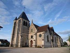
Saint-Parres-aux-Tertres
| Saint-Parres-aux-Tertres | ||
|---|---|---|
 | ||
| ||
 Saint-Parres-aux-Tertres | ||
|
Location within Grand Est region  Saint-Parres-aux-Tertres | ||
| Coordinates: 48°18′01″N 4°07′07″E / 48.3003°N 4.1186°ECoordinates: 48°18′01″N 4°07′07″E / 48.3003°N 4.1186°E | ||
| Country | France | |
| Region | Grand Est | |
| Department | Aube | |
| Arrondissement | Troyes | |
| Canton | Troyes-1 | |
| Intercommunality | CAG Troyenne | |
| Government | ||
| • Mayor (2008–2014) | Colette Rota | |
| Area1 | 11.82 km2 (4.56 sq mi) | |
| Population (2012)2 | 2,989 | |
| • Density | 250/km2 (650/sq mi) | |
| Time zone | CET (UTC+1) | |
| • Summer (DST) | CEST (UTC+2) | |
| INSEE/Postal code | 10357 / 10410 | |
| Elevation |
103–132 m (338–433 ft) (avg. 131 m or 430 ft) | |
|
1 French Land Register data, which excludes lakes, ponds, glaciers > 1 km² (0.386 sq mi or 247 acres) and river estuaries. 2 Population without double counting: residents of multiple communes (e.g., students and military personnel) only counted once. | ||

Saint-Parres-aux-Tertres is a commune in the Aube department in north-central France.
Geography
The Barse flows into the Vieille Seine, an arm of the Seine, in the commune.
Population
| Historical population | ||
|---|---|---|
| Year | Pop. | ±% |
| 1962 | 1,635 | — |
| 1968 | 1,808 | +10.6% |
| 1975 | 2,088 | +15.5% |
| 1982 | 2,402 | +15.0% |
| 1990 | 2,411 | +0.4% |
| 1999 | 2,615 | +8.5% |
| 2008 | 2,854 | +9.1% |
| 2012 | 2,989 | +4.7% |
See also
References
| Wikimedia Commons has media related to Saint-Parres-aux-Tertres. |
This article is issued from Wikipedia - version of the 7/6/2015. The text is available under the Creative Commons Attribution/Share Alike but additional terms may apply for the media files.