Chavanges
| Chavanges | ||
|---|---|---|
 | ||
| ||
 Chavanges | ||
|
Location within Grand Est region  Chavanges | ||
| Coordinates: 48°30′34″N 4°34′29″E / 48.5094°N 4.5747°ECoordinates: 48°30′34″N 4°34′29″E / 48.5094°N 4.5747°E | ||
| Country | France | |
| Region | Grand Est | |
| Department | Aube | |
| Arrondissement | Bar-sur-Aube | |
| Canton | Chavanges | |
| Intercommunality | Chavengeois | |
| Government | ||
| • Mayor (2008–2014) | Guy Pierson | |
| Area1 | 29.79 km2 (11.50 sq mi) | |
| Population (2008)2 | 661 | |
| • Density | 22/km2 (57/sq mi) | |
| Time zone | CET (UTC+1) | |
| • Summer (DST) | CEST (UTC+2) | |
| INSEE/Postal code | 10094 / 10330 | |
|
1 French Land Register data, which excludes lakes, ponds, glaciers > 1 km² (0.386 sq mi or 247 acres) and river estuaries. 2 Population without double counting: residents of multiple communes (e.g., students and military personnel) only counted once. | ||

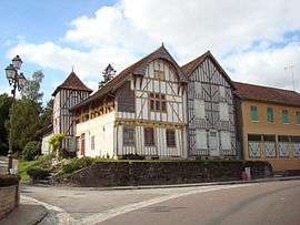
Chavanges is a commune in the Aube department in north-central France.
Population
| Historical population | ||
|---|---|---|
| Year | Pop. | ±% |
| 1962 | 766 | — |
| 1968 | 818 | +6.8% |
| 1975 | 721 | −11.9% |
| 1982 | 695 | −3.6% |
| 1990 | 728 | +4.7% |
| 1999 | 689 | −5.4% |
| 2008 | 661 | −4.1% |
See also
References
| Wikimedia Commons has media related to Chavanges. |
This article is issued from Wikipedia - version of the 10/8/2016. The text is available under the Creative Commons Attribution/Share Alike but additional terms may apply for the media files.