Ruthwell railway station
| Ruthwell | |
|---|---|
|
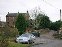
Ruthwell station from the Clarencefield Road in 2010 | |
| Location | |
| Place | Ruthwell |
| Area | Dumfries and Galloway |
| Operations | |
| Original company | Glasgow, Dumfries and Carlisle Railway |
| Pre-grouping | Glasgow and South Western Railway |
| Post-grouping | LMS |
| Platforms | 2 |
| History | |
| 23 August 1848 | Opened |
| 6 December 1965 | Closed |
| 6 April 1964[1] | Closed to goods traffic |
| Disused railway stations in the United Kingdom | |
|
Closed railway stations in Britain A B C D–F G H–J K–L M–O P–R S T–V W–Z | |
|
| |

Ruthwell railway station was a railway station in Dumfries and Galloway south of Dumfries, serving the village of Ruthwell with its famous 8th century carved cross; a rural community within the Parish of Ruthwell, lying a half-mile (1 km) north of Clarencefield and 1 1⁄4 miles (2.0 km) south southwest of Carrutherstown.[2]
History

The station opened in 1848. The station is now closed, although the line running through the station remains open. The station building has been converted into a private dwelling.
Ruthwell was opened by the Glasgow, Dumfries and Carlisle Railway, which then became part of the Glasgow and South Western Railway; in 1923 it became part of the London Midland and Scottish Railway at the Grouping, passing on to the Scottish Region of British Railways following the 1948 nationalisation of the railways. It was closed by the British Railways Board. The station lay 90.9 miles south of Glasgow St Enoch.
George MacDonald was station master at Ruthwell before moving to Moniaive station in the mid 1900s.[3]
The National Archives of Scotland hold a full collection of plans for the station of various dates.[4]
A hamlet called 'Ruthwell Station' grew' up around the former station, previously known as Plans.
Services
| Preceding station | Historical railways | Following station | ||
|---|---|---|---|---|
| Racks Line open; station closed |
Glasgow and South Western Railway Glasgow, Dumfries and Carlisle Railway |
Cummertrees Line open; station closed | ||
References
- ↑ Lindsay, David M. E. (2002). G&SWR Register of stations, routes & lines. G&SWR Association. Part 6.3, Page 20
- ↑ "Ordnance Gazetteer for Scotland". Retrieved 2010-03-10.
- ↑ Kirkpatrick, Ian (2000). The Cairn Valley Light Railway. Usk: The Oakwood Press. ISBN 0-85361-567-5 p. 53
- ↑ "Parish of Ruthwell". Retrieved 2010-03-10.
External links
Coordinates: 55°00′45″N 3°25′27″W / 55.0124°N 3.4242°W