Rue de la Paix, Paris
|
Rue de La Paix from Place de l'Opéra | |
 | |
| Length | 230 m (750 ft) |
|---|---|
| Width | 22.50 m (73.8 ft) |
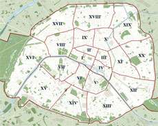
| Arrondissement | 2nd |
| Quarter | Gaillon. |
| From | 2 rue des Capucines and 32 rue Danielle Casanova |
| To | 1 place de l'Opéra |
| Construction | |
| Completion | February 19, 1806 |


The rue de la Paix (French pronunciation: [ʁy də la pɛ]) is a fashionable shopping street in the center of Paris. Located in the 2nd arrondissement of Paris, running north from Place Vendôme and ending at the Opéra Garnier, it is best known for its jewellers, such as the shop opened by Cartier in 1898.[1] Charles Frederick Worth was the first to open a couture house in the rue de la Paix. Many buildings on the street are inspired in design by the hôtels particuliers of Place Vendôme.
History
The street was opened in 1806 from Place Vendôme on the orders of Napoleon I, part of the Napoleonic program to open the heart of the Right Bank of Paris, both towards the undeveloped western suburbs and to the north. Creating the new street required the demolition of the ancient Convent of the Capucins. At first named Rue Napoléon, its name was changed in 1814,[2] after the Bourbon Restoration, to celebrate the newly arranged peace.[3][4]
Transportation
Based in the center of Paris, the street can be reached by:
- metro: line 1

- or buses: 72.
Retail outlets associated with Rue da la Paix
- Louis Aucoc - The Aucoc family firm at 6 Rue de la Paix was established in 1821[5]
- Duvelleroy is a fan-maker house established at 15 Rue de la Paix in 1827 by Jean-Pierre Duvelleroy,
- Cartier - 1898.[1]
- Charles Frederick Worth was the first to open a couture house at 7 rue de la Paix, and in 1885 created the label of his salon "Worth 7, Rue de la Paix".
- Boué Soeurs, a fashion house active from the late 1890s to early 1950s[6]
Rue de la Paix in popular culture
- The Rue de la Paix is the most expensive property in the French version of Monopoly - the equivalent to "Boardwalk" in the American version, or "Mayfair" in the UK version.
- Due to this, the Rue de la Paix is referenced by French singer Zazie in her song of the same name, in which she compares societies based on consumerism to a game of Monopoly.
- Rue de la Paix is mentioned by Rhett Butler in the novel Gone with the Wind by Margaret Mitchell as the source of the green bonnet purchased to bring Scarlett O'Hara out of mourning.
References
- 1 2 Paris 2e arrondissement Mémoire des rues; Auteur: Meryem Khouya; Éditeur: Parimagine, 2007
- ↑ Dictionnaire administratif et historique des rues de Paris et de ses monuments Auteurs Félix Lazare, Louis Clément Lazare Compilé par Félix Lazare, Louis Clément Lazare Éditeur F. Lazare, 1844
- ↑ Jacques Hillairet, Dictionnaire historique des rues de Paris (Paris: Editions de Minuit, 8th ed., 1985), vol. I, p. 265.
- ↑ George Augustus Sala, Paris Herself Again in 1878-9 (Vizetelly & Co., 1884),p. 507.
- ↑ The Burlington Magazine, Vol. 137, No. 1111 (Oct., 1995), pp. 684-687
- ↑ "Bringing Rue de la Paix to America". The American Jewish Chronicle. 2. 1917. p. 724. Retrieved 17 August 2016 – via Google Books.
 | ||
Coordinates: 48°52′8.87″N 2°19′52.06″E / 48.8691306°N 2.3311278°E