Rock Creek, Ohio
| Rock Creek, Ohio | |
|---|---|
| Village | |
|
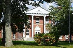
Rock Creek School | |
 Location of Rock Creek, Ohio | |
 Location of Rock Creek in Ashtabula County | |
| Coordinates: 41°39′39″N 80°51′13″W / 41.66083°N 80.85361°WCoordinates: 41°39′39″N 80°51′13″W / 41.66083°N 80.85361°W | |
| Country | United States |
| State | Ohio |
| County | Ashtabula |
| Area[1] | |
| • Total | 0.89 sq mi (2.31 km2) |
| • Land | 0.89 sq mi (2.31 km2) |
| • Water | 0 sq mi (0 km2) |
| Elevation[2] | 804 ft (245 m) |
| Population (2010)[3] | |
| • Total | 529 |
| • Estimate (2012[4]) | 524 |
| • Density | 594.4/sq mi (229.5/km2) |
| Time zone | Eastern (EST) (UTC-5) |
| • Summer (DST) | EDT (UTC-4) |
| ZIP code | 44084 |
| Area code(s) | 440 |
| FIPS code | 39-67846[5] |
| GNIS feature ID | 1061619[2] |
Rock Creek is a village in Ashtabula County, Ohio, United States. The population was 529 at the 2010 census.
The principal village festival is the Ox Roast. Its local elementary school, Rock Creek Elementary, had 285 students beginning the 2004-2005 school year, and the school's mascot is the Roadrunner.
Geography
Rock Creek is located at 41°39′39″N 80°51′13″W / 41.660786°N 80.853646°W,[6] at the confluence of Rock Creek and the Grand River.
According to the United States Census Bureau, the village has a total area of 0.89 square miles (2.31 km2), all land.[1]
Demographics
| Historical population | |||
|---|---|---|---|
| Census | Pop. | %± | |
| 1860 | 443 | — | |
| 1870 | 491 | 10.8% | |
| 1880 | 558 | 13.6% | |
| 1890 | 448 | −19.7% | |
| 1900 | 478 | 6.7% | |
| 1910 | 455 | −4.8% | |
| 1920 | 483 | 6.2% | |
| 1930 | 476 | −1.4% | |
| 1940 | 492 | 3.4% | |
| 1950 | 604 | 22.8% | |
| 1960 | 673 | 11.4% | |
| 1970 | 731 | 8.6% | |
| 1980 | 652 | −10.8% | |
| 1990 | 553 | −15.2% | |
| 2000 | 584 | 5.6% | |
| 2010 | 529 | −9.4% | |
| Est. 2015 | 515 | [7] | −2.6% |
2010 census
As of the census[3] of 2010, there were 529 people, 196 households, and 137 families residing in the village. The population density was 594.4 inhabitants per square mile (229.5/km2). There were 218 housing units at an average density of 244.9 per square mile (94.6/km2). The racial makeup of the village was 97.5% White, 1.5% African American, 0.2% Asian, and 0.8% from two or more races. Hispanic or Latino of any race were 0.2% of the population.
There were 196 households of which 38.3% had children under the age of 18 living with them, 44.4% were married couples living together, 16.3% had a female householder with no husband present, 9.2% had a male householder with no wife present, and 30.1% were non-families. 23.0% of all households were made up of individuals and 8.1% had someone living alone who was 65 years of age or older. The average household size was 2.70 and the average family size was 3.17.
The median age in the village was 36.8 years. 27.2% of residents were under the age of 18; 9.3% were between the ages of 18 and 24; 27.6% were from 25 to 44; 24.6% were from 45 to 64; and 11.3% were 65 years of age or older. The gender makeup of the village was 50.5% male and 49.5% female.
2000 census
As of the census[5] of 2000, there were 584 people, 195 households, and 146 families residing in the village. The population density was 646.2 people per square mile (250.5/km2). There were 201 housing units at an average density of 222.4 per square mile (86.2/km2). The racial makeup of the village was 97.26% White, 1.71% African American, 0.17% Native American, and 0.86% from two or more races. Hispanic or Latino of any race were 0.17% of the population. 32.2% were of German, 14.5% Irish, 8.8% Italian, 7.7% American and 6.9% English ancestry according to Census 2000.
There were 195 households out of which 40.0% had children under the age of 18 living with them, 59.5% were married couples living together, 10.8% had a female householder with no husband present, and 25.1% were non-families. 20.0% of all households were made up of individuals and 10.8% had someone living alone who was 65 years of age or older. The average household size was 2.99 and the average family size was 3.43.
In the village the population was spread out with 32.5% under the age of 18, 8.0% from 18 to 24, 33.0% from 25 to 44, 17.5% from 45 to 64, and 8.9% who were 65 years of age or older. The median age was 32 years. For every 100 females there were 90.2 males. For every 100 females age 18 and over, there were 90.3 males.
The median income for a household in the village was $35,536, and the median income for a family was $37,917. Males had a median income of $28,125 versus $23,409 for females. The per capita income for the village was $13,276. About 7.9% of families and 9.6% of the population were below the poverty line, including 13.3% of those under age 18 and none of those age 65 or over.
References
- 1 2 "US Gazetteer files 2010". United States Census Bureau. Retrieved 2013-01-06.
- 1 2 "US Board on Geographic Names". United States Geological Survey. 2007-10-25. Retrieved 2008-01-31.
- 1 2 "American FactFinder". United States Census Bureau. Retrieved 2013-01-06.
- ↑ "Population Estimates". United States Census Bureau. Retrieved 2013-06-17.
- 1 2 "American FactFinder". United States Census Bureau. Retrieved 2008-01-31.
- ↑ "US Gazetteer files: 2010, 2000, and 1990". United States Census Bureau. 2011-02-12. Retrieved 2011-04-23.
- ↑ "Annual Estimates of the Resident Population for Incorporated Places: April 1, 2010 to July 1, 2015". Retrieved July 2, 2016.
- ↑ "Census of Population and Housing". Census.gov. Retrieved June 4, 2015.
External links
Municipalities and communities of Ashtabula County, Ohio, United States | ||
|---|---|---|
| Cities |  | |
| Villages | ||
| Townships | ||
| CDPs | ||
| Unincorporated communities | ||