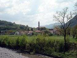
Rocchetta Ligure
| Rocchetta Ligure | |
|---|---|
| Comune | |
| Comune di Rocchetta Ligure | |
 | |
 Rocchetta Ligure Location of Rocchetta Ligure in Italy | |
| Coordinates: 44°42′N 9°3′E / 44.700°N 9.050°ECoordinates: 44°42′N 9°3′E / 44.700°N 9.050°E | |
| Country | Italy |
| Region | Piedmont |
| Province / Metropolitan city | Province of Alessandria (AL) |
| Frazioni | Bregni Inferiore, Bregni Superiore, Celio, Pagliaro Inferiore, Pagliaro Superiore, Piani di Celio, Sant'Ambrogio, Sisola |
| Area | |
| • Total | 10.1 km2 (3.9 sq mi) |
| Elevation | 420 m (1,380 ft) |
| Population (Dec. 2004) | |
| • Total | 208 |
| • Density | 21/km2 (53/sq mi) |
| Demonym(s) | Rocchettini |
| Time zone | CET (UTC+1) |
| • Summer (DST) | CEST (UTC+2) |
| Postal code | 15060 |
| Dialing code | 0143 |
Rocchetta Ligure is a comune (municipality) in the Province of Alessandria in the Italian region Piedmont, located about 110 kilometres (68 mi) southeast of Turin and about 40 kilometres (25 mi) southeast of Alessandria. As of 31 December 2004, it had a population of 208 and an area of 10.1 square kilometres (3.9 sq mi).[1]
The municipality of Rocchetta Ligure contains the frazioni (subdivisions, mainly villages and hamlets) Bregni Inferiore, Bregni Superiore, Celio, Pagliaro Inferiore, Pagliaro Superiore, Piani di Celio, Sant'Ambrogio, and Sisola.
Rocchetta Ligure borders the following municipalities: Albera Ligure, Cabella Ligure, Cantalupo Ligure, Mongiardino Ligure, and Roccaforte Ligure.
Demographic evolution

References
This article is issued from Wikipedia - version of the 1/31/2015. The text is available under the Creative Commons Attribution/Share Alike but additional terms may apply for the media files.