Rimersburg, Pennsylvania
| Rimersburg, Pennsylvania | |
|---|---|
| Borough | |
|
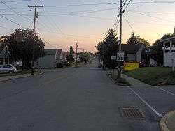
View of Rimersburg from the north end of the borough | |
 Map showing Rimersburg in Clarion County | |
 Map showing Clarion County in Pennsylvania | |
 Rimersburg Map showing Rimersburg in Clarion County | |
| Coordinates: 41°02′30″N 79°30′09″W / 41.04167°N 79.50250°WCoordinates: 41°02′30″N 79°30′09″W / 41.04167°N 79.50250°W | |
| Country | United States |
| State | Pennsylvania |
| County | Clarion |
| Settled | 1829 |
| Incorporated | 1853 |
| Government | |
| • Type | Borough council |
| Area | |
| • Total | 0.36 sq mi (0.94 km2) |
| • Land | 0.36 sq mi (0.94 km2) |
| • Water | 0.0 sq mi (0.0 km2) |
| Elevation | 1,480 ft (450 m) |
| Population (2010) | |
| • Total | 951 |
| • Density | 2,615/sq mi (1,009.6/km2) |
| Time zone | Eastern (EST) (UTC-5) |
| • Summer (DST) | EDT (UTC-4) |
| ZIP code | 16248 |
Rimersburg is a borough in Clarion County in the U.S. state of Pennsylvania. The population was 951 at the 2010 census.[1]
Geography
Rimersburg is located in southwestern Clarion County at 41°02′30″N 79°30′09″W / 41.041643°N 79.502583°W.[2] Pennsylvania Route 68 passes through the center of the borough, leading northeast 5 miles (8 km) to Sligo and 16 miles (26 km) to Clarion, the county seat, and southwest 8 miles (13 km) to East Brady on the Allegheny River. Pennsylvania Route 861 leads east from Rimersburg 12 miles (19 km) to New Bethlehem.
According to the United States Census Bureau, Rimersburg has a total area of 0.36 square miles (0.94 km2), all of it land.[1]
Demographics
| Historical population | |||
|---|---|---|---|
| Census | Pop. | %± | |
| 1860 | 346 | — | |
| 1870 | 324 | −6.4% | |
| 1880 | 334 | 3.1% | |
| 1890 | 360 | 7.8% | |
| 1900 | 487 | 35.3% | |
| 1910 | 855 | 75.6% | |
| 1920 | 1,060 | 24.0% | |
| 1930 | 1,319 | 24.4% | |
| 1940 | 1,393 | 5.6% | |
| 1950 | 1,398 | 0.4% | |
| 1960 | 1,323 | −5.4% | |
| 1970 | 1,146 | −13.4% | |
| 1980 | 1,096 | −4.4% | |
| 1990 | 1,053 | −3.9% | |
| 2000 | 1,051 | −0.2% | |
| 2010 | 951 | −9.5% | |
| Est. 2015 | 911 | [3] | −4.2% |
| Sources:[4][5][6] | |||
As of the census[5] of 2000, there were 1,051 people, 447 households, and 292 families residing in the borough. The population density was 2,961.0 people per square mile (1,159.4/km2). There were 472 housing units at an average density of 1,329.8 per square mile (520.7/km2). The racial makeup of the borough was 99.43% White, 0.10% African American, 0.19% Native American, and 0.29% from two or more races. Hispanic or Latino of any race were 0.10% of the population.
There were 447 households, out of which 30.6% had children under the age of 18 living with them, 45.4% were married couples living together, 15.0% had a female householder with no husband present, and 34.5% were non-families. 32.4% of all households were made up of individuals, and 18.8% had someone living alone who was 65 years of age or older. The average household size was 2.35 and the average family size was 2.95.
In the borough the population was spread out, with 24.4% under the age of 18, 9.4% from 18 to 24, 26.1% from 25 to 44, 21.4% from 45 to 64, and 18.7% who were 65 years of age or older. The median age was 37 years. For every 100 females there were 82.8 males. For every 100 females age 18 and over, there were 77.5 males.
The median income for a household in the borough was $23,155, and the median income for a family was $31,417. Males had a median income of $27,500 versus $17,083 for females. The per capita income for the borough was $12,549. About 15.9% of families and 18.4% of the population were below the poverty line, including 25.3% of those under age 18 and 15.3% of those age 65 or over.
References
| Wikimedia Commons has media related to Rimersburg, Pennsylvania. |
- 1 2 "Geographic Identifiers: 2010 Census Summary File 1 (G001): Rimersburg borough, Pennsylvania". U.S. Census Bureau, American Factfinder. Retrieved April 24, 2015.
- ↑ "US Gazetteer files: 2010, 2000, and 1990". United States Census Bureau. 2011-02-12. Retrieved 2011-04-23.
- ↑ "Annual Estimates of the Resident Population for Incorporated Places: April 1, 2010 to July 1, 2015". Retrieved July 2, 2016.
- ↑ "Census of Population and Housing". U.S. Census Bureau. Retrieved 11 December 2013.
- 1 2 "American FactFinder". United States Census Bureau. Retrieved 2008-01-31.
- ↑ "Incorporated Places and Minor Civil Divisions Datasets: Subcounty Resident Population Estimates: April 1, 2010 to July 1, 2012". Population Estimates. U.S. Census Bureau. Retrieved 11 December 2013.
External links
Municipalities and communities of Clarion County, Pennsylvania, United States | ||
|---|---|---|
| Boroughs | | |
| Townships | ||
| CDPs | ||
| Unincorporated communities | ||
| Footnotes | ‡This populated place also has portions in an adjacent county or counties | |