Rezovski Creek
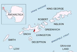
Rezovski Creek (Bulgarian: Резовски поток \'re-zov-ski po-'tok\) is a melt-water stream located on Livingston Island, Antarctica.
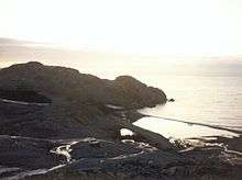
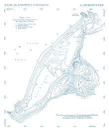
The 500 metres (1,600 ft) long melt-water stream draining that portion of the northwestern slope of Balkan Snowfield located between Hesperides Hill, Atlantic Club Ridge, Krum Rock and Sinemorets Hill on Hurd Peninsula in eastern Livingston Island, South Shetland Islands in Antarctica. The arms of Rezovski Creek encompass the old buildings of the Bulgarian Base. Its lower course forms Grand Lagoon, and has its mouth at the southwest extremity of Bulgarian Beach used as embarkation place servicing St. Kliment Ohridski Base.
A name of national geography; Rezovska is a river in south-eastern Bulgaria. The name was established in use at the time of approval.
Location
The creek's midpoint is located at 62°38′28″S 60°21′57″W / 62.64111°S 60.36583°WCoordinates: 62°38′28″S 60°21′57″W / 62.64111°S 60.36583°W (Large scale Bulgarian mapping of the St. Kliment Ohridski Base vicinity from a topographic survey made from 31 January to 4 February 1996).
Maps
- L.L. Ivanov. St. Kliment Ohridski Base, Livingston Island. Scale 1:1000 topographic map. Sofia: Antarctic Place-names Commission of Bulgaria, 1996. (The first Bulgarian Antarctic topographic map, in Bulgarian)
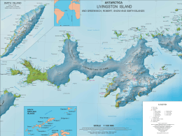
- L.L. Ivanov et al. Antarctica: Livingston Island and Greenwich Island, South Shetland Islands. Scale 1:100000 topographic map. Sofia: Antarctic Place-names Commission of Bulgaria, 2005.
References
This article includes information from the Antarctic Place-names Commission of Bulgaria which is used with permission.