Rekhasim
Rekhasim
| ||
|---|---|---|
| Hebrew transcription(s) | ||
| • ISO 259 | Rkasim | |
| • Also spelled | Rechasim (unofficial) | |
 | ||
| ||
 Rekhasim | ||
| Coordinates: 32°44′55.78″N 35°6′2.89″E / 32.7488278°N 35.1008028°ECoordinates: 32°44′55.78″N 35°6′2.89″E / 32.7488278°N 35.1008028°E | ||
| District | Haifa | |
| Founded | 1951 | |
| Government | ||
| • Type | Local council (from 1959) | |
| • Head of Municipality | Itzhak Raih | |
| Area | ||
| • Total | 2,859 dunams (2.859 km2 or 1.104 sq mi) | |
| Population (2015)[1] | ||
| • Total | 10,682 | |
| Name meaning | Mountain ridges | |

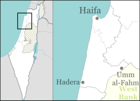
Rekhasim (Hebrew: רְכָסִים, Arabic: رخاسيم; lit. Mountain ridges)[2] is a Haredi town and local council in the Haifa District of Israel. It is located between Kiryat Tiv'on, Kiryat Ata, and Nesher, next to roads 70, 75, and 762.
With a jurisdiction of 2,859 dunams (~2.9 km2), it had a population of 10,682 in 2015. It is ranked low (2 out of 10) on the Israeli socio-economic scale.[3]
Etymology
The town was named after a verse in the Book of Isaiah (Isaiah 40:4), because it is located on four mountain ranges.
Geography
Rekhasim lies on four hills near Mount Carmel, labelled with Hebrew letters (Hill Alef, Bet, Gimel and Dalet). It borders two villages in the Zvulun Regional Council: the Jewish Kfar Hasidim and Arab Ibtin.
Its lowest elevation is only 19.8 m (65 ft) above sea level, while the highest is at 193.6 m (635 ft). The average temperature in January is 11 °C (52 °F), and 27 °C (81 °F) in August. The average annual precipitation is 650 mm (26 in).[3]
History
Rekhasim was founded in 1951 by released soldiers and residents of nearby ma'abarot.[4] It initially absorbed large numbers of immigrants from India, Morocco, Romania, Russia, and Yemen.[2]
In 1955 the Knesses Chizkiyahu yeshiva relocated here from Zikhron Ya'akov. The yeshiva purchased a 10-dunam (0.010 km2; 0.0039 sq mi) lot on the outskirts of the village and five buildings containing a beth midrash, dining hall, dormitories and offices, moving into its new home at the end of April 1955.[5] A small Haredi community developed around the yeshiva, but the majority of residents remained non-Haredi into the 1990s.[2] In 1995 the secular school closed, many non-religious residents left, and the village developed a Haredi majority, with both Ashkenazi and Sephardi neighborhoods. It is now considered a desirable and growing community for young Haredi families.[2]
Educational offerings include tens of kindergartens, six Talmud Torahs, three girls' schools, three yeshiva ketanas, three yeshiva gedolas, and numerous kolels.[2] In addition to the Knesses Chizkiyahu yeshiva system, there is the Sephardi Yeshivas Rechasim, with 400 students.[2]
Rekhasim has more than 80 synagogues and numerous chesed and gemach organizations.[2]
References
- ↑ "List of localities, in Alphabetical order" (PDF). Israel Central Bureau of Statistics. Retrieved 16 October 2016.
- 1 2 3 4 5 6 7 Marks, Yehudah. "The Torah Empire of the North", Hamodia Israel News, March 19, 2015, pp. 21-23.
- 1 2 "Local Authorities in Israel 2005, Publication #1295 - Municipality Profiles - Rekhasim" (PDF) (in Hebrew). Israel Central Bureau of Statistics. Retrieved 2008-02-16.
- ↑ HaReuveni, Immanuel (1999). Lexicon of the Land of Israel (in Hebrew). Miskal - Yedioth Ahronoth Books and Chemed Books. p. 868. ISBN 965-448-413-7.
- ↑ Meringer, Motty (29 April 2009). "Yeshivas Knesses Chizkiyahu". Etrog News. Retrieved 1 November 2009.