Ramin, Tulkarm
| Ramin | |
|---|---|
| Other transcription(s) | |
| • Also spelled | Rameen (official) |
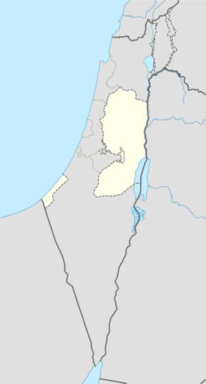 Ramin Location of Ramin within the Palestinian territories | |
| Coordinates: 32°17′03.15″N 35°08′57.28″E / 32.2842083°N 35.1492444°ECoordinates: 32°17′03.15″N 35°08′57.28″E / 32.2842083°N 35.1492444°E | |
| Area | |
| • Jurisdiction | 8,480 dunams (8.5 km2 or 3.3 sq mi) |
| Population (2006) | |
| • Jurisdiction | 3,100 |
Ramin (Arabic:رامين) is a Palestinian village in the northeastern West Bank, located 15 kilometers east of Tulkarm in the Tulkarm Governorate. According to the Palestinian Central Bureau of Statistics, the village had a population of approximately 3,100 inhabitants in mid-year 2006.[1] Ramin's population is made up of the families of Salman (34%), Zafer (23%), Hamad (33%) and Zeidan (10%).[2]
Ramin's total land area is about 8,500 dunams, of which 422 dunums is built-up area, about 500 dunams for quarries and 500 dunams for pastures. The nearby Israeli settlement of Enav was allocated 470 dunams. Ramin's remaining land is covered by olive and almond orchards.[3]
References
- ↑ Projected Mid -Year Population for Tulkarm Governorate by Locality 2004- 2006 Palestinian Central Bureau of Statistics
- ↑ The Effects of the Israeli Practices on Residents of Ramin village Land Research Center. 22 June 2004
- ↑ Israeli settlers set fire to agricultural lands in Ramin village Land Research Center. 14 June 2007
Bibliography
- Barron, J. B., ed. (1923). Palestine: Report and General Abstracts of the Census of 1922. Government of Palestine.
- Conder, Claude Reignier; Kitchener, H. H. (1882). The Survey of Western Palestine: Memoirs of the Topography, Orography, Hydrography, and Archaeology. 2. London: Committee of the Palestine Exploration Fund. (p. 160)
- Dauphin, Claudine (1998). La Palestine byzantine, Peuplement et Populations. BAR International Series 726 (in French). III : Catalogue. Oxford: Archeopress. ISBN 0-860549-05-4. (p. 764)
- Department of Statistics (1945). Village Statistics, April, 1945. Government of Palestine.
- Ellenblum, Ronnie (2003). Frankish Rural Settlement in the Latin Kingdom of Jerusalem. Cambridge University Press. ISBN 9780521521871. (p. 244: Ḍiyāʼ al-Dīn )
- Guérin, Victor (1875). Description Géographique Historique et Archéologique de la Palestine (in French). 2: Samarie, pt. 2. Paris: L'Imprimerie Nationale. (p. 211)
- Hadawi, Sami (1970). Village Statistics of 1945: A Classification of Land and Area ownership in Palestine. Palestine Liberation Organization Research Center.
- Hütteroth, Wolf-Dieter; Abdulfattah, Kamal (1977). Historical Geography of Palestine, Transjordan and Southern Syria in the Late 16th Century. Erlanger Geographische Arbeiten, Sonderband 5. Erlangen, Germany: Vorstand der Fränkischen Geographischen Gesellschaft. ISBN 3-920405-41-2. (p. 127)
- Mills, E., ed. (1932). Census of Palestine 1931. Population of Villages, Towns and Administrative Areas (PDF). Jerusalem: Government of Palestine.
- Palmer, E. H. (1881). The Survey of Western Palestine: Arabic and English Name Lists Collected During the Survey by Lieutenants Conder and Kitchener, R. E. Transliterated and Explained by E.H. Palmer. Committee of the Palestine Exploration Fund. (p. 189)
- Pringle, Denys (1998). The Churches of the Crusader Kingdom of Jerusalem: L-Z (exluding Tyre). Cambridge University Press. ISBN 0521390370. (p. 181: Daniel the Traveller)
- Robinson, Edward; Smith, Eli (1841). Biblical Researches in Palestine, Mount Sinai and Arabia Petraea: A Journal of Travels in the year 1838. 3. Boston: Crocker & Brewster. (pp. 138, 144)
- Zertal, Adam (2004). The Manasseh Hill Country Survey. 1. Boston: BRILL. ISBN 9004137564. (p. 375)
External links
- Welcome To Ramin
- Survey of Western Palestine, Map 11: IAA, Wikimedia commons
| Cities |
|  |
|---|---|---|
| Municipalities | ||
| Villages |
| |
| Refugee camps | ||
This article is issued from Wikipedia - version of the 10/19/2016. The text is available under the Creative Commons Attribution/Share Alike but additional terms may apply for the media files.