Rajgadh
| Rajgadh राजगढ गाविस | |
|---|---|
 Rajgadh Location of Rajgadh in Nepal | |
| Coordinates: 26°30′N 87°56′E / 26.500°N 87.933°ECoordinates: 26°30′N 87°56′E / 26.500°N 87.933°E | |
| Country |
|
| Zone | Mechi |
| District | Jhapa |
| Population (2001) | |
| • Total | 15,354 |
| Time zone | NPT (UTC+05:45) |
| Postal code | 57209[1] |
| Area code(s) | 23 |
Rajgadh (Nepali: राजगढ) is one of the village situated at the southern part of the Jhapa district in Nepal. Its elevation range lies from 80 m to 120 m above sea level. Some of its land area is covered with dense forest known as Charkose Jhadi. Its neighbouring VDCs are Chakchaki, Goldhhap, Sharanamati, Jalthal and Gherabari. A small portion also borders with India.
History
It was the main residence of Rajbanshi people so, it is called as Rajgadh meaning State of Rajbanshi. But later people from hills like Brahmin, Rai,[2] Limbu, etc. came and settled down. Almost more than half the land of Rajgadh VDC belonged to a rich landlord Satyanarayan Agrawal. As per the local people, he used to walk here only in his own land.
Culture
About half of the population of Rajgadh is resided by Rajbanshi community. So it has the dominance of Rajbanshi culture. Also huge number of brahmins and Chettri are also residing here so it also has Hilly (pahadi) culture. Here are the list of people living Rajgadh with their unique culture and tradition.
| Rajbanshi |
| Brahmin |
| Chettri |
| Muslims |
| Rai |
| Limbu |
| Meche |
| Santhal |
| Sah |
Temples
There are some Temples in Rajgadh area; Shree Durga Mandir, Krishna Temple, Shiv Mandir, Shree Dangi Laxmisthan,etc.
Rajgadh's social website
Visit www.hamrorajgadh.blogspot.com for information and you can also send if you have any type of information about Rajgadh vdc and to their members.
Economy
Almost 80% of people's income source is farming. they are fully dependent agriculture.Farming is of traditional type, so production of crops in compare to soil fertility is less.But nowadays some modern technologies are being implemented by some farmers. Beside this, people are also involved in other economical activities. Teacher,Officer,Salesman,Mechanic,etc. are other economical activities.
Rajgadh Bazzar is the main economical center of Rajgadh. Most of the activities related to trade is concentrated in Rajgadh Bazzar. Beside this, Janta Bazzar, Bhagdubba Bazzar, etc. are other small trade centers of Rajgadh. Nowadays, remittance has also been a major source of income in this area.
Education
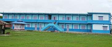
Literacy rate of Rajgadh is average as compared to the other VDC. Pashupati Higher Secondary School is the only higher secondary level government School in Rajgadh. Gyanjyoti Higher Secondary School[3] is another higher secondary school opened from private sector. Beside these Little Star English School, Divyajyoti Secondary School, Sundarpur Primary School, Janta Primary School, Vagwati Pre-secondary School, etc. are major educational institutions in Rajgadh.
Transportation and communication
Rajgadh is not so much facilitated with transportation. Here are only some few number of buses to connect with the cities like Birtamod, Chandragadi, Bhadrapur, Damak and Biratnagar. They left Rajgadh at the interval of (at least) 1 hour. The roads are gravelled. But main route is recently being blacktopped. Other means of transportation are Bicycle, Motorcycle, Van etc. Main communication medium in Rajgadh is Mobile Phones.Almost 85% family have mobile phones. Due to the sudden growth of mobile phone users, Post Office of Rajgadh is in pity state. Recently there is availability of wifi service. But now Ncell giving full service in whole Rajgadh village development committee.
References
- ↑ List of postal codes in Nepal See about postal code of Rajgadh
- ↑ Rai in Nepal
- ↑ Gyanjyoti Higher Secondary School is the only higher secondary school of Rajgadh running in the private sector
