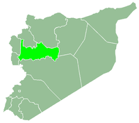
Qamhana
| Qamhana قمحانة Qomhane | |
|---|---|
| Town | |
 Qamhana Location in Syria | |
| Coordinates: 35°11′50″N 36°44′5″E / 35.19722°N 36.73472°ECoordinates: 35°11′50″N 36°44′5″E / 35.19722°N 36.73472°E | |
| Country |
|
| Governorate | Hama |
| District | Hama |
| Subdistrict | Hama |
| Population (2004) | |
| • Total | 13,228 |
| Time zone | EET (UTC+2) |
| • Summer (DST) | EEST (UTC+3) |
| City Qrya Pcode | C3008 |
Qamhana (Arabic: قمحانة, also spelled Qomhane) is a Syrian town located in the Hama Subdistrict of the Hama District in Hama Governorate. It is situated immediately west of the Zayn al-Abidin Mountain. According to the Syria Central Bureau of Statistics (CBS), Qamhana had a population of 13,228 in the 2004 census.[1] Its inhabitants are predominantly Sunni Muslims.
References
- ↑ "General Census of Population 2004.". Retrieved 2014-07-10.
This article is issued from Wikipedia - version of the 9/28/2016. The text is available under the Creative Commons Attribution/Share Alike but additional terms may apply for the media files.