Pucusana District
| Pucusana | |
|---|---|
| District | |
|
Pucusana Bay | |
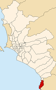 Location of Pucusana in the Lima province | |
| Coordinates: 12°25′S 76°47′W / 12.417°S 76.783°WCoordinates: 12°25′S 76°47′W / 12.417°S 76.783°W | |
| Country |
|
| Region | Lima |
| Province | Lima |
| Founded | January 22, 1943 |
| Capital | Pucusana |
| Subdivisions | 4 populated centers |
| Government | |
| • Mayor | Juan Jose Cuya Espinoza |
| Area | |
| • Total | 37.83 km2 (14.61 sq mi) |
| Elevation | 15 m (49 ft) |
| Population (2005 census) | |
| • Total | 9,231 |
| • Density | 240/km2 (630/sq mi) |
| Time zone | PET (UTC-5) |
| UBIGEO | 150124 |
| Website | munipucusana.gob.pe |

Pucusana is a district in southern Lima Province in Peru. It is bordered by the Pacific Ocean on the west, the district of Santa María del Mar on the north, the Chilca District of the Cañete Province on the east, and the Pacific Ocean on the south. It is well known for its beaches and attracts many beachgoers every summer. Many of them also rent apartments during this season, making its population increase considerably. The district has some restaurants and a club with a large seawater swimming pool. The most popular beaches in the district are Naplo and La Tiza.
External links
This article is issued from Wikipedia - version of the 1/30/2015. The text is available under the Creative Commons Attribution/Share Alike but additional terms may apply for the media files.