Preble Township, Adams County, Indiana
| Preble Township | |
|---|---|
| Township | |
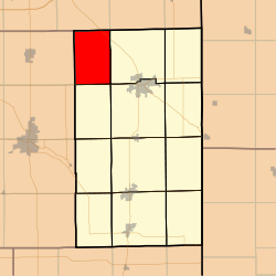 Location in Adams County | |
| Coordinates: 40°52′34″N 85°01′59″W / 40.87611°N 85.03306°WCoordinates: 40°52′34″N 85°01′59″W / 40.87611°N 85.03306°W | |
| Country | United States |
| State | Indiana |
| County | Adams |
| Government | |
| • Type | Indiana township |
| Area | |
| • Total | 23.94 sq mi (62.0 km2) |
| • Land | 23.85 sq mi (61.8 km2) |
| • Water | 0.08 sq mi (0.2 km2) 0.33% |
| Elevation | 801 ft (244 m) |
| Population (2010) | |
| • Total | 1,069 |
| • Density | 44.8/sq mi (17.3/km2) |
| ZIP codes | 46733, 46777 |
| GNIS feature ID | 0453776 |
Preble Township is one of twelve townships in Adams County, Indiana, United States. As of the 2010 census, its population was 1,069.[1]
Geography
According to the 2010 census, the township has a total area of 23.94 square miles (62.0 km2), of which 23.85 square miles (61.8 km2) (or 99.62%) is land and 0.08 square miles (0.21 km2) (or 0.33%) is water.[1]
Unincorporated towns
Adjacent townships
- Washington Township (southeast)
- Kirkland Township
Cemeteries
The township contains the following cemeteries: Fuhrman (abandoned), Magley (also known as Salem or UCC), Mann, St. John Lutheran (Bingen), St. Paul Lutheran, and Zion Lutheran (Friedheim).
Major highways
Rivers
- Saint Mary's River
School districts
- North Adams Community Schools
Political districts
- Indiana's 6th congressional district
- State House District 79
- State Senate District 19
References
- "Preble Township, Adams County, Indiana". Geographic Names Information System. United States Geological Survey. Retrieved 2009-09-24.
- United States Census Bureau 2007 TIGER/Line Shapefiles
- United States National Atlas
- 1 2 "Geographic Identifiers: 2010 Demographic Profile Data (G001): Preble township, Adams County, Indiana". U.S. Census Bureau, American Factfinder. Retrieved May 8, 2013.
External links
Municipalities and communities of Adams County, Indiana, United States | ||
|---|---|---|
| Cities | ||
| Towns | ||
| Townships | ||
| Unincorporated communities |
| |
This article is issued from Wikipedia - version of the 1/3/2014. The text is available under the Creative Commons Attribution/Share Alike but additional terms may apply for the media files.