Powersville, Missouri
| Powersville, Missouri | |
|---|---|
| Village | |
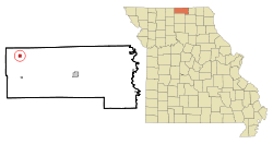 Location of Powersville, Missouri | |
| Coordinates: 40°33′0″N 93°18′8″W / 40.55000°N 93.30222°WCoordinates: 40°33′0″N 93°18′8″W / 40.55000°N 93.30222°W | |
| Country | United States |
| State | Missouri |
| County | Putnam |
| Area[1] | |
| • Total | 0.56 sq mi (1.45 km2) |
| • Land | 0.56 sq mi (1.45 km2) |
| • Water | 0 sq mi (0 km2) |
| Elevation | 1,004 ft (306 m) |
| Population (2010)[2] | |
| • Total | 60 |
| • Estimate (2012[3]) | 60 |
| • Density | 107.1/sq mi (41.4/km2) |
| Time zone | Central (CST) (UTC-6) |
| • Summer (DST) | CDT (UTC-5) |
| ZIP code | 64672 |
| Area code(s) | 660 |
| FIPS code | 29-59420[4] |
| GNIS feature ID | 0735805[5] |
Powersville is a village in Putnam County, Missouri, United States. The population was 60 at the 2010 census.
Geography
Powersville is located at 40°33′00″N 93°18′08″W / 40.549917°N 93.302358°W.[6]
According to the United States Census Bureau, the village has a total area of 0.56 square miles (1.45 km2), all of it land.[1]
Demographics
| Historical population | |||
|---|---|---|---|
| Census | Pop. | %± | |
| 1920 | 356 | — | |
| 1930 | 285 | −19.9% | |
| 1940 | 294 | 3.2% | |
| 1950 | 227 | −22.8% | |
| 1960 | 189 | −16.7% | |
| 1970 | 125 | −33.9% | |
| 1980 | 116 | −7.2% | |
| 1990 | 38 | −67.2% | |
| 2000 | 86 | 126.3% | |
| 2010 | 60 | −30.2% | |
| Est. 2015 | 59 | [7] | −1.7% |
2010 census
As of the census[2] of 2010, there were 60 people, 33 households, and 19 families residing in the village. The population density was 107.1 inhabitants per square mile (41.4/km2). There were 53 housing units at an average density of 94.6 per square mile (36.5/km2). The racial makeup of the village was 98.3% White and 1.7% from two or more races.
There were 33 households of which 18.2% had children under the age of 18 living with them, 45.5% were married couples living together, 6.1% had a female householder with no husband present, 6.1% had a male householder with no wife present, and 42.4% were non-families. 42.4% of all households were made up of individuals and 33.3% had someone living alone who was 65 years of age or older. The average household size was 1.82 and the average family size was 2.37.
The median age in the village was 61.5 years. 13.3% of residents were under the age of 18; 1.6% were between the ages of 18 and 24; 6.7% were from 25 to 44; 36.6% were from 45 to 64; and 41.7% were 65 years of age or older. The gender makeup of the village was 50.0% male and 50.0% female.
2000 census
As of the census[4] of 2000, there were 86 people, 41 households, and 27 families residing in the city. The population density was 153.3 people per square mile (59.3/km²). There were 52 housing units at an average density of 92.7 per square mile (35.9/km²). The racial makeup of the city was 100.00% White.
There were 41 households out of which 26.8% had children under the age of 18 living with them, 53.7% were married couples living together, 4.9% had a female householder with no husband present, and 34.1% were non-families. 34.1% of all households were made up of individuals and 22.0% had someone living alone who was 65 years of age or older. The average household size was 2.10 and the average family size was 2.56.
In the city the population was spread out with 23.3% under the age of 18, 2.3% from 18 to 24, 29.1% from 25 to 44, 25.6% from 45 to 64, and 19.8% who were 65 years of age or older. The median age was 39 years. For every 100 females there were 79.2 males. For every 100 females age 18 and over, there were 94.1 males.
The median income for a household in the city was $25,750, and the median income for a family was $28,958. Males had a median income of $29,375 versus $7,500 for females. The per capita income for the village was $13,795. There were no families and 6.8% of the population living below the poverty line, including no under eighteens and 22.2% of those over 64.
References
- 1 2 "US Gazetteer files 2010". United States Census Bureau. Retrieved 2012-07-08.
- 1 2 "American FactFinder". United States Census Bureau. Retrieved 2012-07-08.
- ↑ "Population Estimates". United States Census Bureau. Retrieved 2013-05-30.
- 1 2 "American FactFinder". United States Census Bureau. Retrieved 2008-01-31.
- ↑ "US Board on Geographic Names". United States Geological Survey. 2007-10-25. Retrieved 2008-01-31.
- ↑ "US Gazetteer files: 2010, 2000, and 1990". United States Census Bureau. 2011-02-12. Retrieved 2011-04-23.
- ↑ "Annual Estimates of the Resident Population for Incorporated Places: April 1, 2010 to July 1, 2015". Retrieved July 2, 2016.
- ↑ "Census of Population and Housing". Census.gov. Retrieved June 4, 2015.
External links
- Historic maps of Powersville in the Sanborn Maps of Missouri Collection at the University of Missouri
Municipalities and communities of Putnam County, Missouri, United States | ||
|---|---|---|
| City | 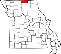 | |
| Villages | ||
| Townships |
| |
| CDP | ||
| Unincorporated communities |
| |
| Ghost towns |
| |