Porterdale, Georgia
| Porterdale, Georgia | |
|---|---|
| Town | |
|
Porterdale Mill | |
 Location in Newton County and the state of Georgia | |
| Coordinates: 33°34′11″N 83°53′53″W / 33.56972°N 83.89806°WCoordinates: 33°34′11″N 83°53′53″W / 33.56972°N 83.89806°W | |
| Country | United States |
| State | Georgia |
| County | Newton |
| Area | |
| • Total | 1 sq mi (2.7 km2) |
| • Land | 1 sq mi (2.7 km2) |
| • Water | 0 sq mi (0 km2) |
| Elevation | 699 ft (213 m) |
| Population (2010) | |
| • Total | 1,429 |
| • Density | 1,281/sq mi (474.4/km2) |
| Time zone | Eastern (EST) (UTC-5) |
| • Summer (DST) | EDT (UTC-4) |
| ZIP code | 30070 |
| Area code(s) | 770 |
| FIPS code | 13-62244[1] |
| GNIS feature ID | 0332738[2] |
| Website | Porterdale, Georgia Website |

Porterdale is a town in Newton County, Georgia, United States. The population was 1,281 at the 2000 census.
History
Porterdale was incorporated on March 10, 1917,[3] and was named after Oliver S. Porter, a local mill owner.[4]
Geography
Porterdale is located at 33°34′11″N 83°53′53″W / 33.56972°N 83.89806°W (33.569585, -83.897968).[5]
According to the United States Census Bureau, the town has a total area of 1.0 square mile (2.6 km2), all of it land.
Demographics
| Historical population | |||
|---|---|---|---|
| Census | Pop. | %± | |
| 1920 | 2,880 | — | |
| 1930 | 3,002 | 4.2% | |
| 1940 | 3,116 | 3.8% | |
| 1950 | 3,207 | 2.9% | |
| 1960 | 2,365 | −26.3% | |
| 1970 | 1,773 | −25.0% | |
| 1980 | 1,451 | −18.2% | |
| 1990 | 1,278 | −11.9% | |
| 2000 | 1,281 | 0.2% | |
| 2010 | 1,429 | 11.6% | |
| Est. 2015 | 1,483 | [6] | 3.8% |
As of the census[1] of 2000, there were 1,281 people, 463 households, and 333 families residing in the town. The population density was 1,241.3 people per square mile (480.2/km²). There were 487 housing units at an average density of 471.9 per square mile (182.6/km²). The racial makeup of the town was 92.58% White, 4.92% African American, 0.31% Native American, 0.94% Asian, 0.55% from other races, and 0.70% from two or more races. Hispanic or Latino of any race were 1.87% of the population.
There were 463 households out of which 33.5% had children under the age of 18 living with them, 47.7% were married couples living together, 18.1% had a female householder with no husband present, and 27.9% were non-families. 23.3% of all households were made up of individuals and 13.2% had someone living alone who was 65 years of age or older. The average household size was 2.77 and the average family size was 3.22.
In the town the population was spread out with 26.6% under the age of 18, 10.5% from 18 to 24, 28.6% from 25 to 44, 20.5% from 45 to 64, and 13.9% who were 65 years of age or older. The median age was 34 years. For every 100 females there were 94.4 males. For every 100 females age 18 and over, there were 91.4 males.
The median income for a household in the town was $23,967, and the median income for a family was $30,398. Males had a median income of $28,409 versus $20,962 for females. The per capita income for the town was $10,812. About 18.7% of families and 22.5% of the population were below the poverty line, including 27.6% of those under age 18 and 15.6% of those age 65 or over.
Porterdale, Ga is one of many small towns that were based around textile mills. The mills were the centerpiece of the area and employed the majority of the local population. These towns were largely founded in the early 1900s. The advent of the global economy has sent these "mill towns" into economic collapse in the latter part of the 20th century. Porterdale is mainly known for its textile mill which still runs today. Formerly the BIBB co. later Dan River INC. Porterdale resides straddling the Yellow River where the Mill used to get its power from. The old part of the mill which is alongside the dam on the Yellow River is Mill Loft apartments. In the eighties and nineties the mill alongside the dam was a flea market that housed many events including wrestling. The nature of the closeness of the houses in this "mill town" extend to the closeness of the community. Porterdale has many loyal followers who loved being part of a southern small mill town.
Infrastructure

Major Highways
Notable people
- Robert C. Blankenship(1921–1970) was decorated with the Dutch Military Order of William (the Dutch equivalent of the Congressional Medal of Honor) for his bravery in Operation Market Garden; born in Porterdale.
- Raymond Moody (1944–) psychologist and author who coined the term near-death experience; born in Porterdale.
References
- 1 2 "American FactFinder". United States Census Bureau. Retrieved 2008-01-31.
- ↑ "US Board on Geographic Names". United States Geological Survey. 2007-10-25. Retrieved 2008-01-31.
- ↑ "City of Porterdale, Georgia". City of Porterdale, Georgia. Retrieved September 4, 2012.
- ↑ "City of Porterdale, Georgia". ePodunk. Retrieved September 4, 2012.
- ↑ "US Gazetteer files: 2010, 2000, and 1990". United States Census Bureau. 2011-02-12. Retrieved 2011-04-23.
- ↑ "Annual Estimates of the Resident Population for Incorporated Places: April 1, 2010 to July 1, 2015". Retrieved July 2, 2016.
- ↑ "Census of Population and Housing". Census.gov. Retrieved June 4, 2015.
External links
| Wikimedia Commons has media related to Porterdale, Georgia. |
- Porterdale, Georgia Website Portal style website, Government, Business, Library, Recreation and more
- City-Data.com Comprehensive Statistical Data and more about Tipton
Municipalities and communities of Newton County, Georgia, United States | ||
|---|---|---|
| Cities | 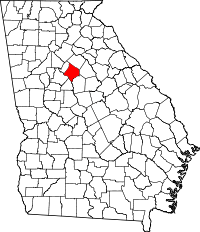 | |
| Town | ||
| Unincorporated communities | ||
| Footnotes | ‡This populated place also has portions in an adjacent county or counties | |