Poocham, New Hampshire
| Poocham, New Hampshire | |
|---|---|
| Unincorporated community | |
 Poocham  Poocham | |
| Coordinates: 42°57′02″N 72°28′38″W / 42.95056°N 72.47722°WCoordinates: 42°57′02″N 72°28′38″W / 42.95056°N 72.47722°W | |
| Country | United States |
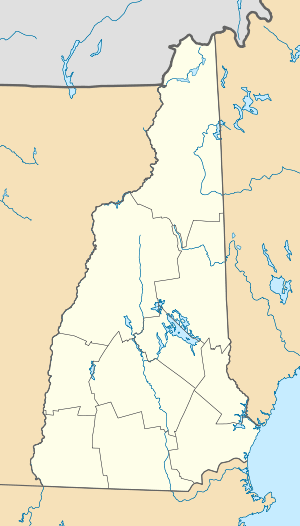
| State | New Hampshire |
| County | Cheshire |
| Town | Westmoreland |
| Elevation | 676 ft (206 m) |
| Time zone | Eastern (EST) (UTC-5) |
| • Summer (DST) | EDT (UTC-4) |
| Area code(s) | 603 |
| GNIS feature ID | 869299[1] |
Poocham is an unincorporated community in the town of Westmoreland in Cheshire County, New Hampshire, United States, near the larger communities of Keene, New Hampshire and Brattleboro, Vermont.
Poocham's oldest houses date from around 1800. By reputation, the name Poocham comes from an Abenaki Indian word meaning "gathering place". The community is almost entirely composed of homes and farms, but a small fluorite mine and growing vineyard are also present.
References
Municipalities and communities of Cheshire County, New Hampshire, United States | ||
|---|---|---|
| City | 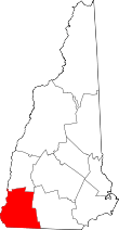 | |
| Towns | ||
| CDPs | ||
| Other villages | ||
This article is issued from Wikipedia - version of the 6/22/2016. The text is available under the Creative Commons Attribution/Share Alike but additional terms may apply for the media files.